Dollis Brook runs through the London Borough of Barnet in north London. It is a tributary of the River Brent, which is itself a tributary of the River Thames. The Dollis Valley Greenwalk follows almost all of Dollis Brook, apart from a short section at the beginning which passes through private land, and the London Loop follows it as far as Barnet Lane. The name Dollis is probably derived from the Middle English word 'dole', meaning the shares of land in the common field.

Folly Brook is a 2+1⁄4-mile (3.6 km) long brook in the London Borough of Barnet. It is a tributary of Dollis Brook, which is a tributary of the River Brent, which is a tributary of the River Thames. Folly Brook is lined for most of its length by narrow strips of woodland and scrub, with a good variety of trees and shrubs. It is one of the best streams in Barnet for small aquatic invertebrates, including several species of caddis fly and a stonefly, which are only found in unpolluted waters.

Moat Mount Open Space is a 110-hectare park and nature reserve in Mill Hill in the London Borough of Barnet. It is part of Moat Mount Open Space and Mote End Farm Site of Borough Importance for Nature Conservation, Grade II, which includes Barnet Gate Wood and Scratchwood Countryside Park, but is separate from Scratchwood itself, which is a neighbouring park and nature reserve. Most of the site is open to the public, but Mote End Farm and some other areas are private. Scratchwood and Moat Mount are a Local Nature Reserve.

Totteridge Fields is a 97-hectare Site of Metropolitan Importance for Nature Conservation (SINC) in Totteridge in the London Borough of Barnet. The SINC includes the privately owned Highwood Hill, and at the western end is a seven-hectare Local Nature Reserve owned by Barnet Council and managed by the London Wildlife Trust.

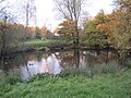
Darland's Lake Nature Reserve is a nature reserve south of Totteridge Village in Barnet, England. It is owned by the London Borough of Barnet and was managed from 1971 by the Hertfordshire and Middlesex Wildlife Trust, and more recently by the borough council. In 2007 the council spent £215,000 on repairing the dam and other works, and then proposed leasing the reserve to the Wildlife Trust. The transfer did not take place and in September 2017 a trust was set up by the London Wildlife Trust and local residents associations which took over the management of Darland's Lake. In 2020, the Darlands Conservation Trust launched an appeal to raise £450,000 for excavation to prevent the lake drying up.

Woodridge Nature Reserve or Woodridge School Nature Reserve is a 0.7-hectare (1.7-acre) Site of Local Importance for Nature Conservation in Woodside Park, London, owned and managed by the London Borough of Barnet. It was designed as a nature trail for local primary schools, but is now very neglected.
Burtonhole Lane and Pasture is a 6.5-hectare (16-acre) Site of Borough Importance for Nature Conservation, Grade II, between Mill Hill and Totteridge in the London Borough of Barnet. It consists of Burtonhole Lane between Partingdale Lane and Burtonhole Close, a footpath east from Burtonhole Lane towards Folly Brook, two fields south of the footpath, and a narrow belt of privately owned woodland north of the footpath. Burtonhole Brook, a tributary of Folly Brook, crosses Burtonhole Lane and the fields.

Hadley Green is a 10-hectare (25-acre) Site of Metropolitan Importance for Nature Conservation in Hadley in the London Borough of Barnet. The reserve straddles the Great North Road between Hadley Green Road and Fold Lane.

Scratchwood is an extensive, mainly wooded, country park in Mill Hill in the London Borough of Barnet. The 57-hectare site is a Site of Metropolitan Importance for Nature Conservation and together with the neighbouring Moat Mount Open Space. It is a Local Nature Reserve.

Glebelands is a Grade I Site of Borough Importance for Nature Conservation in Colney Hatch in the London Borough of Barnet. It is also part of the Coppett's Wood and Glebelands Local Nature Reserve.
Rowley Lodge Field is a Site of Borough Importance for Nature Conservation, Grade II, in Arkley in the London Borough of Barnet.

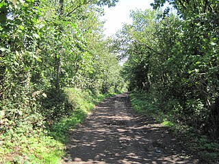
Arkley Lane and Pastures is a 50-hectare (120-acre) Site of Borough Importance for Nature Conservation, Grade II, in Arkley in the London Borough of Barnet. Arkley Lane, off Barnet Road, is an old drovers' road. Located on the Barnet Plateau, it is now a quiet country lane with a traditional bank and ditch. The thick hedges are composed of beech and hornbeam, ash, field maple and magnificent old pedunculate oaks.

Oak Hill Wood is a 10-hectare Local Nature Reserve (LNR) and a Site of Borough Importance for Nature Conservation Grade I, in East Barnet, London. It is owned by the London Borough of Barnet, and part of it is a 5.5-hectare nature reserve managed by the London Wildlife Trust.

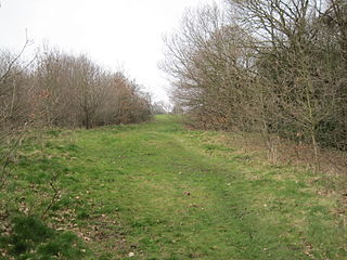
Copthall Railway Walk and Copthall Old Common is a 9-hectare (22-acre) Site of Borough Importance for Nature Conservation, Grade II, in Mill Hill in the London Borough of Barnet.

Totteridge Common is a 3.7 hectare Site of Borough Importance for Nature Conservation, Grade II, in Totteridge in the London Borough of Barnet. The nature reserve is the southern verge of the road Totteridge Common, between Totteridge Park and Oak Lodge. It is registered common land owned by the Totteridge Manor Association and comprised the lands of the former Manor of Totteridge which were transferred to the association in 1954.
Stoneyfields Park is a three-hectare public park in The Hale in the London Borough of Barnet.

Mill Hill Old Railway Nature Reserve is a 2.3-hectare (5.7-acre) Site of Borough Importance for Nature Conservation, Grade II, in Mill Hill in the London Borough of Barnet.
The Mill Field is a 3.4-hectare (8.4-acre) Site of Borough Importance for Nature Conservation, Grade II, in Mill Hill in the London Borough of Barnet. It is a public open space which slopes steeply down from the road called The Ridgeway. It may be the site of the windmill which gave the area its name. This was documented as early as 1321 and had disappeared by 1754.

Burnt Oak Brook is a one-mile-long stream between Mill Hill and Burnt Oak in the London Borough of Barnet. It is a tributary of the Silk Stream, which is a tributary of the River Brent, which is a tributary of the River Thames.