
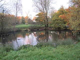
Dollis Brook runs through the London Borough of Barnet in north London. It is a tributary of the River Brent, which is itself a tributary of the River Thames. The Dollis Valley Greenwalk follows almost all of Dollis Brook, apart from a short section at the beginning which passes through private land, and the London Loop follows it as far as Barnet Lane. The name Dollis is probably derived from the Middle English word 'dole', meaning the shares of land in the common field.
The London Borough of Barnet, located on the northern periphery of London and having much of the area within its boundaries in the Metropolitan Green Belt, has many parks and open spaces. In addition there are large areas taken over by cemeteries and golf courses, and part of Hampstead Heath.

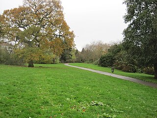
Edgwarebury Park is a 22-hectare park in Edgware in the London Borough of Barnet. It was once part of the manor of Earlsbury, which was first mentioned in 1216. In the later Middle Ages it was owned by All Souls College, Oxford, and there is still evidence of the older landscape of fields and woodland. Hendon Rural District and Middlesex County Council bought the land in two parts in 1929 and 1932, and the park opened in the latter year. It is now owned and managed by Barnet Council.

The Silk Stream is a brook just over 4 kilometres (2.5 mi) long in the London Borough of Barnet. It is one of the major components of the Blue Ribbon Network.

Rowley Green Common is a six hectare Local Nature Reserve and a Site of Importance Metropolitan for Nature Conservation in Arkley, north London. It is owned by the London Borough of Barnet. It is also registered common land.
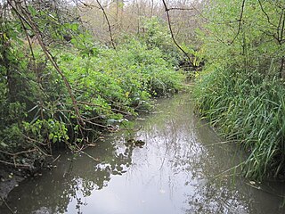
Burtonhole Lane and Pasture is a 6.5-hectare (16-acre) Site of Borough Importance for Nature Conservation, Grade II, between Mill Hill and Totteridge in the London Borough of Barnet. It consists of Burtonhole Lane between Partingdale Lane and Burtonhole Close, a footpath east from Burtonhole Lane towards Folly Brook, two fields south of the footpath, and a narrow belt of privately owned woodland north of the footpath. Burtonhole Brook, a tributary of Folly Brook, crosses Burtonhole Lane and the fields.

King George's Fields is a 28-hectare (69-acre) Site of Borough Importance for Nature Conservation, Grade II, in Monken Hadley in the London Borough of Barnet.

Scratchwood is an extensive, mainly wooded, country park in Mill Hill in the London Borough of Barnet. The 57-hectare site is a Site of Metropolitan Importance for Nature Conservation and together with the neighbouring Moat Mount Open Space. It is a Local Nature Reserve.

Coppetts Wood and Scrublands is a 14.5-hectare (36-acre) Site of Borough Importance for Nature Conservation, Grade I, between Muswell Hill and Friern Barnet in the London Borough of Barnet. It is part of the Coppetts Wood and Glebelands Local Nature Reserve.

Arkley Lane and Pastures is a 50-hectare Site of Borough Importance for Nature Conservation, Grade II, in Arkley in the London Borough of Barnet. Arkley Lane, off Barnet Road, is an old drovers' road. Located on the Barnet Plateau, it is now a quiet country lane with a traditional bank and ditch. The thick hedges are composed of beech and hornbeam, ash, field maple and magnificent old pedunculate oaks.

Oak Hill Wood is a 10-hectare Local Nature Reserve (LNR) and a Site of Borough Importance for Nature Conservation Grade I, in East Barnet, London. It is owned by the London Borough of Barnet, and part of it is a 5.5-hectare nature reserve managed by the London Wildlife Trust.
Totteridge Green is a five hectare Site of Borough Importance for Nature Conservation, Grade II, in Totteridge in the London Borough of Barnet. It is also registered common land.

Edgware Way Grassland or Edgware Way Rough is a 6.7-hectare (17-acre) Site of Metropolitan Importance for Nature Conservation in Edgware in the London Borough of Barnet. It is traversed by Edgwarebury Brook and contains traces of a planned railway viaduct and embankment. This was part of a planned extension of the Northern line from Edgware to Bushey, which was cancelled when the introduction of the Green Belt after the Second World War led to the cancellation of the developments which the railway was to serve. Part of the site is the Environment Agency's Edgwarebury Park Flood Storage Area.

Totteridge Common is a 3.7 hectare Site of Borough Importance for Nature Conservation, Grade II, in Totteridge in the London Borough of Barnet. The nature reserve is the southern verge of the road Totteridge Common, between Totteridge Park and Oak Lodge. It is registered common land owned by the Totteridge Manor Association and comprised the lands of the former Manor of Totteridge which were transferred to the association in 1954.
Stoneyfields Park is a three-hectare public park in The Hale in the London Borough of Barnet.
Deans Brook is a two-kilometre-long stream which runs between Mill Hill and Edgware in the London Borough of Barnet. It is a tributary of the Silk Stream, which is a tributary of the River Brent, which is a tributary of the River Thames.

Mill Hill Old Railway Nature Reserve is a 2.3-hectare (5.7-acre) Site of Borough Importance for Nature Conservation, Grade II, in Mill Hill in the London Borough of Barnet.

Copthall South Fields is a six hectare Site of Local Importance for Nature Conservation, next to Fiveways Corner on the A1, in Mill Hill in the London Borough of Barnet.

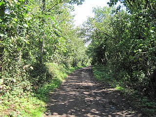
Clay Lane is a one kilometre long public footpath and bridle way in Edgware in the London Borough of Barnet. It is a Site of Local Importance for Nature Conservation.


