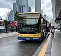
Bus upgrade zones, commonly abbreviated to BUZ, are a feature of Brisbane's public transport system. The name is given to high-frequency bus routes operated by Transport for Brisbane, the Brisbane City Council agency that operates the city's public bus services for Translink. All BUZ services run at least every fifteen minutes from around 6:00am to 11:30pm seven days a week and at least every ten minutes during peak hours from Monday to Friday. [1]
Nearly all BUZ routes are express services which provide quick and frequent access to places along major trunk roads, with the exception of routes 196 and 199, which are the only all-stops BUZ service with bus stops within short walking distances of each other between the inner suburbs of Fairfield, West End, New Farm and Teneriffe. Most BUZ routes are radial, and commence in or near the Brisbane CBD. However, routes 196 and 199 are again an exception, in that they are cross-town routes that passes through the CBD.
Route 111 was upgraded to become the first BUZ service in December 2003. [2] Other BUZ services have been progressively added since then. [3] [4] The Cultural Centre busway station on the South East Busway is the common interchange point for all BUZ services, with the exception of routes 340 and 412. [5]
In 2007, BUZ services carried over 346,000 passengers a week, accounting for around 30% of all Brisbane Transport patronage. Route 199 being the busiest BUZ service, carrying over 53,000 passengers per week. [6]
All BUZ services run at least every fifteen minutes from around 6:00am to 11:30pm seven days a week and at least every ten minutes during peak hours from Monday to Friday. [5] [7] Nearly all BUZ routes are express services which provide quick and frequent access to places along major trunk roads, with the exception of routes 196 and 199, which are the only all-stops BUZ services with bus stops within short walking distances of each other between the inner suburbs of West End and Teneriffe (199) and New Farm and Fairfield (196). All BUZ routes are radial, and commence in or near the Brisbane CBD. However, routes 196 and 199 are again an exception, in that they are cross-town routes that pass through the CBD. [5]
Route | Destinations | Type | Upgrade Date |
---|---|---|---|
100 | Forest Lake via Woolloongabba busway station, PA Hospital, Ipswich Road, Oxley and Inala | Cityxpress | 31 October 2011 [8] |
111 | Eight Mile Plains busway station via South East Busway | Busway service | 15 December 2003 [2] |
120 | Garden City bus station via Tarragindi, QEII Hospital and Griffith University Nathan Campus | Cityxpress | 6 June 2011 [9] |
130 | Parkinson via Mains Rd, Sunnybank and Algester | Cityxpress | 27 January 2004 [10] |
140 | Browns Plains bus station via Mains Rd, Sunnybank and Beaudesert Rd | Cityxpress | 23 February 2009 [3] |
150 | Browns Plains bus station via Runcorn and Stretton (Gowan Rd and Warrigal Rd) | Cityxpress | 8 November 2004 [11] |
180 | Garden City bus station via Greenslopes and Mansfield | Cityxpress | 31 October 2011 [8] |
196 | Fairfield, Highgate Hill, South Brisbane, Fortitude Valley, Merthyr | All Stops | 6 June 2011 [9] |
199 | West End ferry wharf, South Brisbane, Fortitude Valley, New Farm, Teneriffe ferry wharf | All Stops | 20 February 2006 [12] |
200 | Carindale Heights via Woolloongabba busway station, Old Cleveland Road (stopping only at Coorparoo, Carina and Camp Hill) and Carindale Interchange | Cityxpress | 18 February 2006 [13] |
222 | Carindale via Eastern Busway and Old Cleveland Road (stopping only at Coorparoo, Kismet Street, Carina and Camp Hill) | Busway service | 27 August 2011 |
330 | Bracken Ridge via Roma Street, RBWH, Northern Busway, Chermside, Zillmere and Taigum (no stops between RBWH and Chermside, Airport Link Tunnel Express) | Cityxpress | 18 June 2012 [14] |
333 | Chermside bus station via Roma Street, RBWH, Northern Busway, Lutwyche and Kedron | Busway service | |
340 | Carseldine via Roma Street, RBWH, Northern Busway, Lutwyche, Kedron, Chermside and Aspley | Cityxpress | 18 June 2012 [14] |
345 | Aspley via Roma Street, Kelvin Grove, Newmarket, Stafford and Maundrell Tce | Cityxpress | 20 February 2006 |
385 | The Gap via Waterworks Rd, Bardon, Paddington and Roma Street | Cityxpress | |
412 | University of Queensland bus station via Toowong | Cityxpress | |
444 | Moggill via Toowong, Indooroopilly and Kenmore | Cityxpress | 23 October 2006 [15] |
Blue CityGlider (60) | West End ferry wharf, South Brisbane, Fortitude Valley, Newstead, Teneriffe ferry wharf (Same terminus as BUZ Route 199 but only observes Limited Stops) | Special | 11 April 2010 [16] |
Maroon CityGlider (61) | Ashgrove, Bardon, Paddington, City, Woolloongabba busway station, Langlands Park busway station (Similar routing to BUZ Routes 200 and 385 between Coorparoo and Bardon) | Special | 18 February 2013 [17] |
A rush hour or peak hour is a part of the day during which traffic congestion on roads and crowding on public transport is at its highest. Normally, this happens twice every weekday: once in the morning and once in the afternoon or evening, the times during which most people commute. The term is often used for a period of peak congestion that may last for more than one hour.
Transport for Brisbane, previously called Brisbane Transport, is an organisational division of the Brisbane City Council, responsible through its related Council Committee for providing policy and advice to Brisbane City Council, and for delivering various public transport services across the City of Brisbane. The division does this as part of an agreement with Translink, an agency of the Department of Transport and Main Roads that operates public transport across South East Queensland.
The South East Busway is a grade separated bus-only road running south from the Brisbane central business district to Eight Mile Plains in Queensland, Australia. The busway was completed to Woolloongabba in September 2000 and to Eight Mile Plains in April 2001. An extension of the busway to School Road at Rochedale was completed in 2014 with no additional busway stations. The maximum capacity of the busway is 18,000 commuters an hour during peak periods. The busway carries an estimated 70 million passengers annually.
The Northern Busway is a bus-only road running north from the Brisbane central business district to the Royal Brisbane & Women's Hospital in Queensland, Australia. The first section of the busway opened on 23 February 2004 with one station at QUT Kelvin Grove. In December 2005, Normanby and Herston stations opened.
Queen Street bus station is the primary bus terminus in Brisbane central business district in Queensland, Australia. It is underneath Uptown, Brisbane & Queen Street Mall. It opened on 26 March 1988 along with the Myer Centre. At the time it was the largest underground diesel bus station in the world.
Cultural Centre busway station is located in Brisbane, Australia serving the South Bank precinct. It is located directly south of Victoria Bridge and close to South Brisbane railway station.
Buranda busway station is located in Brisbane, Australia serving the suburb of Buranda. It opened on 30 April 2001 when the South East Busway was extended from Woolloongabba to Eight Mile Plains.
Greenslopes busway station is located in Brisbane, Australia serving the suburb of Greenslopes.
Holland Park West busway station is located in Brisbane, Australia serving the suburb of Holland Park West. It opened on 30 April 2001 when the South East Busway was extended from Woolloongabba to Eight Mile Plains.
Griffith University busway station is located in Brisbane, Australia serving the Griffith University, Mount Gravatt and Nathan campuses. It opened on 30 April 2001 when the South East Busway was extended from Woolloongabba to Eight Mile Plains.
Eight Mile Plains busway station is the southernmost station on the South East Busway in Brisbane, Australia serving the suburb of Eight Mile Plains. It opened on 30 April 2001 when the busway was extended from Woolloongabba.
Upper Mount Gravatt busway station is located in Brisbane, Australia serving the suburb of Upper Mount Gravatt. It opened on 30 April 2001 when the South East Busway was extended from Woolloongabba to Eight Mile Plains.
The Springwood Bus Station, in Springwood, is serviced by Translink bus routes. It is a major interchange for TransLink's Southern Region, being an important stop for Logan City Bus Service routes between Brisbane and Loganholme. The architecture of the station is based upon the steel and glass designs of Brisbane's busway stations. It is in Zone 2 of the Translink integrated public transport system.
The Eleanor Schonell Bridge, better known as the Green Bridge, is a 390-metre (1,280 ft)-long cable-stayed bridge which crosses the Brisbane River between Dutton Park and the University of Queensland's St Lucia campus, connecting the UQ Lakes and Dutton Park Place busway stations. Its deck is 185 metres long, 20 metres wide and about 18 metres above the river's surface. The bridge was opened on 17 December 2006, and is the first bridge in Australia exclusively designed for buses, cyclists and pedestrians. The bridge cost $55.5 million to construct.
Translink is the public transit agency for Queensland, and is part of the Department of Transport and Main Roads. Translink was first introduced by the Queensland Government in June 2003 to orchestrate bus, ferry, rail and light rail services. They work with Brisbane Airtrain, Transport for Brisbane, RiverCity Ferries, Queensland Rail and other operators to provide services. Translink operates an integrated ticketing system across Queensland and the go card system to allow the use of one ticket on multiple services in South East Queensland.
Transport in Brisbane, the capital and largest city of Queensland, Australia, is provided by road, rail, river and bay ferries, footpaths, bike paths, sea and air.
In Queensland, Australia, public bus services are coordinated by the Queensland Government's Department of Transport and Main Roads and provided by over 1000 operators. The coordination of public bus transport generally falls under three schemes: Translink services, QConnect services and the remaining rural/regional school services. Some operators also provide entirely private bus services in Queensland which are not subject to the same route and ticketing regulation as the public route providers, or segments thereof, are.
CityGlider is a brand name applied to a pair of high-frequency bus routes operated by Transport for Brisbane in Brisbane, Australia. Bus stops serviced by the CityGlider services are identified with signs and painted kerb. Both operate 24 hours a day on Fridays and Saturdays. Both are operated by dedicated fleets of buses vinyled in either blue or maroon liveries with a gliding possum motif, which was originally illustrated by Anya Lange.
Since the mid-1990s, a 27 kilometre bus rapid transit network has been developed in Brisbane, Australia. It comprises grade-separated bus-only corridors, complementing the Queensland Rail Citytrain network. Management of the busway network is the responsibility of Translink as coordinator of South East Queensland's integrated public transport system.
Brisbane Metro is a planned high-frequency bus rapid transit system that will service Brisbane, Queensland, Australia. It will consist of two routes that will run through the Brisbane central business district (CBD) every five minutes during peak times (12bph), transporting up to 1,800 passengers per hour in each direction. Services are expected to commence in 21st October 2024.