Béni Ounif

Last updated • 4 min readFrom Wikipedia, The Free Encyclopedia

Beni Ounif
ﺑﻨﻰ و ﻧﻴﻒ
ⴰⵢⵜ ⵓⵏⵏⵉⴼ
Commune and town
DZ-08-21-Beni Ounif.svg
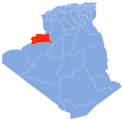
Location of Béni Ounif commune within Béchar Province
Algeria location map.svg
Red pog.svg
Beni Ounif
Location of Béni Ounif within Algeria
Coordinates: 32°03′N1°15′W / 32.05°N 1.25°W / 32.05; -1.25
CountryFlag of Algeria.svg Algeria
Province Béchar Province
District Béni Ounif District
Area
[1]
  Total16,600 km2 (6,400 sq mi)
Elevation
829 m (2,720 ft)
Population
 (2008) [2]
  Total11,209
  Density0.68/km2 (1.7/sq mi)
Time zone UTC+1 (CET)
CP
08100

Béni Ounif is a town and commune in Béchar Province, Algeria, coextensive with the district of Béni Ounif. It has a population of 10,732 as of the 2008 census, [2] up from 8,199 in 1998, [3] and had an annual growth rate of 2.8%, the second highest in the province. [2] The commune covers an area of 16,600 square kilometres (6,400 sq mi). [1]

Contents

History

The Béni Ounif massacre took place in the commune near the Moroccan border, on 15 August 1999. Guerrillas stopped a bus at a fake roadblock and killed some 29 people. President Abdelaziz Bouteflika suggested that the terrorists in question had found shelter in Morocco, [4] but later retracted the accusation.[ citation needed ] The Moroccan Interior Minister Driss Basri denied the allegations. [5]

Geography

Béni Ounif lies at an elevation of 829 metres (2,720 ft) on the Oued Zouzfana [6] downstream of Figuig. To the south the landscape is mostly flat, with a few small hills, while to the north there is a range of taller, rocky hills running from west to east along the Algeria–Morocco border. Aside from the river valleys which support vegetation and agriculture, the low rainfall in the area results in an arid, barren landscape.

Climate

Béni Ounif has a hot desert climate, with very hot summers and cool winters, and light precipitation throughout the year, especially in summer, although a little more rain does fall than in other towns in Béchar Province.

Climate data for Béni Ounif
MonthJanFebMarAprMayJunJulAugSepOctNovDecYear
Mean daily maximum °C (°F)15.1
(59.2)
18.5
(65.3)
20.8
(69.4)
26.1
(79.0)
30.7
(87.3)
35.7
(96.3)
39.7
(103.5)
38.2
(100.8)
32.9
(91.2)
25.5
(77.9)
21
(70)
15.7
(60.3)
26.7
(80.0)
Daily mean °C (°F)9.1
(48.4)
11.4
(52.5)
14
(57)
18.5
(65.3)
23.5
(74.3)
28.2
(82.8)
31.8
(89.2)
30.9
(87.6)
25.6
(78.1)
19.5
(67.1)
14.4
(57.9)
9.4
(48.9)
19.7
(67.4)
Mean daily minimum °C (°F)3.1
(37.6)
4.3
(39.7)
7.3
(45.1)
11.0
(51.8)
16.4
(61.5)
20.7
(69.3)
24.0
(75.2)
23.6
(74.5)
18.3
(64.9)
13.6
(56.5)
7.8
(46.0)
3.2
(37.8)
12.8
(55.0)
Average precipitation mm (inches)12
(0.5)
9
(0.4)
17
(0.7)
12
(0.5)
7
(0.3)
4
(0.2)
1
(0.0)
6
(0.2)
12
(0.5)
20
(0.8)
16
(0.6)
15
(0.6)
131
(5.3)
Source: climate-data.org [7]

Economy

Agriculture is the main industry in Béni Ounif. The commune has a total of 2,030 hectares (5,000 acres) of arable land, of which 820 hectares (2,000 acres) is irrigated. [8] There are a total of 71,800 date palms planted in the commune. [9] As of 2009 there were 23,210 sheep, 16,664 goats, 1,766 camels, and 444 cattle.

Tourism is a part of Béni Ounif's economy; there is one hotel in the town. [10] Tourist attractions include palm groves, the old ksar and an ancient fort. [11]

Infrastructure and housing

75% of Béni Ounif's population is connected to drinking water (the lowest rate in the province), [12] 96% is connected to the sewerage system, [13] and 87% (including 2,412 buildings) have access to electricity. [14] There is one fuel service station in the town. [15]

Béni Ounif has a total of 2,576 houses, of which 1,754 are occupied, giving an occupation rate of 6.1 inhabitants per occupied building. [16]

Transportation

Béni Ounif is on the N6 highway between Mecheria to the northwest and Béchar to the southwest. While a road leads from the western side of the city to the Moroccan town of Figuig, the border has been closed since 1994. [6] Béni Ounif is 110 kilometres (68 mi) from the provincial capital, Béchar. [17] There is a total length of 263 kilometres (163 mi) of roads in the commune. [18]

Béni Ounif has a station on the Méchéria-Béchar railway line operated by the National Company for Rail Transport.

Education

There are 10 elementary schools, with 70 classrooms including 47 in use. [19] There are a total of 2,262 school students. [20]

5.8% of the population has a tertiary education, and another 20.3% has competed secondary education. [21] The overall literacy rate is 79.3%, and is 86.0% among males and 72.7% among females. [22]

Health

Béni Ounif has one polyclinic, 8-room care facilities, a maternity ward, and 2 private pharmacies. [23]

Culture

Béni Ounif has a cinema with 315 seats. [24]

Religion

Béni Ounif has 6 operational mosques, with another 3 under construction. [25] Islam plays a central role in the cultural and religious practices of the people in Béni Ounif. Islamic traditions, such as prayer, fasting during Ramadan, and celebrations of Islamic holidays like Eid al-Fitr and Eid al-Adha, are important aspects of community life.

Tribes

The Berber people are indigenous to North Africa and have a long history in the region. In Algeria, Berbers make up a significant portion of the population, and they have preserved their distinct cultural practices, languages, and traditions. Berber Languages, such as Tamazight, are spoken by many Berbers in Béni Ounif. Arab-Berbers are individuals who have mixed Arab and Berber ancestry. They represent a significant portion of the population in Algeria, including Béni Ounif. Arab-Berbers have cultural characteristics that combine elements from both Arab and Berber traditions. While Berbers and Arab-Berbers are the predominant ethnic groups in Béni Ounif, it's worth noting that there may be smaller populations of other ethnic groups present in the region as well. This could include groups like Tuaregs or Sahrawis, who have historical ties to the broader Sahara region.

Localities

The commune is composed of 11 localities: [26]

The locality Zoubia is a village, located on the N6 highway about 25 kilometres (16 mi) to the northeast, on the border with Naâma Province. [27]

Neighbouring towns and cities

Related Research Articles

<span class="mw-page-title-main">Tabelbala</span> Place in Béni Abbès, Algeria

Tabelbala is a town and commune between Béchar and Tindouf in south-western Algeria, and is the capital, and only significant settlement, of the Daïra of the same name, encompassing most of the western half of Béni Abbès Province. As of the 2008 census, its population was 5,121, up from 4,663 in 1998, with an annual growth rate of 1.0%. The commune covers an area of 60,560 square kilometres (23,380 sq mi), making it by far the largest commune in the province, as well as the least densely populated.
<span class="mw-page-title-main">Béchar</span> City in Algeria

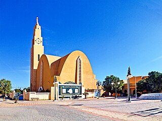
Béchar is the capital city of Béchar Province, Algeria. It is also a commune, coextensive with Béchar District, of Béchar Province. In 2008 the city had a population of 165,627, up from 134,954 in 1998, with an annual growth rate of 2.1%. The commune covers an area of 5,050 square kilometres (1,950 sq mi).
<span class="mw-page-title-main">Igli, Algeria</span> Commune and town in Béchar Province, Algeria

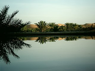
Igli is a town and commune in Béchar Province, western Algeria, located 152 km south of Bechar. It is coextensive with Igli District. Its population was 6,682 as of the 2008 census, up from 5,474 in 1998, and an annual population growth rate of 2.1%. The commune covers an area of 6,220 square kilometres (2,400 sq mi).
<span class="mw-page-title-main">Abadla</span> Commune and town in Béchar Province, Algeria

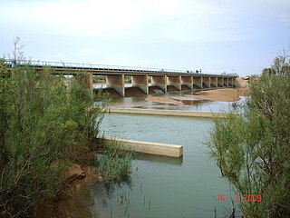
Abadla is a town and commune in western Algeria, and capital of Abadla District, Béchar Province. It is located on the Oued Guir southwest of Béchar. According to the 2008 census its population is 13,636, up from 10,845 in 1998, and an annual growth rate of 2.4%, making it the most populated commune in Béchar Province apart from the capital. The commune covers an area of 2,870 square kilometres (1,110 sq mi).

<span class="mw-page-title-main">Béni Abbès</span> Commune and town in Bechar, Algeria

Béni Abbès, also known as the Pearl of the Saoura, and also as the White Oasis, is a town and commune located in western Algeria in Béchar Province, 241 km (150 mi) far from the provincial capital Béchar, and 1,200 km (746 mi) from Algiers.

<span class="mw-page-title-main">Béni Ikhlef</span> Commune and town in Béchar Province, Algeria

Béni Ikhlef is a town and commune in Kerzaz District, Béchar Province, in western Algeria. As of the 2008 census, its population was 2,459, up from 2,280 in 1998, with an annual growth rate of 0.8%. The commune covers an area of 2,617 square kilometres (1,010 sq mi).

<span class="mw-page-title-main">Boukaïs</span> Commune and town in Béchar Province, Algeria

Boukaïs is a town and commune in Lahmar District, Béchar Province, in western Algeria. According to the 2008 census its population is 970, up from 890 in 1998, and its annual population growth rate is 0.9%. The commune covers an area of 1,760 square kilometres (680 sq mi).

<span class="mw-page-title-main">El Ouata</span> Commune and town in Béchar Province, Algeria

El Ouata is a town and commune in Béchar Province, western Algeria. The commune is coextensive with El Ouata District, which is named after the town. According to the 2008 census its population is 7,343, up from 7,014 in 1998, with an annual population growth rate of 0.5%. The commune covers an area of 2,870 square kilometres (1,110 sq mi).

<span class="mw-page-title-main">Erg Ferradj</span> Commune and town in Béchar Province, Algeria

Erg Ferradj is a town and commune in Abadla District, Béchar Province, in western Algeria. According to the 2008 census its population is 4,406, down from 4,670 in 1998, and an annual population growth rate of -0.6%, the second lowest in the province. The commune covers an area of 6,410 square kilometres (2,470 sq mi).

<span class="mw-page-title-main">Kerzaz</span> Town in Béchar, Algeria

Kerzaz is a town and commune, and capital of Kerzaz District, in Béchar Province, western Algeria. According to the 2008 census its population is 5,028, up from 4,276 in 1998, and its annual growth rate is 1.7%. The commune covers an area of 10,520 square kilometres (4,060 sq mi).
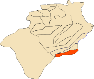
<span class="mw-page-title-main">Ksabi</span> Commune and town in Béchar Province, Algeria

Ksabi is a town and commune in Ouled Khodeïr District, Béchar Province, in western Algeria. According to the 2008 census its population is 3,187, up from 2,656 in 1998, with an annual growth rate of 1.9%. The commune covers an area of 2,220 square kilometres (860 sq mi).

<span class="mw-page-title-main">Méchraâ Houari Boumédienne</span> Commune and town in Béchar Province, Algeria

Méchraâ Houari Boumédienne is a town and commune in Abadla District, Béchar Province, in western Algeria. According to the 2008 census its population is 3,091, down from 3,133 in 1998, with an annual growth rate of -0.1%. The commune covers an area of 2,820 square kilometres (1,090 sq mi).
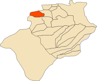
<span class="mw-page-title-main">Méridja</span> Commune and town in Béchar Province, Algeria

Méridja is a town and commune in Kénadsa District, Béchar Province, in western Algeria. As of 2008 the population of the commune was 592, up from 532 in 1998, with an annual growth rate of 1.1%. This makes it the smallest commune by population in Béchar Province. The commune covers an area of 2,270 square kilometres (880 sq mi).

<span class="mw-page-title-main">Mogheul</span> Commune and town in Béchar Province, Algeria

Mogheul is a town and commune in Lahmar District, Béchar Province, in western Algeria near the border with Morocco. According to the 2008 census its population is 635, down from 682 in 1998, with an annual growth rate of -0.7%, the lowest in the province. The commune covers an area of 640 square kilometres (250 sq mi), making it the smallest by area in the province.
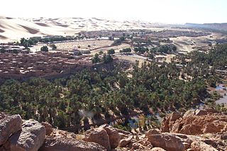
<span class="mw-page-title-main">Taghit</span> Commune and town in Béchar Province, Algeria

Taghit is a town and commune in Taghit District, Béchar Province, in western Algeria. The town is an oasis watered by the underground Oued Zousfana, which runs along beside the dunes of the Grand Erg Occidental. According to the 2008 census its population is 6,317, up from 6,047 in 1998, with an annual growth rate of 0.4%. The commune covers an area of 8,080 square kilometres (3,120 sq mi).

<span class="mw-page-title-main">Tamtert</span> Commune and town in Béni Abbès Province, Algeria

Tamtert, also written Tamert or Tamatart is a town and commune in Béni Abbès District, Béni Abbès Province, in western Algeria. According to the 2008 census its population is 1,248, down from 1,302 in 1998, with an annual growth rate of -0.4%. The commune covers an area of 3,130 square kilometres (1,210 sq mi).

<span class="mw-page-title-main">Timoudi</span> Commune and town in Béchar Province, Algeria

Timoudi is a town and commune in Kerzaz District, Béchar Province, in western Algeria. According to the 2008 census its population is 2,389, up from 2,116 in 1998, with an annual population growth rate of 1.2%. The area of the commune is 6,175 square kilometres (2,384 sq mi).
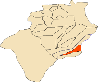
<span class="mw-page-title-main">Ouled Khoudir</span> Commune and town in Béchar Province, Algeria

Ouled Khoudir is a town and commune in Ouled Khoudir District, Béchar Province, in western Algeria. According to the 2008 census its population is 4,251, up from 3,893 in 1998, with an annual growth rate of 0.9%. The commune covers an area of 1,920 square kilometres (740 sq mi).

Zoubia is a village in south-western Algeria. It is part of the commune of Béni Ounif, in Béchar Province, Algeria, and is 25 kilometres (16 mi) northeast of the town of Béni Ounif.
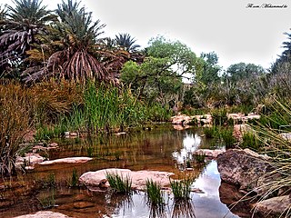
<span class="mw-page-title-main">Fendi, Algeria</span> Commune in Béchar Province, Algeria

Fendi is a village in the commune of Béni Ounif, in Béni Ounif District, Béchar Province, Algeria. The village is located next to a wadi at the end of a local road leading south from its intersection with the N6 highway west of Béni Ounif. It is 75 kilometres (47 mi) east of Béchar and 32 kilometres (20 mi) southwest of Béni Ounif.

References

  1. 1 2 "Population, Area and Density per Commune" (in French). Official Website of the Wilaya of Bechar. Archived from the original on 22 February 2014. Retrieved 16 March 2013.
  2. 1 2 3 "Population: Béchar Wilaya" (PDF) (in French). Office National des Statistiques Algérie. Archived from the original (PDF) on 16 May 2013. Retrieved 13 February 2013.
  3. "Algeria Communes". Statoids. Retrieved 9 March 2013.
  4. "World: Africa Algeria sticks by Morocco allegation". BBC. 4 September 1999. Retrieved 21 February 2013.
  5. "Current misunderstanding in Moroccan-Algerian relations is transient cloud". Arabic News. 8 September 1999. Archived from the original on 16 July 2012. Retrieved 21 February 2013.
  6. 1 2 Kohlbach, Edith (2008). Ostmarokko (in German). Reisebücher. p. 82. ISBN   978-3941015005 . Retrieved 21 February 2013.
  7. "Climate data for: Beni Ounif". climate-data.org. Retrieved 10 March 2013.
  8. "Distribution of Agricultural Land" (in French). Official Website of the Wilaya of Bechar. Archived from the original on 10 July 2014. Retrieved 9 March 2013.
  9. "Plant Productions" (in French). Official Website of the Wilaya of Bechar. Archived from the original on 20 August 2014. Retrieved 9 March 2013.
  10. "Census of Hotels" (in French). Official Website of the Wilaya of Bechar. Archived from the original on 23 January 2016. Retrieved 9 March 2013.
  11. "Tourist Sites and Monuments" (in French). Official Website of the Wilaya of Bechar. Archived from the original on 4 March 2016. Retrieved 9 March 2013.
  12. "Drinking Water" (in French). Official Website of the Wilaya of Bechar. Archived from the original on 9 July 2014. Retrieved 9 March 2013.
  13. "Sewerage Networks" (in French). Official Website of the Wilaya of Bechar. Archived from the original on 10 July 2014. Retrieved 9 March 2013.
  14. "Electrification" (in French). Official Website of the Wilaya of Bechar. Archived from the original on 9 July 2014. Retrieved 9 March 2013.
  15. "Fuel Distribution" (in French). Official Website of the Wilaya of Bechar. Archived from the original on 10 July 2014. Retrieved 9 March 2013.
  16. "Housing" (in French). Official Website of the Wilaya of Bechar. Archived from the original on 4 March 2016. Retrieved 9 March 2013.
  17. "Presentation" (in French). Site Officiel de la Wilaya de Béchar. Archived from the original on 16 February 2013. Retrieved 19 February 2013.
  18. "Density Kilometres" (in French). Official Website of the Wilaya of Bechar. Archived from the original on 29 April 2014. Retrieved 9 March 2013.
  19. "School Infrastructure" (in French). Official Website of the Wilaya of Bechar. Archived from the original on 29 April 2014. Retrieved 9 March 2013.
  20. "Number of Pupils" (in French). Official Website of the Wilaya of Bechar. Archived from the original on 4 March 2016. Retrieved 9 March 2013.
  21. "Structure relative de la population résidente des ménages ordinaires et collectifs âgée de 6 ans et plus selon le niveau d'instruction et la commune de résidence" (PDF) (in French). Office National des Statistiques Algérie. Archived from the original (PDF) on 17 May 2013. Retrieved 13 February 2013.
  22. "Taux d'analphabétisme et taux d'alphabétisation de la population âgée de 15 ans et plus, selon le sexe et la commune de résidence " (PDF) (in French). Office National des Statistiques Algérie. Archived from the original (PDF) on 16 May 2013. Retrieved 13 February 2013.
  23. "Health Facilities by Commune" (in French). Official Website of the Wilaya of Bechar. Archived from the original on 29 April 2014. Retrieved 9 March 2013.
  24. "Cinemas and Museums" (in French). Official Website of the Wilaya of Bechar. Archived from the original on 23 January 2016. Retrieved 9 March 2013.
  25. "Mosques and Koranic Rooms" (in French). Official Website of the Wilaya of Bechar. Archived from the original on 4 March 2016. Retrieved 9 March 2013.
  26. "Décret n° 84–365, fixant la composition, la consistance et les limites territoriale des communes. Wilaya d'El Oued" (PDF) (in French). Journal officiel de la République Algérienne. 19 December 1984. p. 1489. Archived from the original (PDF) on 12 January 2012. Retrieved 2 March 2013.
  27. "Zoubia, Algeria". Google Maps. Retrieved 10 March 2013.

See also