CFD Alsask

Last updated
CFS Alsask
Alsask, Saskatchewan
Former military base by Alsask Saskatchewan - panoramio.jpg
Former military station Alsask in 2011
Canada Saskatchewan location map.svg
Red pog.svg
CFS Alsask
Location of CFS Alsask in Saskatchewan
Coordinates 51°23′31″N110°00′10″W / 51.39194°N 110.00278°W / 51.39194; -110.00278
TypeRadar Station
CodeC-53
Site information
Controlled byRoyal Canadian Air Force ensign.svg  Royal Canadian Air Force
Site history
Built1963 (1963)
Built byRoyal Canadian Air Force ensign.svg  Royal Canadian Air Force
In use1963-1986

Canadian Forces Station Alsask (CFS Alsask) was a military radar station in the Rural Municipality of Milton No. 292, just north of the hamlet of Alsask, Saskatchewan, Canada, a village on the Alberta-Saskatchewan border. [1] [2] It is within the Rural Municipality of Milton No. 292.

Contents

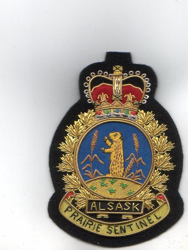
RCAF Station Station Alsask was opened in 1963 as part of the Pinetree Line of NORAD radar stations. The station was later renamed CFS Alsask when the military branches were merged. The station was part of 44 Radar Squadron and had a call sign of November, Jade Ring. [3] The station was disbanded in 1987 and has been taken over by the village. The station property became part of the Rural Municipality of Milton when the village of Alsask was dissolved in 2009. [4]

The station consisted of three radar domes, housing, a school, swimming pool, with a staff complement of 125 (military) and 60 civilian workers. [5]

Alsask Radar Dome

The last remaining radar dome ( 51°23′32″N110°00′12″W / 51.3921°N 110.0033°W / 51.3921; -110.0033 ), built in 1961, was designated a heritage property in 2002.

Entrance Sign at the Dome CFD Alsask Sign.jpg
Entrance Sign at the Dome
CFD Alsask Radar Dome CFD Alsask Radar Dome.jpg
CFD Alsask Radar Dome

[5] The structure situated on the 7 acres of land houses a fiberglass dome used to protect the radar equipment from the weather on a four-story tower, with the lower stories consisting of a computer level and command/control level. [6] It was jointly utilized by the Canadian and American governments for monitoring Soviet activity in the North American airspace. The first floor contained the receiving equipment and the second floor housed the transmitting equipment.

It was disbanded in 1987 and was designated a heritage property in 2002.

The site is currently managed by the Canadian Civil Defence Museum and Archives and is open periodically for tours.

Construction

Construction of the dome began in 1961 and the dome was completed two years later. The dome, which protects the radar equipment, is made of fibreglass. The tower itself is made of steel with metal cladding.

Related Research Articles

<span class="mw-page-title-main">Yorkton</span> City in Saskatchewan, Canada

Yorkton is a city located in south-eastern Saskatchewan, Canada. It is about 450 kilometres (280 mi) north-west of Winnipeg and 300 kilometres (190 mi) south-east of Saskatoon and is the sixth largest city in the province.

Abbey is a village in the Canadian province of Saskatchewan within the Rural Municipality of Miry Creek No. 229 and Census Division No. 8. This village is in the south-western region of the province, north-west of the city of Swift Current. Abbey is serviced by Highway 32 near Highway 738.

<span class="mw-page-title-main">Canadian Forces base</span> Military installation of the Canadian Armed Forces

A Canadian Forces base or CFB is a military installation of the Canadian Armed Forces. For a facility to qualify as a Canadian Forces base, it must station one or more major units.

<span class="mw-page-title-main">Alsask</span> Special service area in Saskatchewan, Canada

Alsask is a special service area in the Rural Municipality of Milton No. 292, in the province of Saskatchewan, Canada. Alsask is located 60 km (37 mi) west of the city of Kindersley. Highway 44 runs to the east of Alsask, and Highway 7 lies a few kilometres to the north. The community had a population of 113 in the 2021 Canadian census.

<span class="mw-page-title-main">CFS Alert</span> Canadian Forces Station in Alert, Nunavut, Canada

Canadian Forces Station Alert, often shortened to CFS Alert, is a signals intelligence intercept facility of the Canadian Armed Forces at Alert, in the Qikiqtaaluk Region of Nunavut, Canada.

<span class="mw-page-title-main">Vanastra, Ontario</span> Dispersed rural community in Ontario, Canada

Vanastra is a dispersed rural community and unincorporated place in the municipality of Huron East, Huron County in southwestern Ontario, Canada, 3 kilometres (1.9 mi) southeast of the community of Clinton. It is located on the former property of a top secret Royal Canadian Air Force (RCAF) station used to train and supply over 7,000 radar technicians and support staff for American, British and Canadian forces during World War II.

Marengo is a village in the Canadian province of Saskatchewan within the Rural Municipality of Milton No. 292 and Census Division No. 13. It is about 45 km (28 mi) west of Kindersley. It is located within the Sun West School Division.

Saskatchewan Highway 7 is a major paved undivided provincial highway in the Canadian province of Saskatchewan, running from the Alberta border to Saskatoon. Highway 7 continues west into Alberta where it becomes Alberta Highway 9.

<span class="mw-page-title-main">Rural Municipality of Milton No. 292</span> Rural municipality in Saskatchewan, Canada

The Rural Municipality of Milton No. 292 is a rural municipality (RM) in the Canadian province of Saskatchewan within Census Division No. 13 and SARM Division No. 6. Located in the west-central portion of the province, it is adjacent to the Alberta boundary.

<span class="mw-page-title-main">Rural Municipality of Humboldt No. 370</span> Rural municipality in Saskatchewan, Canada

The Rural Municipality of Humboldt No. 370 is a rural municipality (RM) in the Canadian province of Saskatchewan within Census Division No. 15 and SARM Division No. 5. Located in the central portion of the province, it is along Highway 5 and Highway 20 north of Regina and east of Saskatoon.

<span class="mw-page-title-main">Kenaston, Saskatchewan</span> Village in Saskatchewan, Canada

Kenaston is a village in the Canadian province of Saskatchewan within the Rural Municipality of McCraney No. 282 and Census Division No. 11. Kenaston is located on Highway 11 at the junction of Highway 15 and is also near Highway 19. This is a scenic area of Saskatchewan situated within the rolling Allan Hills. Kenaston is located between Danielson Provincial Park and Blackstrap Provincial Park.

Leross or is a village in the Canadian province of Saskatchewan within the Rural Municipality of Kellross No. 247 and Census Division No. 10.

Mantario is a special service area in the Rural Municipality of Chesterfield No. 261 in the Canadian province of Saskatchewan.It held village status prior to June 30, 2007. The population was five people in 2011. The community is located 70 kilometres (43 mi) southwest of the town of Kindersley on Highway 44.

Stranraer is an unorganized hamlet located in the Rural Municipality of Mountain View No. 318 in Saskatchewan on Highway 31 and along a now abandoned section of the Kerrobert-Rosetown Canadian Pacific Railway line. The community is along the course of Eagle Creek.

Canadian Forces Station Dana was a military radar station 35 miles east of Saskatoon, Saskatchewan, in the Rural Municipality of Bayne, Saskatchewan.

<span class="mw-page-title-main">Rural Municipality of Bayne No. 371</span> Rural municipality in Saskatchewan, Canada

The Rural Municipality of Bayne No. 371 is a rural municipality (RM) in the Canadian province of Saskatchewan within Census Division No. 15 and SARM Division No. 5. It is located in the north-central portion of the province.

<span class="mw-page-title-main">Rural Municipality of Newcombe No. 260</span> Rural municipality in Saskatchewan, Canada

The Rural Municipality of Newcombe No. 260 is a rural municipality (RM) in the Canadian province of Saskatchewan within Census Division No. 8 and SARM Division No. 3. It is located in the west-central portion of the province.

<span class="mw-page-title-main">CFS Ramore</span> US radar station in Ontario, Canada 1953–1974

Canadian Forces Station Ramore is a closed General Surveillance Radar station. It is located 4 miles (6.4 km) east of Ramore, Ontario. It was closed in 1974. It was operated as part of the Pinetree Line network controlled by NORAD. It has since been sold and is now private property.

Royal Canadian Air Force Station Yorkton was a Long Range Radar (LRR) and Ground Air Transmitter Receiver (GATR) facility of the Pinetree Line. The site was SAGE compatible from day one. It was located near Yorkton, Saskatchewan, Canada.

The Old Alsask School is a municipal-designated historic, two story building located in the hamlet of Alsask in the Rural Municipality of Milton, Saskatchewan, Canada. The building is of a Georgian Revival and Romanesque Revival style originally built in 1913 as a regional primary and secondary school serving Alsask as well as other communities in the region. It replaced an older one room schoolhouse. In 1976 the school was closed and the building purchased by the municipality, it has subsequently been converted into a community hall.

References

  1. "The Encyclopedia of Saskatchewan | Details". Archived from the original on 2009-08-19. Retrieved 2009-12-14.
  2. "Alsask Radar Dome". Historicplaces.ca.
  3. "Alsask, SK". Archived from the original on 2009-06-22. Retrieved 2009-12-14.
  4. "Archived copy". Archived from the original on 2012-02-25. Retrieved 2009-02-10.{{cite web}}: CS1 maint: archived copy as title (link)
  5. 1 2 Cory Toth - Encyclopedia Of Saskatchewan. "The Encyclopedia of Saskatchewan - Details". Uregina.ca.
  6. "Alsask Radar Dome". Heritage Properties. Historical Places - A Joint Federal, Provincial and Territorial Initiative. Retrieved 2012-05-20.