
Loup County is a county in the U.S. state of Nebraska. As of the 2010 United States Census, the population was 632, making it Nebraska's fifth-least populous county and the tenth-least populous county in the United States. Its county seat is Taylor. The county was named after the Pawnee Loup Indians.

The Nebraska Game and Parks Commission (NGPC) is the State of Nebraska's State agency charged with stewardship of the state's fish, wildlife, state park, and outdoor recreation resources. The agency is led by a governor-appointed member commission consisting of 9 commissioners which directs agency management. The commission is also charged with issuing of state hunting licenses, fishing licenses, and boat registrations. The agency also manages State Parks and recreation areas throughout the state. It conducts public education programs for hunting and boating safety. The agency is headquartered in Lincoln, Nebraska.

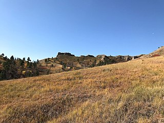
The Pine Ridge is an escarpment between the Niobrara River and the White River in far northwestern Nebraska. The high tableland between the rivers has been eroded into a region of forested buttes, ridges and canyons.

Rock Creek Station was a stagecoach and Pony Express station in southeastern Nebraska, three miles northeast of the present-day village of Endicott. The site is preserved as Rock Creek Station State Historical Park.

The Wildcat Hills are an escarpment between the North Platte River and Pumpkin Creek in the western Panhandle, in the state of Nebraska in the Great Plains region of the United States. Located in Banner, Morrill, and Scotts Bluff counties, the high tableland between the streams has been eroded by wind and water into a region of forested buttes, ridges and canyons that rise 150 to 300 m above the surrounding landscape.
Schramm Park State Recreation Area is a state recreation area in southeast Nebraska, United States, on the north side of the Platte River in Sarpy County.
Branched Oak State Recreation Area (SRA) is a Nebraska state recreation area located 2.5 miles north of Malcolm, Nebraska in Lancaster County. The lake is the largest of the Salt Valley Lakes with 1,800 acres (7 km2) of water in a 5,595-acre (23 km2) park.

Platte River State Park is a public recreation area encompassing 453 acres (183 ha) on the southern bluffs of the Platte River two miles (3.2 km) west of Louisville, Nebraska. The state park has a relatively steep, rolling topography compared to the surrounding region, with much of it forested.
Chadron State Park is a public recreation area located within the Nebraska National Forest, nine miles (14 km) south of Chadron, Nebraska, in the northwestern portion of the state. The park's 974 acres (394 ha) include a portion of the Pine Ridge escarpment and Chadron Creek. The park is wooded with ponderosa pine throughout and cottonwood trees near the creek and lagoon.

Virginia Smith Dam is a dam in Garfield County, Nebraska, about five miles northwest of Burwell.

Lewis and Clark State Recreation Area (SRA) is an 864-acre State Recreation Area located on the southern shore of Lewis and Clark Lake, in northeastern Nebraska. The recreation area is located in Knox County, approximately 12 miles (19 km) northwest of Crofton. The recreation area is managed by the Nebraska Game and Parks Commission.

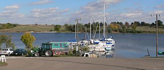
Fremont Lakes State Recreation Area (SRA) is a state park in eastern Nebraska, United States. The recreation area is located along the Platte River, approximately 3 miles (4.8 km) west of Fremont, or about 40 miles (64 km) northwest of Omaha. The recreation area is managed by the Nebraska Game and Parks Commission.
Willow Creek State Recreation Area (SRA) is a state park in northeastern Nebraska, United States. The recreation area is located on the 700 acre Willow Creek Reservoir, approximately 4 miles (6.4 km) southwest of Pierce, or about 15 miles (24 km) northwest of Norfolk. The recreation area is managed by the Nebraska Game and Parks Commission.
Box Butte Reservoir State Recreation Area (SRA) is a state park in northwestern Nebraska, United States. The recreation area is located on the 1,600 acre Box Butte Reservoir, a reservoir on the Niobrara River, approximately 9.5 miles (15.3 km) north of Hemingford, or about 31 miles (50 km) southeast of Crawford. The recreation area is managed by the Nebraska Game and Parks Commission. There are camping, fishing, swimming, and other recreational opportunities available.
Bluestem State Recreation Area (SRA) is a state park in southeastern Nebraska, United States. The recreation area is located on the 325-acre Bluestem Reservoir, approximately 2.5 miles (4.0 km) west of Sprague, or about 18 miles (29 km) south of the State Capitol, Lincoln. The recreation area is managed by the Nebraska Game and Parks Commission. The area is popular for boating, fishing, camping, and swimming. The reservoir is stocked with largemouth bass, bluegill, channel catfish, walleye and crappies. There are 19 primitive campsites.
Stagecoach State Recreation Area (SRA) is a state recreation area in southeastern Nebraska, United States. The recreation area surrounds the 195 acres (0.79 km2) Stagecoach Lake, located approximately 20 miles (32 km) south of Lincoln. The recreation area is managed by the Nebraska Game and Parks Commission.
Enders Reservoir State Recreation Area (SRA) is a state recreation area in southwestern Nebraska, United States. The recreation area surrounds the Enders Reservoir, a reservoir on Frenchman's Creek, approximately 1 mile (1.6 km) south of Enders, or about 7.5 miles (12.1 km) southeast of Imperial. The recreation area is managed by the Nebraska Game and Parks Commission. There are camping, fishing, swimming, and other recreational opportunities available.
Medicine Creek State Recreation Area (SRA) is a state recreation area in southern Nebraska, United States. The recreation area surrounds the 1,768-acre Medicine Creek Reservoir also known as Harry Strunk Lake, a reservoir on Medicine Creek. The recreation area is managed by the Nebraska Game and Parks Commission. There are camping, fishing, swimming, and other recreational opportunities available.
Memphis State Recreation Area (SRA) is a state recreation area in east-central Nebraska, United States. The recreation area surrounds the 48-acre Memphis Lake. The recreation area is managed by the Nebraska Game and Parks Commission.

