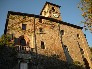
Calestano

Last updated
Calestano
Comune
Comune di Calestano
Calestano strada storica.jpg
Italy provincial location map 2015.svg
Red pog.svg
Calestano
Location of Calestano in Italy
Coordinates: 44°36′N10°7′E / 44.600°N 10.117°E / 44.600; 10.117 Coordinates: 44°36′N10°7′E / 44.600°N 10.117°E / 44.600; 10.117
Country Italy
Region Emilia-Romagna
Province Parma (PR)
Frazioni Borsano, Canesano, Cascina, Castello, Chiastre, Fragno, Fragnolatico, Fragnolo, La Costa, Linara, Marzolara, Montale, Pioppone, Ramiano, Ravarano, Ronzano, San Remigio, Torre, Vallerano, Vigolone
Government
  Mayor Francesco Peschiera
Area
  Total 57.36 km2 (22.15 sq mi)
Elevation 417 m (1,368 ft)
Population (30 April 2017) [1]
  Total 2,127
  Density 37/km2 (96/sq mi)
Demonym(s) Calestanesi
Time zone CET (UTC+1)
  Summer (DST) CEST (UTC+2)
Postal code43030
Dialing code 0525
Website Official website

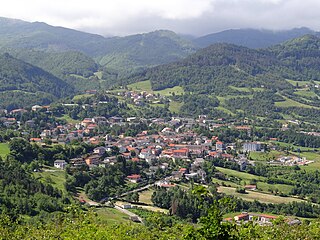
Calestano (Parmigiano: Calistan) is a comune (municipality) in the Province of Parma in the Italian region Emilia-Romagna, located about 100 kilometres (62 mi) west of Bologna and about 30 kilometres (19 mi) southwest of Parma.

The Parmigiano dialect, sometimes the Parmesan dialect, is a dialect of the Emilian language spoken in the Province of Parma, the western-central portion of the Emilia-Romagna administrative region.

<i>Comune</i> third-level administrative divisions of the Italian Republic

The comune is a basic administrative division in Italy, roughly equivalent to a township or municipality.

Province of Parma Province of Italy

The Province of Parma is a province in the Emilia-Romagna region of Italy. Its largest town and capital is the city of Parma.

Calestano borders the following municipalities: Berceto, Corniglio, Felino, Langhirano, Sala Baganza, Terenzo.

Berceto Comune in Emilia-Romagna, Italy

Berceto is a village and comune in Italy, located in the Apennine Mountains on the main road between La Spezia and Parma, in the Taro River valley, in the region of Emilia-Romagna.

Corniglio Comune in Emilia-Romagna, Italy

Corniglio is a comune (municipality) in the Province of Parma in the Italian region Emilia-Romagna, located about 100 kilometres (62 mi) west of Bologna and about 40 kilometres (25 mi) southwest of Parma.

Felino Comune in Emilia-Romagna, Italy

Felino is a comune (municipality) in the Province of Parma in the Italian region Emilia-Romagna, located about 90 kilometres (56 mi) west of Bologna and about 13 kilometres (8 mi) southwest of Parma. As of 2011 it had a population of 8,621.

Related Research Articles

Albareto Comune in Emilia-Romagna, Italy

Albareto is a comune (municipality) in the Province of Parma in the Italian region Emilia-Romagna, located about 130 kilometres (81 mi) west of Bologna and about 60 kilometres (37 mi) southwest of Parma.

Colorno Comune in Emilia-Romagna, Italy

Colorno is a comune (municipality) in the Province of Parma in the Italian region Emilia-Romagna, located about 90 kilometres (56 mi) northwest of Bologna and about 15 kilometres (9 mi) north of Parma.

Langhirano Comune in Emilia-Romagna, Italy

Langhirano is a comune (municipality) in the Province of Parma in the Italian region Emilia-Romagna, located about 90 kilometres (56 mi) west of Bologna and about 20 kilometres (12 mi) south of Parma.

Lesignano de Bagni Comune in Emilia-Romagna, Italy

Lesignano de' Bagni is a comune (municipality) in the Province of Parma in the Italian region Emilia-Romagna, located about 90 kilometres (56 mi) west of Bologna and about 15 kilometres (9 mi) south of Parma.

Montechiarugolo Comune in Emilia-Romagna, Italy

Montechiarugolo is a comune (municipality) in the Province of Parma in the Italian region Emilia-Romagna, located about 80 kilometres (50 mi) northwest of Bologna and about 13 kilometres (8 mi) southeast of Parma.

Noceto Comune in Emilia-Romagna, Italy

Noceto is a comune (municipality) in the province of Parma in the Italian region Emilia-Romagna, located about 100 kilometres (62 mi) northwest of Bologna and about 12 kilometres (7 mi) west of Parma.

Palanzano Comune in Emilia-Romagna, Italy

Palanzano is a comune (municipality) in the Province of Parma in the Italian region Emilia-Romagna, located about 90 kilometres (56 mi) west of Bologna and about 40 kilometres (25 mi) south of Parma. Palanzano borders the following municipalities: Corniglio, Monchio delle Corti, Neviano degli Arduini, Tizzano Val Parma, Ventasso, Vetto.

Pellegrino Parmense Comune in Emilia-Romagna, Italy

Pellegrino Parmense is a comune (municipality) in the Province of Parma in the Italian region Emilia-Romagna, located about 120 kilometres (75 mi) west of Bologna and about 35 kilometres (22 mi) west of Parma, in the northern part of the Valle del Ceno.

Sala Baganza Comune in Emilia-Romagna, Italy

Sala Baganza is a comune (municipality) in the Province of Parma in the Italian region Emilia-Romagna, located about 90 kilometres (56 mi) northwest of Bologna and about 12 kilometres (7 mi) southwest of Parma.

San Secondo Parmense Comune in Emilia-Romagna, Italy

San Secondo Parmense is a comune (municipality) in the Province of Parma in the Italian region Emilia-Romagna, located about 200 kilometres (120 mi) northwest of Bologna and about 15 kilometres (9 mi) northwest of Parma.

Solignano Comune in Emilia-Romagna, Italy

Solignano is a comune (municipality) in the Province of Parma in the Italian region Emilia-Romagna, located about 110 kilometres (68 mi) west of Bologna and about 35 kilometres (22 mi) southwest of Parma.

Sorbolo Comune in Emilia-Romagna, Italy

Sorbolo is a comune (municipality) in the Province of Parma in the Italian region Emilia-Romagna, located about 80 kilometres (50 mi) northwest of Bologna and about 11 kilometres (7 mi) northeast of Parma.

Terenzo Comune in Emilia-Romagna, Italy

Terenzo is a comune (municipality) in the Province of Parma in the Italian region Emilia-Romagna, located about 100 kilometres (62 mi) west of Bologna and about 30 kilometres (19 mi) southwest of Parma. As of 31 December 2004, it had a population of 1,250 and an area of 72.4 square kilometres (28.0 sq mi).

Tizzano Val Parma Comune in Emilia-Romagna, Italy

Tizzano Val Parma is a comune (municipality) in the Province of Parma in the Italian region Emilia-Romagna, located about 90 kilometres (56 mi) west of Bologna and about 35 kilometres (22 mi) southwest of Parma.

Tornolo Comune in Emilia-Romagna, Italy

Tornolo is a comune (municipality) in the Province of Parma in the Italian region Emilia-Romagna, located about 140 kilometres (87 mi) west of Bologna and about 70 kilometres (43 mi) southwest of Parma.

Traversetolo Comune in Emilia-Romagna, Italy

Traversetolo is a comune (municipality) in the Province of Parma in the Italian region Emilia-Romagna, located about 80 kilometres (50 mi) west of Bologna and about 20 kilometres (12 mi) south of Parma.

Valmozzola Comune in Emilia-Romagna, Italy

Valmozzola is a comune (municipality) in the Province of Parma in the Italian region Emilia-Romagna, located about 120 kilometres (75 mi) west of Bologna and about 45 kilometres (28 mi) southwest of Parma.

Varsi Comune in Emilia-Romagna, Italy

Varsi is a comune (municipality) in the Province of Parma in the Italian region Emilia-Romagna, located about 120 kilometres (75 mi) west of Bologna and about 40 kilometres (25 mi) southwest of Parma.

References

  1. All demographics and other statistics: Italian statistical institute Istat.