| Traversetolo | |
|---|---|
| Comune | |
| Comune di Traversetolo | |
 | |
 Traversetolo Location of Traversetolo in Italy | |
| Coordinates: 44°38′N10°23′E / 44.633°N 10.383°E Coordinates: 44°38′N10°23′E / 44.633°N 10.383°E | |
| Country | Italy |
| Region | Emilia-Romagna |
| Province | Parma (PR) |
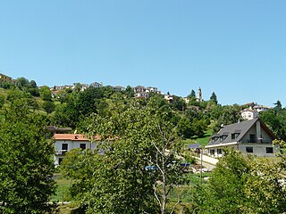
| Frazioni | Ariana, Bannone, Borgo Bottone, Borgo Salice, Campagna, Cantone, Carcarecchio, Case Cavalli, Case Montefiascone, Case Pozzo, Case Ronchei, Castellaro, Castione de' Baratti, Cazzola, Cevola, Cronovilla, Gabbiola, Gavazzo, Guardasone, Il Borgo, La Casa, La Fornace, Mamiano, Mazzola, Orio, Sbizzini, Sivizzano, Stafei, Stombellini, Torre, Val Cassano, Vignale, Villa Carbognani. |
| Government | |
| • Mayor | Simone Dall'Orto |
| Area | |
| • Total | 54.86 km2 (21.18 sq mi) |
| Elevation | 176 m (577 ft) |
| Population (31 December 2016) [1] | |
| • Total | 9,425 |
| • Density | 170/km2 (440/sq mi) |
| Demonym(s) | Traversetolesi |
| Time zone | CET (UTC+1) |
| • Summer (DST) | CEST (UTC+2) |
| Postal code | 43029 |
| Dialing code | 0521 |
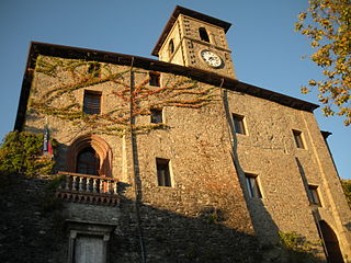
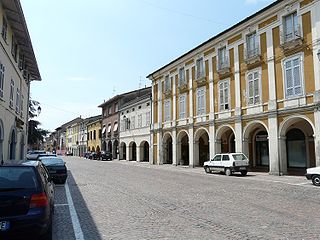
Traversetolo (Parmigiano: Travarsèddol) is a comune (municipality) in the Province of Parma in the Italian region Emilia-Romagna, located about 80 kilometres (50 mi) west of Bologna and about 20 kilometres (12 mi) south of Parma.
The Parmigiano dialect, sometimes the Parmesan dialect, is a dialect of the Emilian language spoken in the Province of Parma, the western-central portion of the Emilia-Romagna administrative region.

The comune is a basic administrative division in Italy, roughly equivalent to a township or municipality.

The Province of Parma is a province in the Emilia-Romagna region of Italy. Its largest town and capital is the city of Parma.
Traversetolo borders the following municipalities: Canossa, Lesignano de' Bagni, Montechiarugolo, Neviano degli Arduini, Parma, San Polo d'Enza.
Canossa is a comune and castle town in the Province of Reggio Emilia, Emilia-Romagna, northern Italy. It is the site where Holy Roman Emperor Henry IV did penance in 1077, standing three days bare-headed in the snow, in order to reverse his excommunication by Pope Gregory VII. The Walk to Canossa is sometimes used as a symbol of the changing relationship between the medieval Church and State.

Lesignano de' Bagni is a comune (municipality) in the Province of Parma in the Italian region Emilia-Romagna, located about 90 kilometres (56 mi) west of Bologna and about 15 kilometres (9 mi) south of Parma.
Montechiarugolo is a comune (municipality) in the Province of Parma in the Italian region Emilia-Romagna, located about 80 kilometres (50 mi) northwest of Bologna and about 13 kilometres (8 mi) southeast of Parma.