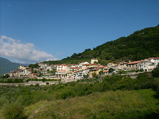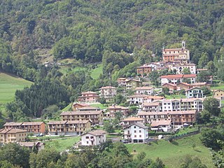
Costarainera is a comune (municipality) in the Province of Imperia in the Italian region Liguria, located about 100 kilometres (62 mi) southwest of Genoa and about 9 kilometres (6 mi) southwest of Imperia. As of 31 December 2004, it had a population of 775 and an area of 2.4 square kilometres (0.93 sq mi).

Mendatica is a comune (municipality) in the Province of Imperia in the Italian region Liguria, located about 100 kilometres (62 mi) southwest of Genoa and about 30 kilometres (19 mi) northwest of Imperia.

Montegrosso Pian Latte is a comune (municipality) in the Province of Imperia in the Italian region Liguria, located about 100 kilometres (62 mi) southwest of Genoa and about 25 kilometres (16 mi) northwest of Imperia.

Pietrabruna is a comune (municipality) in the Province of Imperia in the Italian region Liguria, located about 100 kilometres (62 mi) southwest of Genoa and about 11 kilometres (7 mi) west of Imperia. As of 31 December 2004, it had a population of 568 and an area of 9.9 square kilometres (3.8 sq mi).

Pornassio is a comune (municipality) in the Province of Imperia in the Italian region Liguria, located about 90 kilometres (56 mi) southwest of Genoa and about 25 kilometres (16 mi) northwest of Imperia. As of 31 December 2004, it had a population of 642 and an area of 27.7 square kilometres (10.7 sq mi).

Terzorio is a comune (municipality) in the Province of Imperia in the Italian region Liguria, located about 100 kilometres (62 mi) southwest of Genoa and about 11 kilometres (7 mi) southwest of Imperia. The municipality has an area of 1.9 square kilometres (0.73 sq mi).

Beverino is a comune (municipality) of c. 2,000 inhabitants in the province of La Spezia in the Italian region Liguria, located about 70 kilometres (43 mi) southeast of Genoa and about 11 kilometres (7 mi) north of La Spezia. It is part of the Vara river and of the Regional natural Park of Montemarcello-Magra.

Germignaga is a comune (municipality) in the Province of Varese in the Italian region Lombardy, located about 70 km northwest of Milan and about 20 km northwest of Varese. As of 31 December 2004, it had a population of 3,721 and an area of 6.2 km².

Camerata Cornello is a comune (municipality) in the Province of Bergamo in the Italian region of Lombardy, located about 60 km (37 mi) northeast of Milan and about 20 km (12 mi) north of Bergamo.

Cassiglio is a comune (municipality) in the Province of Bergamo in the northern Italian region of Lombardy, located about 100 kilometres (62 mi) northeast of Milan and about 45 kilometres (28 mi) north of Bergamo.

Lenna is a comune (municipality) in the Province of Bergamo in the Italian region of Lombardy, located about 70 kilometres (43 mi) northeast of Milan and about 30 kilometres (19 mi) north of Bergamo. As of 31 December 2004, it had a population of 676 and an area of 12.9 square kilometres (5.0 sq mi).

Piazza Brembana is a comune (municipality) in the Province of Bergamo in the Italian region of Lombardy, located about 70 kilometres (43 mi) northeast of Milan and about 30 kilometres (19 mi) north of Bergamo.

Taleggio is a comune (municipality) in the Province of Bergamo in the Italian region of Lombardy, located about 60 kilometres (37 mi) northeast of Milan and about 25 kilometres (16 mi) northwest of Bergamo. As of 31 December 2004, it had a population of 583 and an area of 46.6 square kilometres (18.0 sq mi).

Agugliano is a comune (municipality) in the Province of Ancona in the Italian region Marche, located about 13 kilometres (8 mi) southwest of Ancona.
Camerata Picena is a comune (municipality) in the Province of Ancona in the Italian region Marche, located about 14 kilometres (9 mi) southwest of Ancona.
Chiaravalle is a comune (municipality) in the Province of Ancona in the Italian region Marche, located about 15 kilometres (9 mi) west of Ancona. As of 31 December 2004, it had a population of 14,397 and an area of 17.4 square kilometres (6.7 sq mi).

Santa Maria Nuova is a comune (municipality) in the Province of Ancona in the Italian region Marche, located about 20 kilometres (12 mi) southwest of Ancona.

Cervara di Roma is a comune (municipality) in the Metropolitan City of Rome in the Italian region of Latium, located about 50 kilometres (31 mi) east of Rome. Cervara di Roma borders the following municipalities: Agosta, Arsoli, Camerata Nuova, Marano Equo, Rocca di Botte, Subiaco.
Vallepietra is a comune (municipality) in the Metropolitan City of Rome in the Italian region Lazio, located about 60 kilometres (37 mi) east of Rome, in the Monti Simbruini area.
Fonte Nuova is a comune (municipality) in the Metropolitan City of Rome in the Italian region Lazio, located about 15 kilometres (9 mi) northeast of Rome.


