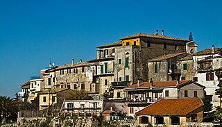
Poggio Catino is a comune (municipality) in the Province of Rieti in the Italian region of Latium, located about 45 kilometres (28 mi) northeast of Rome and about 20 kilometres (12 mi) southwest of Rieti. As of 31 December 2011, it had a population of 1,335 and an area of 15.0 square kilometres (5.8 sq mi).

Camerata Nuova is a comune (municipality) in the Metropolitan City of Rome in the Italian region of Lazio, located about 50 kilometres east of Rome.
Campagnano di Roma is a comune (municipality) in the Metropolitan City of Rome in the Italian region of Latium, located about 30 kilometres northwest of Rome. It was first mentioned in 1076, having been carved out of the great estate assembled on the Roman pattern by Pope Adrian I, ca. 780, his Domusculta Capracorum. In medieval times, Campagnano di Roma was on the via Francigena. Here, Sigeric, Archbishop of Canterbury, sojourned on his return journey from Rome about 990.

Carpineto Romano is a comune (municipality) in the Metropolitan City of Rome in the Italian region Lazio, located about 60 kilometres southeast of Rome.
Casape is a comune (municipality) in the Metropolitan City of Rome in the Italian region of Latium, located about 30 kilometres (19 mi) east of Rome, on the western slopes of the Monti Prenestini.

Cervara di Roma is a comune (municipality) in the Metropolitan City of Rome in the Italian region of Latium, located about 50 kilometres (31 mi) east of Rome. Cervara di Roma borders the following municipalities: Agosta, Arsoli, Camerata Nuova, Marano Equo, Rocca di Botte, Subiaco.

Licenza is a comune (municipality) in the Metropolitan City of Rome Capital, in the Italian region of Latium, located about 40 kilometres (25 mi) northeast of Rome.
Mandela is a comune (municipality) in the Metropolitan City of Rome in the Italian region of Lazio, located about 40 kilometres (25 mi) northeast of Rome.
Manziana is a comune (municipality) in the Metropolitan City of Rome in the Italian region of Latium, located about 40 kilometres (25 mi) northwest of Rome.

Mazzano Romano is a comune (municipality) in the Metropolitan City of Rome in the Italian region of Latium, located about 35 kilometres (22 mi) north of Rome.
Monteflavio is a comune (municipality) in the Metropolitan City of Rome in the Italian region of Latium, located about 35 kilometres northeast of Rome.

Montelibretti is a town and comune (municipality) in the Metropolitan City of Rome in the Italian region of Lazio, located about 30 kilometres (19 mi) northeast of Rome on the slopes of Monti Sabini.
Montorio Romano is a comune (municipality) in the Metropolitan City of Rome in the Italian region of Latium, located about 35 kilometres (22 mi) northeast of Rome.

Nazzano is a comune (municipality) in the Metropolitan City of Rome in the Italian region Lazio, located about 40 kilometres (25 mi) north of Rome.
Ponzano Romano is a comune (municipality) in the Metropolitan City of Rome in the Italian region of Latium, located about 40 kilometres (25 mi) north of Rome. As of 31 December 2004, it had a population of 1,061 and an area of 19.3 square kilometres (7.5 sq mi).

Riofreddo is a comune (municipality) in the Metropolitan City of Rome in the Italian region Lazio, located about 45 kilometres (28 mi) northeast of Rome. The name is derived from the Latin "Rivus frigidus," meaning "cold river" or "cold stream."
Rocca Santo Stefano is a comune (municipality) in the Metropolitan City of Rome in the Italian region of Latium, located about 45 kilometres (28 mi) east of Rome.

Roviano is a comune (municipality) in the Metropolitan City of Rome in the Italian region of Latium, located about 45 kilometres (28 mi) northeast of Rome.

San Gregorio da Sassola is a comune (municipality) in the Metropolitan City of Rome in the Italian region of Latium, located about 30 kilometres (19 mi) east of Rome.
Torrita Tiberina is a comune (municipality) in the Metropolitan City of Rome in the Italian region Lazio, located about 40 kilometres (25 mi) north of Rome. As of 31 December 2004, it had a population of 1,010 and an area of 10.8 square kilometres (4.2 sq mi).


