Anzio is a town and comune on the coast of the Lazio region of Italy, about 51 kilometres (32 mi) south of Rome.

Nettuno is a town and comune of the Metropolitan City of Rome in the Lazio region of central Italy, 60 kilometres south of Rome. A resort city and agricultural center on the Tyrrhenian Sea, it has a population of approximately 50,000.

Trevignano Romano is a small town and comune in the Metropolitan City of Rome, Lazio, central Italy. With a population of about 5,000, it is located on the volcanic Lake Bracciano. It is about 47 kilometres (29 mi) away from Rome.

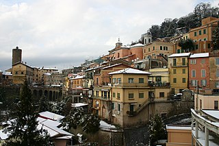
Nemi is a town and comune in the Metropolitan City of Rome, in the Alban Hills overlooking Lake Nemi, a volcanic crater lake. It is 6 kilometres (4 mi) northwest of Velletri and about 30 kilometres (19 mi) southeast of Rome.
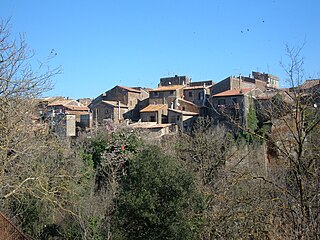
Bassano Romano is a town and comune situated in the hills of Monti Sabatini in the province of Viterbo, in northern Lazio (Italy). With its origins about 1000 as the agricultural hamlet of Bassano di Sutri the village's future was founded in 1160 by the wealthy landowner Enotrio Serco, who initiated the construction at the top of the slope of a fortified residence that over the centuries became a princely dwelling, frescoed by famous artists. In 1482 Pope Sixtus IV assigned the Foedus Bassani to the Anguillara, Roman patricians . The growth of the comune redoubled after 1565, when the signory was reassigned by Pope Clement VIII to the Giustiniani, merchants of Genoese origin settled at Rome. In 1605 the signory was raised to a marquessate: a hunting lodge called "La Rocca", granaries, a stone bridge and the church dedicated to San Vincenzo were all constructed. During the Giustiniani residence, artists were commissioned to carry out frescoes: Francesco Albani, Domenico Zampieri "Domenichino" and Antonio Tempesta are all represented. In 1644, a bulla of Pope Innocent X made the marchese of Bassano a prince, and the flock of papal and noble visitors included James Stuart, pretender to the thrones of England and Scotland. In 1735, under Giustiniani patronage the maiolica manufactory of Bartolomeo Terchi was transferred here from Siena.

Romano di Lombardia is a comune (municipality) in the Province of Bergamo in the northern Italian region of Lombardy, located about 45 kilometres (28 mi) east of Milan and about 20 kilometres (12 mi) southeast of Bergamo. It received the honorary title of city with a presidential decree on September 17, 1962.

Barbarano Romano is a comune (municipality) in the Province of Viterbo in the Italian region of Latium, located about 50 kilometres (31 mi) northwest of Rome and about 20 kilometres (12 mi) south of Viterbo.

Agosta is a comune (municipality) in the Metropolitan City of Rome in the Italian region of Latium, located about 45 kilometres (28 mi) east of Rome.

Arcinazzo Romano is a comune (municipality) in the Metropolitan City of Rome in the Italian region of Lazio, located about 50 kilometres (31 mi) east of Rome.

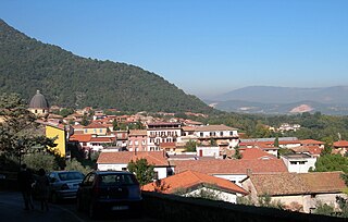
Cervara di Roma is a comune (municipality) in the Metropolitan City of Rome in the Italian region of Latium, located about 50 kilometres (31 mi) east of Rome. Cervara di Roma borders the following municipalities: Agosta, Arsoli, Camerata Nuova, Marano Equo, Rocca di Botte, Subiaco.

Lanuvio is a comune (municipality) in the Metropolitan City of Rome in the Italian region of Latium, located about 30 kilometres (19 mi) southeast of Rome, on the Alban Hills.
Magliano Romano is a comune (municipality) in the Metropolitan City of Rome in the Italian region of Latium, located about 30 kilometres (19 mi) north of Rome.

Mazzano Romano is a comune (municipality) in the Metropolitan City of Rome in the Italian region of Latium, located about 35 kilometres (22 mi) north of Rome.

Montelibretti is a town and comune (municipality) in the Metropolitan City of Rome in the Italian region of Lazio, located about 30 kilometres (19 mi) northeast of Rome on the slopes of Monti Sabini.

Riofreddo is a comune (municipality) in the Metropolitan City of Rome in the Italian region Lazio, located about 45 kilometres (28 mi) northeast of Rome. The name is derived from the Latin "Rivus frigidus," meaning "cold river" or "cold stream."

Roviano is a comune (municipality) in the Metropolitan City of Rome in the Italian region of Latium, located about 45 kilometres (28 mi) northeast of Rome.

Sacrofano is a comune (municipality) in the Metropolitan City of Rome in the Italian region of Latium, located about 25 kilometres (16 mi) north of Rome. Located near the Monti Sabatini, at the feet of an extinct volcano, it is included in the Regional Park of Veii.

Maenza is a comune (municipality) in the Province of Latina in the Italian region Lazio, located about 70 km (43 mi) southeast of Rome and about 25 km (16 mi) east of Latina. It is home to a castle, originally built as a watchtower in the 12th–13th centuries, and enlarged in the 16th century. In an effort to bring in new residents, it is selling abandoned houses for €1 if buyers commit to renovations.

Supino is a comune (municipality) in the Province of Frosinone in the Italian region Lazio, located about 70 kilometres (43 mi) southeast of Rome and about 10 kilometres (6 mi) west of Frosinone.

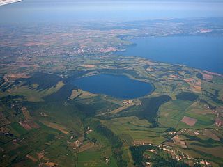
Polline Martignano is the 59th zona of the Italian capital Rome, abbreviated as Z. LIX. It belongs to the Municipio XV and has 40 inhabitants (2016). It is located as an exclave in the northwest of the city and it is surrounded by the municipalities of Anguillara Sabazia, Campagnano di Roma and Trevignano Romano.


