References
- 1 2 3 4 5 6 Miller, Donald C. (1978). Ghost Towns of California. Boulder, Colorado: Pruett Publishing Company. p. 29. ISBN 0871085178.
- ↑ Durham, David L. (1998). California's Geographic Names: A Gazetteer of Historic and Modern Names of the State. Clovis, California: Word Dancer Press. p. 511. ISBN 1-884995-14-4.
Municipalities and communities of Amador County, California, United States | ||
|---|---|---|
| Cities | 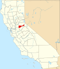 | |
| CDPs | ||
| Other unincorporated communities | ||
| Ghost towns | ||
| Footnotes | ‡This CDP also has portions in an adjacent county or counties | |
38°17′46″N120°53′28″W / 38.2962°N 120.8912°W
| | This Amador County, California-related article is a stub. You can help Wikipedia by expanding it. |