Related Research Articles

Bonneville County is a county located in the U.S. state of Idaho. As of the 2020 census, the population was 123,964, making it the fourth-most populous county in Idaho and the most populous in eastern Idaho. Its county seat and largest city is Idaho Falls. Bonneville County was established in 1911 and named after Benjamin Bonneville (1796–1878), a French-born officer in the U.S. Army, fur trapper, and explorer in the American West. Benjamin was the son of Nicholas Bonneville of France, an Illuminati member who had written the "Illuminati Manifesto for World Revolution" in 1792, which played a significant role in the French revolution. Bonneville County is part of the Idaho Falls Metropolitan Statistical Area.

The Cariboo is an intermontane region of British Columbia, Canada, centered on a plateau stretching from Fraser Canyon to the Cariboo Mountains. The name is a reference to the caribou that were once abundant in the region.
The Selkirk Mountains are a mountain range spanning the northern portion of the Idaho Panhandle, eastern Washington, and southeastern British Columbia which are part of a larger grouping of mountains, the Columbia Mountains. They begin at Mica Peak and Krell Hill near Spokane and extend approximately 320 km north from the border to Kinbasket Lake, at the now-deserted location of the onetime fur company post, Boat Encampment. The range is bounded on its west, northeast and at its northern extremity by the Columbia River, or the reservoir lakes now filling most of that river's course. From the Columbia's confluence with the Beaver River, they are bounded on their east by the Purcell Trench, which contains the Beaver River, Duncan River, Duncan Lake, Kootenay Lake and the Kootenay River. The Selkirks are distinct from, and geologically older than, the Rocky Mountains. The neighboring Monashee and Purcell Mountains, and sometimes including the Cariboo Mountains to the northwest, are also part of the larger grouping of mountains known as the Columbia Mountains. A scenic highway loop, the International Selkirk Loop, encircles the southern portions of the mountain range.
Caribou Mountains can refer to:
Wayan is a small unincorporated community, located 35 miles north of Soda Springs in Caribou County, Idaho, United States. Located on State Highway 34, it is part of a valley known as Grays Lake, and its zip code is 83285. Wayan is located at 42.978 N and 111.376 W. The community was named after its first post master and his wife.

Caribou–Targhee National Forest is located in the states of Idaho and Wyoming, with a small section in Utah in the United States. The forest is broken into several separate sections and extends over 2.63 million acres (10,600 km2). To the east the forest borders Yellowstone National Park, Grand Teton National Park and Bridger–Teton National Forest. Most of the forest is a part of the 20-million-acre (81,000 km2) Greater Yellowstone Ecosystem.
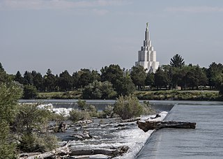
Eastern Idaho is the area of Idaho lying east of the Magic Valley region. Much of the region is in the Mormon Corridor, and the Church of Jesus Christ of Latter-day Saints plays a major role in the lives of the region's residents.

Sugarbowl-Grizzly Den Provincial Park and Protected Area is a provincial park in British Columbia, Canada.
Cache National Forest is a 533,840-acre area of National Forest System land in Idaho and Utah which was established on July 1, 1908, by the U.S. Forest Service. The majority of its area is in Utah, and was initially created when the Bear River National Forest was disbanded. On July 1, 1915, all of Pocatello National Forest was added. In 1973 the Idaho portion was transferred to the administration of Caribou National Forest, while the Utah portion was combined administratively with Wasatch National Forest, creating the Wasatch-Cache National Forest. In descending order of forestland area, the Cache National Forest portion is located in Cache, Bear Lake, Franklin, Weber, Rich, Box Elder, Caribou, and Morgan counties. The forest has a current area of 701,453 acres (2,838.68 km2), which comprises 43.56% of the combined Wasatch-Cache's total acreage. The forest is administered from Salt Lake City, Utah as part of the Wasatch-Cache National Forest, but there are local ranger district offices in Logan and Ogden. From circa 1911 until August 1923, the area was roamed by Old Ephraim.

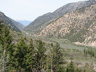
Gem Valley is a rural valley in Caribou County, Bannock, and Franklin counties in Idaho, United States, so named for its local gemstones which can be found throughout the valley. It is approximately 20 miles (32 km) wide at its widest point east to west, and 60–70 miles (97–113 km) long north to south. By local definition, Gem Valley originates at the Chesterfield Reservoir to the north, and terminates at the Oneida Narrows Reservoir to the south.
Grays Lake is a wetland in Idaho, United States. It lies in Bonneville County and Caribou County. Grays Lake National Wildlife Refuge was established in the area in 1965. Ranching is the predominant use of surrounding lands.
Freedom is an unincorporated community in both northeastern Caribou County, Idaho, and northwestern Lincoln County, Wyoming, in the United States; the Wyoming portion of the community is also a census-designated place (CDP). The population was 247 at the 2020 census.
Lincoln is a census-designated place in Bonneville County, Idaho located just east of Idaho Falls, southwest of Iona and north of Ammon. As of the 2010 census, its population was 3,647. Lincoln has an area of 1.465 square miles (3.79 km2), all of it land.
Caribou Mountain or Mount Caribou may refer to:
Cariboo is an adapted spelling of the word "caribou". The term can refer to:
Blackfoot Dam is a dam in Caribou County, Idaho, in the eastern part of the state.
Teton Valley is located on the west slope of the Teton Mountain Range in the western United States. Sometimes known as "The quiet side of the Tetons", it is composed of the cities of Victor, Idaho, Driggs, Idaho, Tetonia, Idaho, and Alta, Wyoming. The valley's economy is based in agriculture and ranching, with a shifting emphasis towards recreational tourism. Teton Valley has a unique climate and geology, as well as a wide variety of attractions including national parks and opportunities for wildlife viewing, fishing, hiking, horseback riding, skiing and participating in the arts.
Hatch is an unincorporated community in Caribou County, in the U.S. state of Idaho.
References
- ↑ Idaho.gov - Caribou County Archived August 15, 2009, at the Wayback Machine accessed 2009-05-29
- ↑ "Caribou Mountain, Idaho". Peakbagger.com. Retrieved 2022-09-24.
43°20′N111°30′W / 43.333°N 111.500°W
| | This Bonneville County, Idaho state location article is a stub. You can help Wikipedia by expanding it. |
| | This Caribou County, Idaho state location article is a stub. You can help Wikipedia by expanding it. |