
The Outback is a remote, vast, sparsely populated area of Australia. The Outback is more remote than the bush, which includes any location outside the main urban areas.

Coonabarabran is a town in Warrumbungle Shire that sits on the divide between the Central West and North West Slopes regions of New South Wales, Australia. At the 2016 census, the town had a population of 2,537. Local and district residents refer to the town as 'Coona'.

The Macquarie River is part of the Macquarie–Barwon catchment within the Murray–Darling basin, is one of the main inland rivers in New South Wales, Australia.

Inverell is a large town in northern New South Wales, Australia, situated on the Macintyre River, close to the Queensland border. It is also the centre of Inverell Shire. Inverell is located on the Gwydir Highway on the western slopes of the Northern Tablelands. It has a temperate climate. In the 2016 census, the population of Inverell was 11,660 and the Inverell Shire population was 16,483.

Bourke is a town in the north-west of New South Wales, Australia. The administrative centre and largest town in Bourke Shire, Bourke is approximately 800 kilometres (500 mi) north-west of the state capital, Sydney, on the south bank of the Darling River.

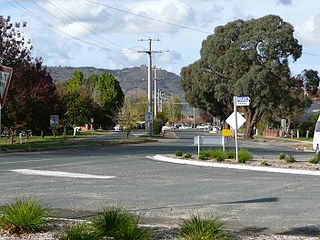
Mendooran is a small town adjacent to the Castlereagh River in the Warrumbungle Shire of central western New South Wales, Australia. The town lies at an altitude of 271 metres above sea level, 348 kilometres west of Sydney, 75 kilometres from Dubbo and 71 kilometres southeast of Coonabarabran. At the 2011 census, Mendooran had a population of 302 people. The Castlereagh Highway also runs through the town, changing its name to Bandulla Street in the centre.

Oxley is a south-western suburb in the City of Brisbane, Queensland, Australia. It is located approximately 10.8 kilometres (6.7 mi) from the Brisbane CBD. It was named after the early Australian explorer John Oxley. The suburb supports a mix of residential, retail and industrial land.

Pambula is a town in Bega Valley Shire on the far south coast of New South Wales, Australia 454 kilometres (282 mi) south of Sydney via the Princes Highway. At the 2016 census, Pambula had a population of 970 people.

Wauchope is a town in the Mid North Coast region of New South Wales, Australia. It is within the boundaries of the Port Macquarie-Hastings Council area. Wauchope is inland on the Hastings River and the Oxley Highway 19 km (12 mi) west of Port Macquarie. The town is 383 km (238 mi) north of the state capital Sydney.

Iluka is a small village at the mouth of the Clarence River in north-eastern New South Wales, Australia. It is situated directly across the river from the resort town of Yamba. At the 2016 census, Iluka had a population of 1,718 people. The town's name is derived from an Aboriginal word meaning "near the sea".

"Let's Dance" is a song recorded by English singer-songwriter David Bowie, released as the title track of his 1983 album Let's Dance. Written by Bowie and produced by Nile Rodgers of the band Chic, it was released as the lead single from the album in March 1983 and went on to become one of his biggest-selling tracks. It was recorded in late 1982 at the Power Station in Manhattan and was the first song recorded for the album. The end of the song features a guitar solo by then-rising blues guitarist Stevie Ray Vaughan.

Innamincka, formerly Hopetoun, is a town and locality in north-east South Australia, with a population of 44 people. By air it is 821 kilometres north-east of Adelaide and 365 kilometres north-east from the closest town, Lyndhurst. It is also 66 kilometres north-east of the Moomba Gas Refinery. The town lies within the Innamincka Regional Reserve and is surrounded by the Strzelecki Desert to the south and the Sturt Stony Desert to the north. It is linked by road to Lyndhurst via the Strzelecki Track, to the Birdsville Developmental Roadvia Cordillo Downs Road and Arrabury Road (via Haddon Corner,and the Walkers Crossing Track to the Birdsville Track; the Walkers Crossing Track is closed in summer and only traversable in dry weather. The township is situated along the Cooper Creek, a part of the Lake Eyre basin.

Bangalow is a small town in the Northern Rivers region of New South Wales, Australia in Byron Shire. The town is 765 kilometres (475 mi) north of Sydney and 167 kilometres (104 mi) south of Brisbane, just off the Pacific Highway. The town's name appears to have been derived from an Aboriginal word, "Bangalla", said to mean 'a low hill' or 'a kind of palm tree'.

Oxley is a community on the lower Lachlan River in the Riverina district of New South Wales, Australia near the junction of the Lachlan and Murrumbidgee Rivers. The township which developed in the mid-1860s was named after the noted Australian explorer, John Oxley. At the 2006 census, Oxley had a population of 159 people.
Walwa, is a town in the Shire of Towong in north east Victoria, Australia. The town is located 1 kilometre from the Murray River on the former Murray Valley highway between Wodonga and Corryong. At the 2016 census, the Walwa population had declined to just 177 having been 268 just ten years earlier.

Eugowra is a town in the Central West region of New South Wales, Australia. The town is split between Forbes Shire and Cabonne Shire local government area, 341 kilometres (212 mi) west of the state capital, Sydney. At the 2016 census, Eugowra had a population of 779.

Dorrigo, a small town on the Waterfall Way, is located on the Northern Tablelands, in northern New South Wales, Australia. The town is part of Bellingen local government area.
Nelligen is a village on the Clyde River on the South Coast of New South Wales, Australia. It is located on the Kings Highway.

Carroll is a parish and small village on the Oxley Highway, 20 km east of Gunnedah, New South Wales. At the 2016 census, Carroll had a population of 337 people. The Namoi River runs approximately parallel to the highway which is also the main street there. Periodically this river floods the town and surrounding area, forcing the closure of the Oxley Highway. The surrounding area is part of the Liverpool Plains region.

European land exploration of Australia deals with the opening up of the interior of Australia to European settlement which occurred gradually throughout the colonial period, 1788–1900. A number of these explorers are very well known, such as Burke and Wills who are well known for their failed attempt to cross the interior of Australia, as well as Hamilton Hume and Charles Sturt.
