
Park County is a county in the U.S. state of Wyoming. As of the 2010 United States Census, the population was 28,205. The county seat is Cody.

Crook County is a county in the northeastern section of the U.S. state of Wyoming. As of the 2010 United States Census, the population was 7,083, making it the third-least populous county in Wyoming. Its county seat is Sundance.
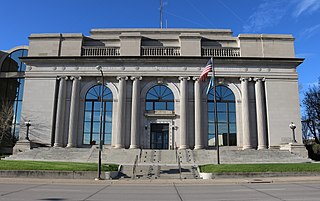
Pennington County is a county in the U.S. state of South Dakota. As of the 2020 United States Census, the population was 109,222, making it the second-most populous county in South Dakota. Its county seat is Rapid City. The county was created in 1875, and was organized in 1877. It is named for John L. Pennington, fifth Governor of Dakota Territory, who held office in 1875 when the county was formed.

Custer County is a county in the U.S. state of South Dakota. As of the 2020 United States Census, the population was 8,318. Its county seat is Custer. The county was created in 1875, and was organized in 1877.
U.S. Route 12 is an east–west United States highway, running from Aberdeen, Washington, to Detroit, Michigan, for almost 2,500 miles (4,000 km). The highway has mostly been superseded by Interstate 90 (I-90) and I-94, but unlike most U.S. routes that have been superseded by an Interstate, US 12 remains as an important link for local and regional destinations. The highway's western terminus is in Aberdeen, Washington, at an intersection with US 101, while the highway's eastern terminus is in Downtown Detroit, at the corner of Michigan and Cass avenues, near Campus Martius Park.
U.S. Route 14, an east–west route, is one of the original United States highways of 1926. It currently has a length of 1,398 miles (2,250 km), but it had a peak length of 1,429 miles (2,300 km). For much of its length, it runs roughly parallel to Interstate 90.

South Dakota Highway 44 (SD 44) is a state highway in southern South Dakota that runs from U.S. Route 385 (US 385) west of Rapid City to Interstate 29 (I-29) south of Sioux Falls. It is just more than 379 miles (610 km) long.

Three Forks is an unincorporated community in Pennington County, South Dakota, United States. It lies at the intersection of U.S. Routes 16 and 385, just north of Hill City along Spring Creek. A small general store featuring fuel is open year-round; other businesses are open seasonally, including a campground, a motel, a miniature golf-course, and an ice-cream stand. The campground is the site of an annual Octoberfest event, and the area is heavily patronized during the Sturgis Motorcycle Rally in August of each year. In recent years, considerable residential development of the immediate area has swollen its population.

Keystone Wye is an interchange of U.S. Route 16 (US 16) and US 16A located in the Black Hills of South Dakota, featuring two unique structural glued laminated timber bridges. The Keystone Wye is a three-level Directional T interchange for the two divided highways, constructed in 1967-1968 as part of a project by the South Dakota Department of Transportation (SDDOT) to convert US 16 to a four-lane highway between Rapid City and Keystone. It was designed by Clyde Jundt and Kenneth C. Wilson.
Wyoming Highway 24 (WYO 24), also known as the Bear Lodge Highway, is a 46.72-mile (75.19 km) state highway in Crook County, Wyoming, United States. that connects U.S. Route 14 (US 14) in Carlile Junction with South Dakota Highway 34 (SD 34) at the South Dakota state line. The route passes through the northern portion of the Bear Lodge Mountains, part of the Black Hills National Forest. The highway also passes by Devils Tower National Monument.
South Dakota Highway 87 (SD 87) is a 37.894-mile-long (60.984 km) state highway in the southwestern part of the U.S. state of South Dakota. It travels through the Black Hills region. The highway's southern terminus is at an intersection with U.S. Route 385 (US 385), about 6 miles (9.7 km) southeast of Pringle, within the southwestern part of Wind Cave National Park. Its northern terminus is at an intersection with US 16/US 385 about 3 miles (4.8 km) south-southwest of Hill City, within the east-central part of the Black Hills National Forest.

South Dakota Highway 36 is an east–west state route located in southwest South Dakota. It begins at the junction of U.S. Route 16A on the eastern edge of Custer State Park, and ends at South Dakota Highway 79 just south of Hermosa. It is slightly over nine miles (14 km) in length.
U.S. Highway 20 is a part of the United States Numbered Highway System that runs for 3,365 miles (5,415 km) from Newport, Oregon to Boston, Massachusetts. Within the State of Nebraska it is a state highway that begins on the Wyoming–Nebraska state line west of Harrison near the Niobrara River and runs to the Nebraska–Iowa state line in South Sioux City. Throughout its 431.60-mile (694.59 km) length the route passes through a diverse range of landscapes including bluffs and escarpments in the Northwest Panhandle, the Nebraska Sandhills in the northern part of the state, and rolling hills and plains as the highway approaches the Missouri River valley south of Sioux City, Iowa. Throughout its length, US 20 is a two-lane highway with the exception of the easternmost 8.45 miles (13.60 km) which is four-lane divided highway, the last 3.21 miles (5.17 km) of which is concurrent with Interstate 129. The 197 miles (317 km) between the Wyoming border and Valentine is designated as the Bridges to Buttes Byway, one of nine scenic byways in the state of Nebraska.
Maverick Junction, South Dakota, United States, is an unincorporated community located in Fall River County at the intersection of South Dakota Highway 79 and US Highways 18 and 385, approximately five miles southeast of Hot Springs.
Mule Creek Junction is an unpopulated locale in Niobrara County, Wyoming at the junction of US 18 and US 85.
Four Mile is an unincorporated community in Custer County, South Dakota, United States, located four miles west of Custer at the junction of U.S. Route 16 and Pleasant Valley Road.

Dewey is an unincorporated community near the southwest corner of Custer County, South Dakota, United States, less than one mile from the Wyoming border in a prairie region of the Black Hills. There are approximately five or six homes in town. Dewey has a volunteer fire department in the Edgemont city district.
South Dakota Highway 79 (SD 79) is a 209-mile (336 km) state highway western South Dakota, United States, that runs from Maverick Junction near the Black Hills National Forest to the North Dakota state line.

The Bear Lodge Mountains are a small mountain range in Crook County, Wyoming. These mountains are protected in the Black Hills National Forest as part of its Bearlodge District. Devils Tower National Monument was the first U.S. National Monument and draws about 400,000 visitors per year to the area. The Bear Lodge Mountains are one of three mountain ranges that comprise the Black Hills region and national forest, including the Black Hills itself and South Dakota's Elk Mountains.
U.S. Route 385 (US 385) is a part of the United States Numbered Highway System that travels from Big Bend National Park in Texas to US 85 in Deadwood, South Dakota. Within the state of Nebraska, the highway is known as the Gold Rush Byway, one of nine scenic byways across the state. The highway follows along the old Sidney-Black Hills trail which played a crucial role during the Black Hills Gold Rush in the late 1870s. It served as the primary route to transport gold and mining gear between Sidney, Nebraska and the Black Hills to the north. Today, the highway enters Nebraska in the southeastern portion of the Nebraska Panhandle on the state line with Colorado northeast of Julesburg and continues in a northerly direction to the South Dakota state line north of Chadron.

