Garrett County (gərɛt) is the westernmost county of the U.S. state of Maryland. As of the 2010 census, the population was 30,097, making it the third-least populous county in Maryland. Its county seat is Oakland. The county was named for John Work Garrett (1820–1884), president of the Baltimore and Ohio Railroad. Created from Allegany County, Maryland in 1872, it was the last Maryland county to be formed.

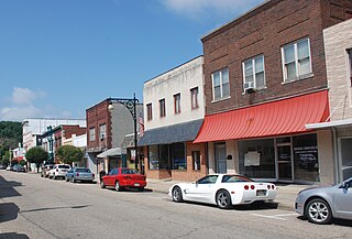
Clifton Forge is a town in Alleghany County, Virginia, United States which is part of the Roanoke Region. The population was 3,884 at the 2010 census. The Jackson River flows through the town, which as a result was once known as Jackson's River Station.

The Pedlar River is a 33.9-mile-long (54.6 km) tributary of the James River in west-central Virginia in the United States. Via the James River, it is part of the watershed of Chesapeake Bay.
Mill Creek is a 5.3-mile-long (8.5 km) tributary stream of the North Fork South Branch Potomac River in Pendleton County, West Virginia. Mill Creek rises on the western flanks of North Fork Mountain and from there, flows north through Germany Valley. Its confluence with the North Fork lies at Hinkle Gap between Germany and Harman Knobs.
Greenwood Mountain is the name of several mountain summits in the United States.
West End is a Roanoke, Virginia neighborhood located in central Roanoke south of the Norfolk Southern railyard. It borders the neighborhoods of Hurt Park and Mountain View on the west, Downtown on the east, Gilmer on the north across the Norfolk Southern railyard and Old Southwest on the south.
Kenwood is a Roanoke, Virginia neighborhood located in southeast Roanoke, along the north bank of the Roanoke River. It borders the neighborhoods of Morningside on the west, Fallon on the north, Riverdale on the south and the Town of Vinton on the east. The neighborhood is predominantly residential in character with the bulk of commercial development built along its Virginia State Route 24 frontage. Its development patterns typical of those experienced for an American city during the early 20th century.
Westview Terrace is a Roanoke, Virginia neighborhood located in northwest Roanoke. It borders the neighborhoods of Peachtree/Norwood on the west, Villa Heights and Washington Heights on the south and Miller Court/Arrowood on the north and east. The neighborhood is predominantly residential in character throughout its area with limited commercial development along its Virginia State Route 117 frontage. Its development patterns typical of those experienced for an American city during the mid-20th century with low-density housing.

The Tye River is a 35.4-mile-long (57.0 km) tributary of the James River in central Virginia in the United States. Originating on the eastern slope of the Blue Ridge Mountains in Nelson County, and fed by the Piney and Buffalo rivers, by way of the James River it is part of the watershed of the Chesapeake Bay.

Carpenter Creek in western Virginia, now known as Potts Creek, was shown on a map of the area drawn by Joshua Fry and Peter Jefferson in 1751 and printed in 1755, and so called in the text of Thomas Jefferson's "Notes on the State of Virginia" that he prepared in the 1780s. Carpenter's Creek is also shown as such on John Ballendine's map of the James River published c1772 and Thomas Hutchins' map of the western regions of Virginia published in 1778.
Fort Carpenter, Alleghany County, Virginia, was built about 1755-1756 by Joseph Carpenter, who migrated from the Province of New York to "the big bend" of the Jackson River on the Virginia frontier about 1745-1746. It was actually a fortified house, or blockhouse. Located on a low bluff near the mouth of Carpenter Creek, it was later known as Cedar Hill. Logs and stones from the original structure were used in the later dwelling now on the site. A young George Washington visited the string of frontier forts during the French and Indian War in 1756, inspecting Fort Young on the north side of the Jackson River, and Fort Carpenter, described as a fortified house, on the south side.
The Buffalo River is a 31.5-mile-long (50.7 km) tributary of the Tye River in the U.S. state of Virginia. It is part of the James River watershed.

Craig Creek is an 84-mile-long (135 km) tributary of the James River in the U.S. state of Virginia. It flows through the Ridge-and-Valley Appalachians in western Virginia, passing 15 miles (24 km) northwest of Roanoke.
The Little Calfpasture River is a 23.7-mile-long (38.1 km) tributary of the Maury River in the U.S. state of Virginia. It is part of the James River watershed.
The Little Piney River is a 7.6-mile-long (12.2 km) tributary of the Piney River in Amherst County in the U.S. state of Virginia. Via the Piney and Tye rivers, it is part of the James River watershed.
The Saint Marys River is an 8.4-mile-long (13.5 km) tributary of the South River in Augusta County in the U.S. state of Virginia. By the South and Maury rivers, it is part of the James River watershed.
The South River is a 20.3-mile-long (32.7 km) tributary of the Maury River in the U.S. state of Virginia. It is part of the James River watershed.
Located in Rockbridge County, Virginia, House Mountain is a natural landmark of the area. The mountain consists of two peaks, one called "Little House Mountain" and the other "Big House Mountain". Situated five miles from Lexington, it is a popular hiking trail for the people of the city and the surrounding counties.
Kate's Mountain, south of White Sulphur Springs in Greenbrier County, West Virginia, was named for Catherine "Kate" Carpenter, who in September 1756 took refuge with her child on the mountain's peak during an Indian attack in which her husband Nicholas Carpenter was killed near Fort Dinwiddie in the vicinity of White Sulphur Springs, West Virginia. Kate's Mountain is the highest of the peaks in Greenbrier State Forest at 3,280 feet. Kate's Mountain was the inspiration for the 19th Century romantic poem The Mystic Circle of Kate's Mountain, first published in fragmentary form in 1860 and published in its entirety in 1895. Kate's Mountain is the type location for Kate’s Mountain Clover, Trifolium virginicum J.K. Small, 1892, the symbol of the West Virginia Native Plant Society.
Roanoke Mountain is a mountain in Virginia. It is located two miles south of the Roanoke River and one mile east of the Blue Ridge Parkway.