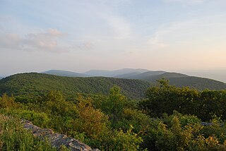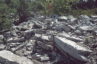
Catoctin Mountain, along with the geologically associated Bull Run Mountains, forms the easternmost mountain ridge of the Blue Ridge Mountains, which are in turn a part of the Appalachian Mountains range. The ridge runs northeast/southwest for about 50 miles (80 km) departing from South Mountain near Emmitsburg, Maryland, and running south past Leesburg, Virginia, where it disappears into the Piedmont in a series of low-lying hills near Aldie, Virginia. The ridge forms the eastern rampart of the Loudoun and Middletown valleys.

Shenandoah Mountain is a mountain ridge approximately 73 miles (117 km) long in Virginia and West Virginia. The steep, narrow, sandstone-capped ridge extends from northern Bath County, Virginia to southern Hardy County, West Virginia. Along the way, its crest defines the borders between Highland and Augusta counties, Virginia, and between Pendleton County, West Virginia, and Rockingham County, Virginia. The name comes from the Iroquoian word for 'deer'.

Mill Creek Mountain is a continuous mountain ridge that runs northeast through Hampshire and Hardy counties in the Eastern Panhandle region of the U.S. state of West Virginia. Rising to its greatest elevation of 2,650 feet (808 m) at High Knob, Mill Creek is a folded mountain ridge, belonging to the Ridge-and-Valley Appalachians. Mill Creek Mountain forms the western edge of the South Branch Potomac River Valley and is named for Mill Creek that carves through it at Mechanicsburg Gap allowing the Northwestern Turnpike to pass through as well. Along with Sawmill Ridge, Mill Creek Mountain forms the Trough along the South Branch.

Patterson Creek Mountain is a mountain ridge that forms the border between Mineral and Hampshire counties and Grant and Hardy Counties in West Virginia's Eastern Panhandle. The mountain's namesake, Patterson Creek, parallels its western flank. The southern end of the Patterson Creek Mountain is near the confluence of Lunice Creek and the South Branch Potomac River and its northern end is located southwest of Springfield. The mountain reaches its highest elevation at Charles Knob.

Short Hill Mountain is a mountain ridge of the Blue Ridge Mountains in northwest Loudoun County, Virginia.

Between the Hills is a small valley in northwest Loudoun County, Virginia, distinct from, but associated with, the greater Loudoun Valley.

Reddish Knob of Shenandoah Mountain is one of the highest points in Virginia, rising 4,397 feet (1,340 m). A narrow, paved road reaches the summit from Harrisonburg, Virginia.

State Route 9 is a primary state highway in the U.S. state of Virginia. Known as Charles Town Pike, the state highway runs 13.08 miles (21.05 km) from the West Virginia state line near Mechanicsville, where the highway continues west as West Virginia Route 9, east to SR 7 and SR 7 Business in Paeonian Springs. SR 9 is the main east–west highway of northwestern Loudoun County, connecting Leesburg with Hillsboro and the West Virginia cities of Charles Town and Martinsburg. As a result, the state highway and its West Virginia continuation are a major, overburdened commuter route between the Eastern Panhandle of West Virginia and Washington, D.C..

Allegheny Mountain is a major mountain ridge in the southern range of the Allegheny Mountains, part of the Appalachian Mountains. It forms the Eastern Continental Divide along part of its course and also serves as part of the Virginia-West Virginia state line.

The Silurian Tuscarora Formation — also known as Tuscarora Sandstone or Tuscarora Quartzite — is a mapped bedrock unit in Pennsylvania, Maryland, West Virginia, and Virginia, USA.
Salt Pond Mountain is a mountain located in Giles County, Virginia. The mountain, which is part of the Ridge-and-valley province of the Appalachian Mountains, extends about seven miles (12 km) from southwest to northeast. The highest peak is Bald Knob, at the southeast end, south of Mountain Lake. Salt Pond Mtn. joins Johns Creek Mountain at the southwest end, and the Big Mountain – Potts Mountain ridge at the northeast end, just south of West Virginia.

The Ordovician Reedsville Formation is a mapped surficial bedrock unit in Pennsylvania, Maryland, Virginia, West Virginia, and Tennessee, that extends into the subsurface of Ohio. This rock is a slope-former adjacent to the prominent ridge-forming Bald Eagle sandstone unit in the Appalachian Mountains. It is often abbreviated Or on geologic maps.

The Devonian Hamilton Group is a mapped bedrock unit in the United States. The unit is present in New York, Pennsylvania, Maryland, Ohio and West Virginia. In Virginia, it is known as the laterally equivalent Millboro Shale. The group is named for the village of Hamilton, New York. Details of stratigraphic nomenclature for this unit as used by the U.S. Geological Survey are available on-line from the National Geologic Map Database. These rocks are the oldest strata of the Devonian gas shale sequence.
The Devonian Mahantango Formation is a mapped bedrock unit in Pennsylvania, West Virginia, and Maryland. It is named for the North branch of the Mahantango Creek in Perry and Juniata counties in Pennsylvania. It is a member of the Hamilton Group, along with the underlying the Marcellus Formation Shale. South of Tuscarora Mountain in south central Pennsylvania, the lower members of this unit were also mapped as the Montebello Formation. Details of the type section and of stratigraphic nomenclature for this unit as used by the U.S. Geological Survey are available on-line at the National Geologic Map Database.

The Mississippian Pocono Formation is a mapped bedrock unit in Pennsylvania, Maryland, and West Virginia, in the United States. It is also known as the Pocono Group in Maryland and West Virginia, and the upper part of the Pocono Formation is sometimes called the Burgoon Formation or Burgoon Sandstone in Pennsylvania. The Pocono is a major ridge-former In the Ridge-and-Valley Appalachians of the eastern United States

Raven Rocks is spur of Blue Ridge Mountain in Jefferson County, West Virginia. The peak is located just north of Jefferson County's border with Clarke County, Virginia and west of its border with Loudoun County, Virginia.

Trimble Knob, located southwest of Monterey in Highland County, Virginia, is a conical hill composed of basalt, a volcanic rock, of Eocene age. It is the eroded remnant of what was an active volcano or diatreme that last erupted approximately 35 million years ago, making it one of the youngest volcanos on the east coast of North America.

Champe Rocks are a pair of large crags in Pendleton County in the Eastern Panhandle of West Virginia, USA. Easily visible from West Virginia Route 28, they are situated within the Spruce Knob-Seneca Rocks National Recreation Area. They are — along with the nearby and more celebrated Seneca Rocks — the most imposing examples in eastern West Virginia of several formations of the white/gray Tuscarora quartzite and are a popular challenge for rock climbers.
The Weverton Formation is a quartzite geologic formation in Maryland, Virginia, West Virginia, and Pennsylvania. It is considered the basal member of the Chilhowee Group. The Weverton Formation dates back to the Cambrian period.


