
Franklin is an independent city in the Commonwealth of Virginia. As of the 2010 census, the population was 8,582. The Bureau of Economic Analysis combines the city of Franklin with Southampton County for statistical purposes.

Bristol is an independent city in the Commonwealth of Virginia. As of the 2010 census, the population was 17,835. It is the twin city of Bristol, Tennessee, just across the state line, which runs down the middle of its main street, State Street. The Bureau of Economic Analysis combines the city of Bristol, Virginia, with neighboring Washington County, Virginia, for statistical purposes. Bristol is a principal city of the Kingsport–Bristol–Bristol, TN-VA Metropolitan Statistical Area, which is a component of the Johnson City–Kingsport–Bristol, TN-VA Combined Statistical Area – commonly known as the "Tri-Cities" region.

Cumberland is a home rule-class city in Harlan County, Kentucky, in the United States. The population according to the 2010 Census was 2,237, down from 2,611 at the 2000 census.

Clintwood is a town in Dickenson County, Virginia, United States. The population was 1,414 at the 2010 census, with an estimated population of 1,343 in 2014. It is the county seat of Dickenson County.
Clinchport is a town in Scott County, Virginia, United States. The population was 70 at the 2010 census. Clinchport is the least-populated municipality in Virginia. It is part of the Kingsport–Bristol (TN)–Bristol (VA) Metropolitan Statistical Area, which is a component of the Johnson City–Kingsport–Bristol, TN-VA Combined Statistical Area – commonly known as the "Tri-Cities" region.

Duffield is a town in Scott County, Virginia, United States. The population was 91 at the 2010 census. It is part of the Kingsport–Bristol (TN)–Bristol (VA) Metropolitan Statistical Area, which is a component of the Johnson City–Kingsport–Bristol, TN-VA Combined Statistical Area – commonly known as the "Tri-Cities" region.

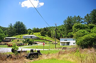
Dungannon is a town in Scott County, Virginia, United States. The population was 332 at the 2010 census. It was named after the town of Dungannon in County Tyrone, Northern Ireland.

Gate City is a town in Scott County, Virginia, United States. The population was 2,034 at the 2010 census. It is the county seat of Scott County.

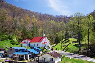
Nickelsville is a town in Scott County, Virginia, United States. The population was 383 at the 2010 census. It is part of the Kingsport–Bristol (TN)–Bristol (VA) Metropolitan Statistical Area, which is a component of the Johnson City–Kingsport–Bristol, TN-VA Combined Statistical Area – commonly known as the "Tri-Cities" region.
Kermit is a town in Mingo County, West Virginia, United States. The population was 406 at the 2010 census. Kermit is located along the Tug Fork, opposite Warfield, Kentucky. The Norfolk Southern Railway's Kenova District runs through town.
Mountain Empire Community College is a public community college in Big Stone Gap, Virginia. It is one of the 23 schools in the Virginia Community College System. The college serves residents of Dickenson, Lee, Scott, and Wise counties, as well as the City of Norton. The first classes were offered in the Fall of 1972. Dr. Terrance Suarez became the school's fifth president in January 2002.

The Guest River is a short tributary of the Clinch River in southwestern Virginia in the United States. It is part of the watershed of the Mississippi River by way of the Clinch, Tennessee and Ohio Rivers. According to the Geographic Names Information System, the river has also been known historically as the Guests River.

Bays Mountain is a ridge of the Ridge-and-Valley Appalachians, located in eastern Tennessee. It runs southwest to northeast, from just south of Knoxville to Kingsport.

The Huntington–Ashland metropolitan area is the largest metropolitan statistical area in West Virginia and includes seven counties across three states: West Virginia, Kentucky, and Ohio. New definitions from February 28, 2013 placed the population at 361,580. The MSA is nestled along the banks of the Ohio River within the Appalachian Plateau region. The area is referred to locally as the "Tri-State area". In addition, the three largest cities are referred to as the River Cities.
The Wilds Christian Association, Inc. is a Protestant Christian organization, based in Brevard, North Carolina. The organization was founded by a group of Christians at Bob Jones University who recognized the need for a Christian camp in the Southeastern United States. In 1967, the group purchased a 1,000 acres (4.0 km2) property near Brevard, North Carolina and established The Wilds Christian Camp and Conference Center about two years later. Today, The Wilds is one of the largest Christian camps in the United States. About 21,000 people attend annual retreats, while summer camp averages 1,100 to 1,200 campers per week.
Bee Rock Tunnel is a former railroad tunnel that is located in Appalachia, Virginia. It was built in 1891 by the Louisville and Nashville Railroad. The tunnel is now part of the Bee Tunnel-Roaring Branch Trail.
Darnell Town is an unincorporated community in Lee County, Virginia, in the United States.
Pattonsville is an unincorporated community in Scott County, in the U.S. state of Virginia.
Fulkerson is an unincorporated community in Scott County, in the U.S. state of Virginia.


