
Kirkham is a town and civil parish in the Borough of Fylde in Lancashire, England, midway between Blackpool and Preston and adjacent to the smaller town of Wesham. It owes its existence to Carr Hill upon which it was built and which was the location of a Roman fort. At the census of 2011, it had a population 7,194.

Cramlington is a town and civil parish in Northumberland, England, 6 miles north of Newcastle upon Tyne, and 10 miles north of its city centre. The name suggests a probable founding by the Danes or Anglo-Saxons. The population was 29,405 as of 2011 census data from Northumberland County Council. It sits on the border between Northumberland and North Tyneside with the traffic interchange at Moor Farm, Annitsford, linking the two areas.

Newbiggin-by-the-Sea is a seaside town and civil parish in Northumberland, England, located on the North Sea coast.

Maltby is a former mining town and civil parish of 16,688 inhabitants (2011) in the Metropolitan Borough of Rotherham, South Yorkshire, England. It was historically in the West Riding of Yorkshire. It is located about 6 miles (10 km) east of Rotherham town centre and 10 miles (16 km) north-east of Sheffield city centre. It forms a continuous urban area with Hellaby, separated from the rest of Rotherham by the M18 motorway.

North Shields is a town in the Borough of North Tyneside in Tyne and Wear, England. It is 8 miles (13 km) north-east of Newcastle upon Tyne and borders nearby Wallsend and Tynemouth.

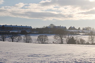
Great Lumley is a village in County Durham, England. It is situated south east of Chester-le-Street, near Lumley Castle. It has a population of 3,843, reducing to 3,684 at the 2011 census.

Temple is a neighbourhood of Glasgow located in the north of the city, bounded by Anniesland to the south, Knightswood to the west and Kelvindale to the east; Netherton lies to the north. Temple appears in Joan Blaeu's 1662 Atlas of Scotland and many subsequent maps.

Allenheads is a former mining village in the Pennines to the north of Weardale in Northumberland, England. Lead extraction was the settlement's industry until the mine closed in the late 19th century. Allenheads, which is 404 m (1,325 ft) above sea level, is situated 8 miles (13 km) further along the River East Allen from Allendale.

Seaton Delaval is a village in Northumberland, England, with a population of 4,371. The largest of the five villages in Seaton Valley, it is the site of Seaton Delaval Hall, completed by Sir John Vanbrugh in 1727.

Bretherton is a small village and civil parish in the Borough of Chorley, Lancashire, England, situated to the south west of Leyland and east of Tarleton. The population of the civil parish at the 2011 census was 669. Its name suggests pre-conquest origins and its early history was closely involved with the manor house Bank Hall and the families who lived there. Bretherton remained a rural community and today is largely residential with residents commuting to nearby towns.

Seghill is a large village located on the Northumberland border which is the county boundary between Northumberland and Tyne and Wear. Seghill is situated between the villages of Seaton Delaval and Annitsford, about 8 miles (13 km) north of Newcastle upon Tyne.

Southowram is a village in Calderdale, West Yorkshire, England that stands on the hill top to the east of Halifax, on the south side of Shibden valley. The village falls within the Town ward of Calderdale Council. It is a small Pennine village near Bank Top, Brookfoot and Siddal. Northowram is on the northern side of the valley and is roughly equidistant from Halifax and Brighouse.

Ninebanks is a small village in south west Northumberland, England in the North Pennines Area of Outstanding Natural Beauty 8 miles (13 km) north-east of Alston by road. It is noted for the early sixteenth century Ninebanks Tower, sometimes described as a pele tower, but possibly built as a watchtower. It is made of sandstone and has four floors, the lowest of which is now below the level of the road. There is an independently run Ninebanks Youth Hostel, which is actually in nearby Mohope.

Lanner is a village and civil parish in west Cornwall, England, United Kingdom. It is situated on the A393 about 2 miles (3.2 km) south-east of Redruth.

Clara Vale is a village situated on the south bank of the River Tyne in Tyne and Wear, England. Once an independent village in County Durham it became incorporated into the new metropolitan county of Tyne and Wear in 1974 as part of the Metropolitan Borough of Gateshead.
Woodhorn is a village and former civil parish, now in the parish of Newbiggin by the Sea, in Northumberland, England, about 2 miles (3 km) east of Ashington. In 1931 the parish had a population of 219. The village is sometimes identified with Wucestre, given to St Cuthbert by King Ceolwulf when he gave up his throne in 737 to become a monk at Lindisfarne. A medieval bell at Woodhorn, inscribed "Ave Maria", is said to be one of the oldest in existence.

Scremerston is a village in Northumberland, England. The village lies on the North Sea coast just under 2.5 miles (4 km) south of Berwick-upon-Tweed and 4.3 miles (7 km) from the Anglo-Scottish border. It is adjacent to the A1, providing access to Newcastle upon Tyne to the south, and to Edinburgh to the north.
Seaton Burn is a village in Tyne and Wear, England to the north of Newcastle upon Tyne, and adjacent to Wideopen which is just south of it. The A1 used to pass through the village but now bypasses the village just to the west, where it meets the A19 which is the link road to the Tyne Tunnel.
Marley Hill is a former colliery village about six miles to the south west of Gateshead, near the border between Tyne and Wear and County Durham. It has been part of the Metropolitan Borough of Gateshead since 1974. Prior to this it was part of Whickham Urban District. It lies within the Whickham South & Sunniside electoral ward of the Blaydon parliamentary constituency.
Percy Main is a small village absorbed into North Shields, North East England. Historically in Northumberland, it is now part of Tyne and Wear.

