Related Research Articles

Topography concerns the shape and character of the Earth's surface and maps were among the first artifacts to record these observations. In modern mapping, a topographic map or topographic sheet is a type of map characterized by large-scale detail and quantitative representation of relief, usually using contour lines, but historically using a variety of methods. Traditional definitions require a topographic map to show both natural and artificial features. A topographic survey is typically based upon systematic observation and published as a map series, made up of two or more map sheets that combine to form the whole map. A topographic map series uses a common specification that includes the range of cartographic symbols employed, as well as a standard geodetic framework that defines the map projection, coordinate system, ellipsoid and geodetic datum. Official topographic maps also adopt a national grid referencing system.

Washoe Lake is a lake located near Carson City in the Washoe Valley of Washoe County, Nevada. It is a very shallow lake with a surface area that can vary greatly from year to year. Washoe Lake State Park sits on the lake's southeastern shore.

Pilot Peak is the highest mountain in the Pilot Range in extreme eastern Elko County, Nevada, United States. It is the most topographically prominent peak in Elko County and the fourth-most prominent peak in Nevada. The peak is on public land administered by the Bureau of Land Management and thus has no access restrictions.

Freel Peak is a mountain located in the Carson Range, a spur of the Sierra Nevada, near Lake Tahoe in California.

Pomme de Terre State Park is a state park in the U.S. state of Missouri consisting of 734.44 acres (297.22 ha) located on Pomme de Terre Lake in Hickory County. The park features a marina, campgrounds, swimming beaches, and hiking trails.

Wallace State Park is a public recreation area located seven miles (11 km) south of Cameron in Clinton County, Missouri. The state park's 502 acres (203 ha) encompass a six-acre (2.4 ha) lake, Lake Allaman, for swimming, fishing, and boating, hiking trails, picnicking facilities, and a campground.
Windy Lake may refer to one of eight lakes of that name in Ontario, Canada:

The United States Geological Survey is a scientific agency of the United States government. The scientists of the USGS study the landscape of the United States, its natural resources, and the natural hazards that threaten it. The organization's work spans the disciplines of biology, geography, geology, and hydrology. The USGS is a fact-finding research organization with no regulatory responsibility.
Potagannissing Bay is a shallow, island-strewn bay on Lake Huron in Algoma District, Ontario, Canada and Chippewa County, Michigan, United States. It is bounded by the land masses of St. Joseph Island, Ontario at the northwest and Drummond Island, Michigan at the southeast, and by the water bodies the Saint Marys River and the De Tour Passage at the southwest and the North Channel at the northeast. The bay is northeast of De Tour Village, Chippewa County. The bay's waters are rich in freshwater fish.
Carson Lake in Ontario, Canada may refer to one of six lakes of that name:
Cedar Lake may refer to one of eighteen lakes of that name in Ontario, Canada:
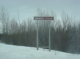
Beaver Creek may refer to one of nine rivers in Manitoba, Canada:

Lake George is a lake in Chippewa County, Michigan, United States, and Algoma District, Northwestern Ontario, Canada, that lies between Sugar Island in Michigan on the west and the Ontario mainland on the east.
References
- ↑ Access the map sheet from the Atlas of Canada Toporama web page Archived August 31, 2010, at the Wayback Machine .
- ↑ "Carson Lake". Geographical Names Data Base. Natural Resources Canada . Retrieved 2011-02-08.
- ↑ "Carson Lake". Geographical Names Data Base. Natural Resources Canada . Retrieved 2011-02-08.
- ↑ "Carson Lake". Geographical Names Data Base. Natural Resources Canada . Retrieved 2011-02-08.
- ↑ "Carson Lake". Geographical Names Data Base. Natural Resources Canada . Retrieved 2011-02-08.
- ↑ "Carson Lake". Geographical Names Data Base. Natural Resources Canada . Retrieved 2011-02-08.
- ↑ "Carson Lake". Geographic Names Information System . United States Geological Survey . Retrieved 2011-02-08.
- ↑ "Carson Lake". Geographic Names Information System . United States Geological Survey . Retrieved 2011-02-08.
- ↑ "Carson Lake". Geographic Names Information System . United States Geological Survey . Retrieved 2011-02-08.
- ↑ "Carson Lake". Geographic Names Information System . United States Geological Survey . Retrieved 2011-02-08.
- ↑ "Carson Lake". Geographic Names Information System . United States Geological Survey . Retrieved 2011-02-08.
- ↑ "Carson Lake". Geographic Names Information System . United States Geological Survey . Retrieved 2011-02-08.
- ↑ "Carson Lake". Geographic Names Information System . United States Geological Survey . Retrieved 2011-02-08.
- ↑ "Carson Lake". Geographic Names Information System . United States Geological Survey . Retrieved 2011-02-08.
| This article includes a list of lakes that share the same name (or similar names). If an internal link incorrectly led you here, you may wish to change the link to point directly to the intended lake article. |