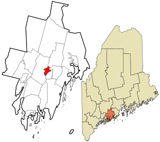
Hancock County is a county located in the U.S. state of Maine. As of the 2020 census, the population was 55,478. Its county seat is Ellsworth. The county was incorporated on June 25, 1789, and named for John Hancock, the first governor of the Commonwealth of Massachusetts.
Old Saybrook Center is the primary village and a census-designated place (CDP) in the town of Old Saybrook, Middlesex County, Connecticut, United States. The population was 2,278 at the 2020 census, out of 10,481 in the entire town of Old Saybrook. The CDP includes the traditional town center and the peninsula known as Saybrook Point.

Brooksville is a town on Penobscot Bay in Hancock County, Maine, United States. As of the 2020 census, the town population was 935. It contains the villages of North Brooksville, South Brooksville, West Brooksville, Brooksville Corner, and Harborside.

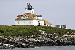
Castine is a town in Hancock County in eastern Maine, United States. The population was 1,320 at the 2020 census. Castine is the home of Maine Maritime Academy, a four-year institution that graduates officers and engineers for the United States Merchant Marine and marine related industries. Approximately 1000 students are enrolled. During the French colonial period, Castine was the southern tip of Acadia and served as the regional capital between 1670 and 1674.

Stonington is a town in Hancock County, Maine, United States. It is located on the southern portion of the island of Deer Isle. The population was 1,056 at the 2020 census. It includes the villages of Burnt Cove, Oceanville, Green Head, and Clam City. A picturesque working waterfront and tranquil tourist destination in eastern Penobscot Bay, Stonington has consistently ranked among the top lobster ports in the country and is the largest lobster port in Maine. In 2011, 14,854,989 pounds of lobster were landed by Stonington fishermen, with a value of $46.3 million.

Penobscot Indian Island Reservation is an Indian reservation for the Penobscot Tribe of Maine, a federally recognized tribe of the Penobscot in Penobscot County, Maine, United States, near Old Town. The population was 758 at the 2020 census. The reservation extends for many miles alongside 15 towns and two unorganized territories in a thin string along the Penobscot River, from its base at Indian Island, near Old Town and Milford, northward to the vicinity of East Millinocket, almost entirely in Penobscot County. A small, uninhabited part of the reservation used as a game preserve and hunting and gathering ground is in South Aroostook, Aroostook County, by which it passes along its way northward.
Bar Harbor is a census-designated place (CDP) in the town of Bar Harbor in Hancock County, Maine, United States. The CDP population was 2,552 at the 2010 census, out of a population of 5,235 in the town of Bar Harbor as a whole.
Bucksport is a census-designated place (CDP) in the town of Bucksport in Hancock County, Maine, United States. The population was 2,885 at the 2010 census, down from 2,970 at the 2000 census.
Blue Hill is a census-designated place (CDP) in the town of Blue Hill in Hancock County, Maine, United States. The CDP population was 943 as per the 2010 census, out of a population of 2,686 in the town of Blue Hill as a whole.
Southwest Harbor is a census-designated place (CDP) in the town of Southwest Harbor in Hancock County, Maine, United States. The CDP population was 720 at the 2010 census, out of 1,764 people in the town as a whole.

Damariscotta is a census-designated place (CDP) comprising the main village of the town of Damariscotta in Lincoln County, Maine, United States. The population was 1,142 at the 2010 census, out of 2,218 in the entire town. In the 2000 census, the village was part of the Damariscotta-Newcastle CDP.
Newcastle is a census-designated place (CDP) comprising the main village of the town of Newcastle in Lincoln County, Maine, United States. The population was 667 at the 2010 census, out of 1,752 in the entire town. In the 2000 census, the village was part of the Damariscotta-Newcastle CDP.

Bucksport is a historical town in Hancock County, Maine, United States. The population was 4,944 at the 2020 census. Bucksport is across the Penobscot River estuary from Fort Knox and the Penobscot Narrows Bridge, which replaced the Waldo–Hancock Bridge.

Camden is a census-designated place (CDP) comprising the main village in the town of Camden in Knox County, Maine, United States. The population was 3,570 at the 2010 census, out of 4,850 in the entire town of Camden.

Boothbay Harbor is a census-designated place (CDP) comprising the densely populated center of the town of Boothbay Harbor in Lincoln County, Maine, United States. The population was 1,086 at the 2010 census, down from 1,237 at the 2000 census.

Waldoboro is a census-designated place (CDP) comprising the central village in the town of Waldoboro in Lincoln County, Maine, United States. The population was 1,300 at the 2020 census, out of 5,075 people in the entire town of Waldoboro.

Wiscasset is a census-designated place (CDP) comprising the primary settlement in the town of Wiscasset in Lincoln County, Maine, United States. The population was 1,232 at the 2020 census, out of 3,732 people in the entire town. Wiscasset is the county seat of Lincoln County.

Hampden is a town on the Penobscot River estuary in Penobscot County, Maine, United States. The population was 7,709 at the 2020 census. Hampden is part of the Bangor metropolitan statistical area.
The Off-the-Neck Historic District encompasses a well-preserved set of early 19th-century rural properties on Maine State Route 166 in Castine, Maine, as well as canal dug in 1779 by British forces during the American Revolutionary War across the neck separating the Bagaduce Peninsula from the mainland. The district takes its name from the fact that the included properties are just north of this neck on the mainland. The district was listed on the National Register of Historic Places in 1986.

State Route 175 (SR 175) is a state highway entirely in Hancock County, Maine that travels for 37.8 miles (60.8 km). The shape of the route is an unusual U-shape and travels along the peninsula surrounded by Blue Hill Bay, Eggemoggin Reach, and Bagaduce River. The route is signed as north-south but has two northern termini: at State Routes 15, 172, and 176 in Blue Hill, and at SR 166 in Penobscot. The transition point of the directional signage occurs about 2+1⁄2 miles (4.0 km) from the Blue Hill terminus.


