Franklin, Maine

Last updated

Franklin
Town of Franklin, Maine
FranklinME SchoodicGrange.jpg
Schoodic Grange Hall
Nickname(s): 
Frankie, The Franklins, Franklin Foothills, Franklintown
USA Maine location map.svg
Red pog.svg
Franklin
Usa edcp location map.svg
Red pog.svg
Franklin
Coordinates: 44°35′15″N68°13′48″W / 44.58750°N 68.23000°W / 44.58750; -68.23000
Country United States
State Maine
County Hancock
Villages, hamlets, and neighbourhoodsFranklin
East Franklin
Egypt
West Franklin
Rabbittown
Cards Crossing
George’s Pond
Franklin Foothills
Hog Bay Hills
Donnell’s Pond
West Blackswoods
Macomber Mill
Great Pond
Schoodic Station
Southbay
Alderville
Shipyard Point
Lonely Oaks
Government
  TypeNew England Town Meeting; Select Board
Area
[1]
  Total41.43 sq mi (107.30 km2)
  Land36.45 sq mi (94.41 km2)
  Water4.98 sq mi (12.90 km2)
Elevation
200 ft (61 m)
Population
 (2020)
  Total1,567
  Density43/sq mi (16.6/km2)
Time zone UTC-5 (Eastern (EST))
  Summer (DST) UTC-4 (EDT)
ZIP code
04634
Area code 207
FIPS code 23-26350
GNIS feature ID0582479

Franklin is a town in Hancock County, Maine, United States. The population was 1,567 at the 2020 census. [2] The town's namesake is Benjamin Franklin. [3]

Contents

About

The first settler, in 1764, was Moses Butler, for whom Butler's Point is named.[ citation needed ]

Principal products (in chronological order) have been ship masts, railroad ties, granite, blueberries, and Christmas trees. [4]

The town is adjacent to the towns of Hancock, Eastbrook, Sullivan, and the Blackswoods District (Unorganized Territory) and is considered part of the Schoodic Foothills area, named for Schoodic Mountain and the adjacent Schoodic Peninsula. Franklin is a member of the Schoodic Communities School District; its elementary-middle school, and junior high school students attend Mountain View School in neighbouring Sullivan, while its high schoolers may attend Sumner Memorial High School (Regional School Unit 24) in East Sullivan.

The town includes numerous hills, lakes, ponds, blueberry barrens, and scenic vistas of Hogs Bay and the Schoodic Foothills.

The town is governed by an annual open town meeting and a board of selectpersons.

Composed of several villages, hamlets, and neighbourhoods, the town spans much of northern Hog Bay to the south and inland towards the highlands of eastern Hancock County. These include Franklin Village, East Franklin, West Franklin, Egypt, Hog Bay Hills / Johnny's Brook, Shipyard Point, Butler Point, Cards Crossing, George's Pond, Donnell Pond, and Rabbittown.

Geography

According to the United States Census Bureau, the town has a total area of 41.43 square miles (107.30 km2), of which 36.45 square miles (94.41 km2) is land and 4.98 square miles (12.90 km2) is water. [1]

Demographics

Historical population
CensusPop.Note
1830 382
1840 50231.4%
1850 73646.6%
1860 1,00436.4%
1870 1,0423.8%
1880 1,1025.8%
1890 1,26414.7%
1900 1,201−5.0%
1910 1,161−3.3%
1920 925−20.3%
1930 820−11.4%
1940 742−9.5%
1950 709−4.4%
1960 627−11.6%
1970 70812.9%
1980 97938.3%
1990 1,14116.5%
2000 1,37020.1%
2010 1,4838.2%
2020 1,5675.7%
U.S. Decennial Census [5]

2010 census

As of the census [6] of 2010, there were 1,483 people, 652 households, and 411 families residing in the town. The population density was 40.7 inhabitants per square mile (15.7/km2). There were 1,043 housing units at an average density of 28.6 per square mile (11.0/km2). The racial makeup of the town was 97.3% White, 0.2% African American, 0.8% Native American, 0.7% Asian, and 1.0% from two or more races. Hispanic or Latino people of any race were 0.6% of the population.

There were 652 households, of which 26.5% had children under the age of 18 living with them, 48.9% were married couples living together, 9.7% had a female householder with no husband present, 4.4% had a male householder with no wife present, and 37.0% were non-families. 26.8% of all households were made up of individuals, and 9.5% had someone living alone who was 65 years of age or older. The average household size was 2.26 and the average family size was 2.73.

The median age in the town was 44.6 years. 19.8% of residents were under the age of 18; 6.7% were between the ages of 18 and 24; 24% were from 25 to 44; 34.4% were from 45 to 64; and 15.1% were 65 years of age or older. The gender makeup of the town was 49.2% male and 50.8% female.

2000 census

As of the census [7] of 2000, there were 1,370 people, 579 households, and 389 families residing in the town. The population density was 37.3 inhabitants per square mile (14.4/km2). There were 902 housing units at an average density of 24.6 per square mile (9.5/km2). The racial makeup of the town was 95.84% White, 0.07% African American, 0.80% Native American, 0.51% Asian, 0.07% from other races, and 2.70% from two or more races. Hispanic or Latino people of any race were 0.29% of the population.

There were 579 households, out of which 28.7% had children under the age of 18 living with them, 56.1% were married couples living together, 8.3% had a female householder with no husband present, and 32.8% were non-families. 26.4% of all households were made up of individuals, and 10.7% had someone living alone who was 65 years of age or older. The average household size was 2.35 and the average family size was 2.80.
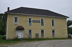
Town offices FranklinME TownHall.jpg
Town offices

In the town, the population was spread out, with 22.6% under the age of 18, 5.8% from 18 to 24, 29.6% from 25 to 44, 27.2% from 45 to 64, and 14.9% who were 65 years of age or older. The median age was 40 years. For every 100 females, there were 98.6 males. For every 100 females age 18 and over, there were 91.7 males.

The median income for a household in the town was $32,070, and the median income for a family was $38,594. Males had a median income of $28,214 versus $19,900 for females. The per capita income for the town was $17,188. About 10.7% of families and 15.9% of the population were below the poverty line, including 15.8% of those under age 18 and 23.4% of those age 65 or over.

Further Reading

Related Research Articles

<span class="mw-page-title-main">Chesterville, Maine</span> Town in Maine, United States

Chesterville is a town in Franklin County, Maine, United States. The population was 1,328 at the 2020 census.

<span class="mw-page-title-main">Eustis, Maine</span> Town in Maine, United States

Eustis is a town in Franklin County, Maine, United States. The population was 641 at the 2020 census. Eustis, which includes the village of Stratton, is a popular recreation area.

<span class="mw-page-title-main">New Sharon, Maine</span> Town in the state of Maine, United States

New Sharon is a town in Franklin County, Maine, incorporated in 1794. The population was 1,458 at the 2020 census. The town is roughly bisected by the Sandy River, a tributary of the Kennebec River.

New Vineyard is a town in Franklin County, Maine, United States. The population was 721 at the 2020 census.

Aurora is a town in Hancock County, Maine, United States. The town was named for the goddess of dawn. The population was 93 at the 2020 census.

<span class="mw-page-title-main">Brooklin, Maine</span> Town in the state of Maine, United States

Brooklin is a town in Hancock County, Maine, United States. The population was 827 at the 2020 census.

Dedham is a town in Hancock County, Maine, United States. The population was 1,648 at the 2020 census. The town includes the site of a Cold War airplane crash on Bald Mountain.

Eastbrook is a town in Hancock County, Maine, United States. The population was 424 at the 2020 census.

<span class="mw-page-title-main">Gouldsboro, Maine</span> Town in the state of Maine, United States

Gouldsboro is a town and municipality in Hancock County, Maine, United States on the Schoodic Peninsula. The town was named for Robert Gould, a landholder in the town. The town has many historically separate fishing villages, summer colonies and communities, including Birch Harbor, Prospect Harbor, South Gouldsboro, West Gouldsboro, Summer Harbor, Wonsqueak Harbor, Bunker's Harbor, Chicken Mill, Jones' Pond, Westbay, and Corea. The population was 1,703 at the 2020 census.

Great Pond is a town in Hancock County, Maine, United States. The population was 61 at the 2020 census.

<span class="mw-page-title-main">Hancock, Maine</span> Town in the state of Maine, United States

Hancock is a town in Hancock County, Maine, United States. The population was 2,466 at the 2020 census. Located on the mainland at the head of Frenchman Bay, Hancock has commanding views of Mount Desert Island.

<span class="mw-page-title-main">Penobscot, Maine</span> Town in the state of Maine, United States

Penobscot is a town in Hancock County, Maine, United States. The Bagaduce River flows through the town. The population was 1,136 at the 2020 census.

Sullivan is a town in Hancock County, Maine, United States. The population was 1,219 at the 2020 census. The town was named for Daniel Sullivan, an early settler. Colloquially referred to as "Sully" or "the Sullivans"—like many Maine municipalities composed of villages with geographic designations of the town proper—the municipality was incorporated in 1789. Located in the Upper Schoodic Peninsula sub-region of Maine's Downeast Acadia region, the municipality has been known as "Waukeag", "New Bristol", and later Sullivan; and once included the nearby communities of Hancock, Sorrento, and what would later be Township 7, South & Middle Districts. Once home to abundant granite quarries, the town of Sullivan is now a residential community for nearby Ellsworth and Mount Desert Island. Located along U.S. Route 1, the Taunton River, and Hog Bay, Sullivan is home to a reversing tidal falls and many scenic turnouts that dot the Schoodic National Scenic Byway along the Upper Schoodic Peninsula.

<span class="mw-page-title-main">Trenton, Maine</span> Town in the state of Maine, United States

Trenton is a town in Hancock County, Maine, United States, near Acadia National Park. The population was 1,584 at the 2020 census. Hancock County-Bar Harbor Airport is located in Trenton.

<span class="mw-page-title-main">Verona Island, Maine</span> Town in Maine, United States

Verona Island is a town located on an island of the same name in the Penobscot River in Hancock County, Maine, United States. The population was 507 at the 2020 census.

<span class="mw-page-title-main">Winter Harbor, Maine</span> Town in the state of Maine, United States

Winter Harbor is a town on the Schoodic Peninsula in Hancock County, Maine, United States. The population was 461 at the 2020 census. The town is located just outside the Schoodic Peninsula portion of Acadia National Park, and is due east of the town of Bar Harbor and Ellsworth. Winter Harbor was once the location of a US Naval Station, NSGA-WH, which closed in the mid-2000s, and is now home to the Schoodic Institute’s Education and Research Center.

<span class="mw-page-title-main">Charleston, Maine</span> Town in the state of Maine, United States

Charleston is a town in Penobscot County, Maine, United States. It is part of the Bangor Metropolitan Statistical Area. The population was 1,558 at the 2020 census. Charleston includes the village of West Charleston and is home to the Higgins Classical Institute, a Christian school.

<span class="mw-page-title-main">Smithfield, Maine</span> Town in the state of Maine, United States

Smithfield is a town in Somerset County, Maine, United States. The population was 925 at the 2020 census. The town was incorporated on February 29, 1840 making it the only town in Maine incorporated on Leap Day. The town was named after the Rev. Henry Smith, an early settler.

East Hancock is an unorganized territory in Hancock County, Maine, United States. The population was 85 at the 2020 census.

<span class="mw-page-title-main">Hancock, Wisconsin</span> Village in Wisconsin, United States

Hancock is a village in Waushara County, Wisconsin, United States. The population was 417 at the 2010 census. The village is located within the Town of Hancock.

References

  1. 1 2 "US Gazetteer files 2010". United States Census Bureau . Retrieved December 16, 2012.
  2. "Census - Geography Profile: Franklin town, Hancock County, Maine" . Retrieved January 20, 2022.
  3. Gannett, Henry (1905). The Origin of Certain Place Names in the United States. Govt. Print. Off. pp.  131.
  4. Maine League of Historical Societies and Museums (1970). Doris A. Isaacson (ed.). Maine: A Guide 'Down East'. Rockland, Me: Courier-Gazette, Inc. p. 275.
  5. "Census of Population and Housing". Census.gov. Retrieved June 4, 2015.
  6. "U.S. Census website". United States Census Bureau . Retrieved December 16, 2012.
  7. "U.S. Census website". United States Census Bureau . Retrieved January 31, 2008.

44°35′13″N68°13′56″W / 44.58694°N 68.23222°W / 44.58694; -68.23222