
Maine is a state in the New England region of the United States, and the northeastern most state in the Lower 48. It borders New Hampshire to the west, the Gulf of Maine to the southeast, and the Canadian provinces of New Brunswick and Quebec to the northeast and northwest, and shares a maritime border with Nova Scotia. Maine is the largest state in New England by total area, nearly larger than the combined area of the remaining five states. Of the 50 U.S. states, it is the 12th-smallest by area, the 9th-least populous, the 13th-least densely populated, and the most rural. Maine's capital is Augusta, and its most populous city is Portland, with a total population of 68,408, as of the 2020 census.
Naukati Bay is a census-designated place (CDP) in the Prince of Wales-Hyder Census Area of the Unorganized Borough of the U.S. state of Alaska. The population was 113 at the 2010 census, down from 135 in 2000.
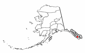
Drew is a township in Penobscot County, Maine, United States. The population was 26 at the 2020 census. It is part of the Bangor Metropolitan Statistical Area. The Surety of Sinners Orthodox Mission, a Russian Orthodox church, is located in Drew. A former plantation, Drew completed the de-organization process in 2023 to become part of Maine's unorganized territory.

Bangor Charter Township is a charter township in Bay County in the U.S. state of Michigan. The township's population was 14,045 as of the 2020 Census and is included in the Bay City Metropolitan Statistical Area.

Wentworth Location is a township in Coös County, New Hampshire, United States. Its population was 28 at the 2020 census. It is part of the Berlin, NH-VT Micropolitan Statistical Area.

Connor is an unorganized territory (township) in Aroostook County, Maine, United States. The population was 418 at the 2020 census. It is the location of a former Nike missile site and the Blotner Radar Site.

Square Lake is an unorganized territory in Aroostook County, Maine, United States. The population was 706 at the 2020 census.
Wyman is an unorganized territory in Franklin County, Maine, United States. The population was 82 at the 2020 census. It is designated as Township 4 Range 3 of Bingham's Kennebec Purchase.
Criehaven is an alternative name for Ragged Island, an unorganized territory in Knox County, Maine, United States. Criehaven was formerly a plantation including Ragged Island just south of Matinicus Isle in outer Penobscot Bay, plus Matinicus Rock to its southeast, and Seal Island, the location of Seal Island National Wildlife Refuge, to its northeast. Criehaven surrendered its organization and reverted to an unorganized territory in 1925, but the name persists.
North Oxford is an unorganized territory in Oxford County, Maine, United States. The population was 16 at the 2020 census.

South Oxford is an unorganized territory located in Oxford County, Maine, United States. The population was 591 at the 2020 census. The unorganized territory encompasses the areas designated under state law as Albany Township, Mason Township, and Batchelder's Grant. Albany and Mason were formerly incorporated as towns. Albany disincorporated in 1937 while Mason disincorporated in 1935.
North Penobscot is an unorganized territory in Penobscot County, Maine, United States. The population was 405 at the 2020 census.
Twombly Ridge is an unorganized territory (township) located in Penobscot County, Maine, United States. At the 2020 census, the unorganized territory had a total population of 0.
Mud Lake is an unorganized territory located in Marshall County, Minnesota, United States. In all censuses since 2000, the unorganized territory recorded a population of 0.

Unity is an unincorporated territory (township) in Kennebec County, Maine, United States. The population was 36 at the 2020 census. The township was a former plantation that surrendered its organization in 1942.

Orono is a town in Penobscot County, Maine, United States. Located on the Penobscot and Stillwater rivers, it was first settled by American colonists in 1774. They named it in honor of Chief Joseph Orono, a sachem of the indigenous Penobscot nation who long occupied this territory.

The town is the basic unit of local government and local division of state authority in the six New England states. Most other U.S. states lack a direct counterpart to the New England town. New England towns overlie the entire area of a state, similar to civil townships in other states where they exist, but they are fully functioning municipal corporations, possessing powers similar to cities and counties in other states. New Jersey's system of equally powerful townships, boroughs, towns, and cities is the system which is most similar to that of New England. New England towns are often governed by a town meeting, an assembly of eligible town residents. The great majority of municipal corporations in New England are based on the town model; there, statutory forms based on the concept of a compact populated place are uncommon, though elsewhere in the U.S. they are prevalent. County government in New England states is typically weak, and in some states nonexistent. Connecticut, for example, has no county governments, nor does Rhode Island. Both of those states retain counties only as geographic subdivisions with no governmental authority, while Massachusetts has abolished eight of fourteen county governments so far. Counties serve mostly as dividing lines for the states' judicial systems and some other state services in the southern New England states while providing varying services in the more sparsely populated three northern New England states.

Cousins Island is an island in Casco Bay within the town of Yarmouth in Cumberland County, Maine, United States. It is listed as a census-designated place, with a population of 490 as of the 2010 census. The CDP is part of the Portland–South Portland–Biddeford, Maine Metropolitan Statistical Area.
Louds Island, also once known as Muscongus Island, is an island in Muscongus Bay off the coast of Round Pond, a village of Bristol, Maine, United States. It is also an unorganized territory of Maine. It is approximately 3 miles (4.8 km) long and 1 mile (1.6 km) wide at its widest point. The island did not have a flush toilet until 2009. The 2020 census lists Louds Island with a population of 3. It is part of the unorganized territory of Lincoln County.

Muscle Ridge Islands is an archipelago and unorganized territory off the coast of South Thomaston in Knox County, Maine, United States. The population was 9 at the 2020 census.


