A ZIP Code is a postal code used by the United States Postal Service (USPS) in a system it introduced in 1963. The term ZIP is an acronym for Zone Improvement Plan; it was chosen to suggest that the mail travels more efficiently and quickly when senders use the code in the postal address. The basic format consists of five digits. An extended ZIP+4 code was introduced in 1983 which includes the five digits of the ZIP Code, followed by a hyphen and four additional digits that reference a more specific location.

New Castle is an unincorporated community in Jefferson County, Alabama, United States. New Castle is 9 miles (14 km) north of downtown Birmingham. New Castle has a post office with ZIP code 35119. New Castle was formerly home to coal mines operated by John T. Milner.

Diamond Point is a hamlet in Warren County, New York, United States. The community is located along the western shore of Lake George and New York State Route 9N 3.9 miles (6.3 km) north-northeast of the village of Lake George. Diamond Point has a post office with ZIP code 12824, which opened on September 6, 1877.

Pendleton is an unincorporated community in Henry County, Kentucky, United States. The community is located along Kentucky Route 153 7.5 miles (12.1 km) west-northwest of New Castle. Pendleton has a post office with ZIP code 40055.

Sycamore is an unincorporated community in Greene County, Pennsylvania, United States. The community is located along Pennsylvania Route 18 4 miles (6.4 km) west-northwest of Waynesburg. Sycamore has a post office with ZIP code 15364, which opened on April 25, 1878.

Edinburg is an unincorporated community in Lawrence County, Pennsylvania, United States. The community is located along Pennsylvania Route 551 near U.S. Route 224 on the south bank of the Mahoning River, 4.7 miles (7.6 km) west of New Castle. Edinburg has a post office with ZIP code 16116.

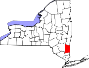
Glenham is a hamlet in Dutchess County, New York, United States. The community is 2.5 miles (4.0 km) east-northeast of Beacon. Glenham has a post office with ZIP code 12527, which opened on March 6, 1839.

Hollowville is a hamlet in Columbia County, New York, United States. The community is 6.1 miles (9.8 km) east-southeast of Hudson. Hollowville has a post office with ZIP code 12530.

Mellenville is a hamlet in Columbia County, New York, United States. The community is located along New York State Route 217 0.8 miles (1.3 km) west of Philmont. Mellenville has a post office with ZIP code 12544.

Kenoza Lake is a hamlet in Sullivan County, New York, United States. The community is located along New York State Route 52 14.5 miles (23.3 km) west-northwest of Monticello. Kenoza Lake has a post office with ZIP code 12750, which opened on March 10, 1851.

Long Eddy is a hamlet in Sullivan County, New York, United States. The community is located along New York State Route 97 and the Delaware River in the westernmost corner of the county, 10.4 miles (16.7 km) southeast of Hancock. Long Eddy has a post office with ZIP code 12760.

Youngsville is a hamlet in Sullivan County, New York, United States. The community is located along New York State Route 52 7.2 miles (11.6 km) west of Liberty. Youngsville has a post office with ZIP code 12791, which opened on March 10, 1851.

Childwold is a hamlet in St. Lawrence County, New York, United States. The community is located along New York State Route 3 10.8 miles (17.4 km) west-northwest of Tupper Lake. Childwold has a post office with ZIP code 12922.

Clockville is a hamlet in Madison County, New York, United States. The community is 2.6 miles (4.2 km) south of Canastota. Clockville has a post office with ZIP code 13043.

Scipio Center is a hamlet in Cayuga County, New York, United States. The community is located along New York State Route 34 10.3 miles (16.6 km) south of Auburn. Scipio Center has a post office with ZIP code 13147, which opened on February 20, 1934.

Blossvale is a hamlet in Oneida County, New York, United States. The community is 10.5 miles (16.9 km) west-northwest of Rome. Blossvale has a post office with ZIP code 13308, which opened on July 30, 1832.

Chase Mills is a hamlet in St. Lawrence County, New York, United States. The community is located along the Grasse River 6.2 miles (10.0 km) east of Waddington. Chase Mills has a post office with ZIP code 13621, which opened on November 19, 1853.

Castle Creek is a hamlet in Broome County, New York, United States. The community is located along U.S. Route 11 8.9 miles (14.3 km) north of Binghamton. Castle Creek has a post office with ZIP code 13744, which opened on December 23, 1845.

East Pharsalia is a hamlet in Chenango County, New York, United States. The community is 10 miles (16 km) west of Norwich. East Pharsalia had a post office from March 10, 1830 until September 28, 2002; it still has its own ZIP code, 13758.

Seneca Castle is a hamlet in Ontario County, New York, United States. The community is 5.8 miles (9.3 km) west-northwest of Geneva. Seneca Castle has a post office with ZIP code 14547.


