Washington, New York

Last updated

Washington, New York
Town of Washington
Washington, NY, town hall.jpg
Town hall, in Millbrook
Flag of Washington, New York.svg
Dutchess County New York incorporated areas Washington highlighted.svg
Location of Washington, New York
Coordinates: 41°47′12″N73°40′53″W / 41.78667°N 73.68139°W / 41.78667; -73.68139
Country United States
State New York
County Dutchess
Government
  Type Town Council
   Town Supervisor Gary Ciferri (R)
   Town Council
Members' List
Area
[1]
  Total58.88 sq mi (152.51 km2)
  Land58.17 sq mi (150.66 km2)
  Water0.71 sq mi (1.85 km2)
Elevation
607 ft (185 m)
Population
 (2020)
  Total4,522
Time zone UTC-5 (Eastern (EST))
  Summer (DST) UTC-4 (EDT)
FIPS code 36-027-78388
GNIS feature ID0979601 [2]
Website www.washingtonny.org

Washington is a town in Dutchess County, New York, United States. The population was 4,522 at the 2020 census. [3] The town is named after George Washington, who passed through the town during the Revolution.

Contents

Washington is in the central part of the county, northeast of the city of Poughkeepsie. U.S. Route 44 passes across the town.

History

Prior to the arrival of European settlers, the area was the abode of the sedentary Wappinger Indians. [4]

Although some Dutch had settled in the area, it was the British grant of the Great Nine Partners Patent in 1697 that spurred growth. [4] Lt. Col. Henry Filkins was the largest landowner and his family continued in leadership until forced to flee at the start of the American Revolution. [4]

When Dutchess County was first organized in 1683, it was subdivided into twelve precincts. What is now the towns of Stanford, Clinton, Pleasant Valley, and Washington constituted Charlotte Precinct, later named after Charlotte of Mecklenburg-Strelitz. [5] The town was formed as part of the county reorganization in 1788 as one of the original twelve towns, with the towns of Poughkeepsie and Clinton to the west. [6] The town lost territory in 1793 to form the new town of Stanford. [6]

The Newburgh, Dutchess and Connecticut Railroad (formerly the Dutchess and Columbia Railroad [7] ) came through in 1869 cutting north-south across the town, [8] with a station between Mechanic and Hart's Village. [9]

Notable people

Geography

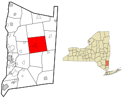
According to the United States Census Bureau, the town has a total area of 58.9 square miles (152.5 km2), of which 58.2 square miles (150.7 km2) is land and 0.69 square miles (1.8 km2), or 1.21%, is water. [11] Washington is bordered by Pleasant Valley and Clinton to the west, Stanford to the north, Amenia to the east, and Dover and Union Vale to the south. A small part of LaGrange also borders the town.

The main channel of Wappinger Creek flows through the northeast corner of the town, and its East Branch flows through the center of the town. [7]

The Canoe Hills are located on the 2,000 acre Cary Arboretum [12] in the Town of Washington. [13]

Communities and locations in Washington

Demographics

Historical population
CensusPop.Note
1820 2,882
1830 3,0365.3%
1840 2,833−6.7%
1850 2,805−1.0%
1860 2,685−4.3%
1870 2,7924.0%
1880 2,7970.2%
1890 2,766−1.1%
1900 3,0329.6%
1910 3,027−0.2%
1920 2,795−7.7%
1930 3,0428.8%
1940 3,0801.2%
1950 3,42711.3%
1960 3,6957.8%
1970 4,40719.3%
1980 4,382−0.6%
1990 4,4792.2%
2000 4,7425.9%
2010 4,7410.0%
2020 4,522−4.6%
U.S. Decennial Census [3]

As of the census [14] of 2000, there were 4,742 people, 1,914 households, and 1,244 families residing in the town. The population density was 80.3 inhabitants per square mile (31.0/km2). There were 2,192 housing units at an average density of 37.1 per square mile (14.3/km2). The racial makeup of the town was 94.69% White, 2.83% African American, 0.06% Native American, 0.65% Asian, 0.02% Pacific Islander, 0.78% from other races, and 0.97% from two or more races. Hispanic or Latino of any race were 3.58% of the population.

There were 1,914 households, out of which 28.1% had children under the age of 18 living with them, 54.1% were married couples living together, 7.7% had a female householder with no husband present, and 35.0% were non-families. 29.5% of all households were made up of individuals, and 11.2% had someone living alone who was 65 years of age or older. The average household size was 2.37 and the average family size was 2.95.

In the town, the population was spread out, with 24.4% under the age of 18, 5.8% from 18 to 24, 26.1% from 25 to 44, 27.2% from 45 to 64, and 16.5% who were 65 years of age or older. The median age was 41 years. For every 100 females, there were 93.7 males. For every 100 females age 18 and over, there were 90.7 males.

The median income for a household in the town was $52,104, and the median income for a family was $69,074. Males had a median income of $45,938 versus $31,411 for females. The per capita income for the town was $32,561. About 2.7% of families and 7.2% of the population were below the poverty line, including 3.5% of those under age 18 and 6.1% of those age 65 or over.

Related Research Articles

<span class="mw-page-title-main">Dutchess County, New York</span> County in New York, United States

Dutchess County is a county in the U.S. state of New York. As of the 2020 census, the population was 295,911. The county seat is the city of Poughkeepsie. The county was created in 1683, one of New York's first twelve counties, and later organized in 1713. It is located in the Mid-Hudson Region of the Hudson Valley, north of New York City.

<span class="mw-page-title-main">Ancram, New York</span> Town in New York, United States

Ancram is a town in Columbia County, New York, United States. The population was 1,440 at the 2020 census, down from 1,573 at the 2010 census. The town was named after Ancram, Scotland.

<span class="mw-page-title-main">Brinckerhoff, New York</span> Census-designated place in New York, United States

Brinckerhoff is a hamlet and census-designated place (CDP) in Dutchess County, New York, United States. The population was 2,900 at the 2010 census. It is part of the Poughkeepsie–Newburgh–Middletown, NY Metropolitan Statistical Area as well as the larger New York–Newark–Bridgeport, NY-NJ-CT-PA Combined Statistical Area.

<span class="mw-page-title-main">Clinton, Dutchess County, New York</span> Town in New York, United States

Clinton is a town in Dutchess County, New York, United States. The population was 4,037 in the 2020 census, down from 4,312 in the 2010 census.

<span class="mw-page-title-main">Crown Heights, New York</span> Census-designated place in New York, United States

Crown Heights is a hamlet and census-designated place (CDP) in Dutchess County, New York, United States. The population was 2,840 at the 2010 census. It is part of the Poughkeepsie–Newburgh–Middletown, NY Metropolitan Statistical Area as well as the larger New York–Newark–Bridgeport, NY-NJ-CT-PA Combined Statistical Area.

<span class="mw-page-title-main">East Fishkill, New York</span> Town in New York, United States

East Fishkill is a town on the southern border of Dutchess County, New York, United States. The population was 29,707 at the 2020 census. Until its creation in 1849, the town was the eastern portion of the town of Fishkill.

<span class="mw-page-title-main">LaGrange, New York</span> Town in New York, United States

LaGrange is a town in Dutchess County, New York, United States. The population was 15,975 at the 2020 census. The town was named after the estate of the Marquis de Lafayette.

<span class="mw-page-title-main">Millbrook, New York</span> Village in Dutchess County, New York, US

Millbrook is a village in Dutchess County, New York, United States. Millbrook is located in the Hudson Valley, on the east side of the Hudson River, 90 miles (140 km) north of New York City. Millbrook is near the center of the town of Washington, of which it is a part. In the 2020 census, Millbrook's population was 1,455. It is often referred to as a low-key version of the Hamptons, and is one of the most affluent villages in New York.

<span class="mw-page-title-main">Myers Corner, New York</span> Census-designated place in New York, United States

Myers Corner is a hamlet and census-designated place (CDP) in the town of Wappinger, Dutchess County, New York, United States. The population was 6,790 at the 2010 census. It is part of the Poughkeepsie–Newburgh–Middletown, NY Metropolitan Statistical Area as well as the larger New York–Newark–Bridgeport, NY-NJ-CT-PA Combined Statistical Area.

<span class="mw-page-title-main">Red Oaks Mill, New York</span> Census-designated place in New York, United States

Red Oaks Mill is a hamlet and census-designated place (CDP) in Dutchess County, in the U.S. state of New York. It lies within the limits of the towns of Poughkeepsie and LaGrange. The population was 3,613 at the 2010 census.

<span class="mw-page-title-main">Spackenkill, New York</span> Census-designated place in New York, United States

Spackenkill is a hamlet and census-designated place (CDP) in Dutchess County, New York, United States. The population was 4,123 at the 2010 census. It is part of the Poughkeepsie–Newburgh–Middletown, NY Metropolitan Statistical Area as well as the larger New York–Newark–Bridgeport, NY-NJ-CT-PA Combined Statistical Area.

<span class="mw-page-title-main">Wappinger, New York</span> Town in New York, United States

Wappinger is a town in Dutchess County, New York, United States. The town is located in the Hudson River Valley region, on the eastern bank of the Hudson River. The population was 28,216 at the 2020 census. The name is derived from the Wappinger Native Americans who inhabited the area. Wappinger comprises three-fourths of the incorporated village of Wappingers Falls, several unincorporated hamlets such as Chelsea, Diddell, Hughsonville, Middlebush, Myers Corners, New Hackensack, and Swartwoutville, and a number of neighborhoods.

<span class="mw-page-title-main">Fishkill, New York</span> Village in New York, United States

Fishkill is a village within the town of Fishkill in Dutchess County, New York, United States. The village is in the eastern part of the town of Fishkill on U.S. Route 9. It is north of Interstate 84. NY 52 is the main street. It is part of the Poughkeepsie–Newburgh–Middletown, NY Metropolitan Statistical Area as well as the larger New York–Newark–Bridgeport, NY-NJ-CT-PA Combined Statistical Area. The first U. S. Post Office in New York state was established in Fishkill by Samuel Loudon, its first Postmaster.

<span class="mw-page-title-main">Fishkill (town), New York</span> Town in New York, United States

Fishkill is a town in the southwestern part of Dutchess County, New York, United States. It lies approximately 60 miles (97 km) north of New York City. The population was 24,226 at the 2010 census. Fishkill surrounds the city of Beacon, and contains a village, which is also named Fishkill.

<span class="mw-page-title-main">Pleasant Valley (CDP), New York</span> Census-designated place in New York, United States

Pleasant Valley is a census-designated place (CDP) in the southwestern part of the town of Pleasant Valley in Dutchess County, New York, United States. The population was 1,145 at the 2010 census. It is part of the Poughkeepsie–Newburgh–Middletown, NY Metropolitan Statistical Area as well as the larger New York–Newark–Bridgeport, NY-NJ-CT-PA Combined Statistical Area.

<span class="mw-page-title-main">Pleasant Valley (town), New York</span> Town in New York, United States

Pleasant Valley is a town in Dutchess County, within the Hudson Valley of New York, United States. The population was 9,799 at the 2020 census. The town is centrally located in the county, northeast of the city of Poughkeepsie. U.S. Route 44 passes through the town.

<span class="mw-page-title-main">Poughkeepsie (town), New York</span> Town in New York, United States

Poughkeepsie, officially the Town of Poughkeepsie, is a town in Dutchess County, New York, United States. As of the 2020 United States Census, the population was 45,471. The name is derived from the native term Uppuqui meaning "lodge-covered", plus ipis meaning "little water", plus ing meaning "place", all of which translates to "the reed-covered lodge by the little water place", or Uppuqui-ipis-ing. This later evolved into Apokeepsing, then into Poughkeepsing, and finally Poughkeepsie.

<span class="mw-page-title-main">Red Hook (village), New York</span> Village in New York, United States

Red Hook is a village in Dutchess County, New York, United States. The population was 1,975 at the 2020 census. It is part of the Poughkeepsie–Newburgh–Middletown, NY Metropolitan Statistical Area as well as the larger New York–Newark–Bridgeport, NY-NJ-CT-PA Combined Statistical Area. The name is derived from the Dutch "Roode Hoeck" – hoeck meaning peninsula, and roode meaning red – a reference to the vibrant reds in the area's fall foliage.

<span class="mw-page-title-main">Rhinebeck (town), New York</span> Town in New York, United States

Rhinebeck is a town in Dutchess County, New York, United States. The population was 7,596 at the 2020 census. It is part of the Poughkeepsie-Newburgh-Middletown metropolitan area as well as the larger New York metropolitan area.

<span class="mw-page-title-main">Kiryas Joel-Poughkeepsie-Newburgh metropolitan area</span> Metropolitan statistical area in New York, United States

The Kiryas Joel-Poughkeepsie-Newburgh, NY Metropolitan Statistical Area, as defined by the United States Office of Management and Budget, is an area consisting of two counties in New York's Hudson Valley, with the municipalities of Kiryas Joel, Poughkeepsie, and Newburgh as its principal cities. As of the 2020 census, the MSA had a population of 679,221. The area was centered on the urban area of Poughkeepsie-Newburgh. Prior to July 2023, it was known as the Poughkeepsie-Newburgh-Middletown, NY Metropolitan Statistical Area; whereupon it was renamed to its current name, to reflect population changes among its largest municipalities.

References

  1. "2016 U.S. Gazetteer Files". United States Census Bureau. Retrieved July 4, 2017.
  2. "US Board on Geographic Names". United States Geological Survey. October 25, 2007. Retrieved January 31, 2008.
  3. 1 2 U.S. Census, 2020, 'Washington town, Dutchess County, New York'
  4. 1 2 3 Bookman, Janet; Bookman, George (1972). "Three Centuries on the Canoe Hills". Dutchess County Historical Society Yearbook. Vol. 57. pp. 88–99, page 89.
  5. Lyall, John Edward (1909). "The Town of Washington". In Hasbrouck, Frank (ed.). The History of Dutchess County New York. Poughkeepsie, New York: S. A. Matthieu. pp. 476–497, page 476. Retrieved November 6, 2022.
  6. 1 2 Lyall 1909 , p. 477
  7. 1 2 Beers, Frederick W. (1867). Town of Washington, Dutchess County, New York (Map). Beers, Ellis & Soule.
  8. Lyall 1909 , p. 478
  9. "A Brief History of Millbrook". Millbrook Historical Society.
  10. Barry, John. "The Cars, the Rock and Roll Hall of Fame and the Hudson Valley". Poughkeepsie Journal. Gannett. Retrieved October 20, 2015.
  11. "Geographic Identifiers: 2010 Demographic Profile Data (G001): Washington town, Dutchess County, New York". U.S. Census Bureau, American Factfinder. Archived from the original on February 13, 2020. Retrieved November 16, 2015.
  12. Payne, Willard W. (1978). "The Cary Arboretum of the New York Botanical Gardens" (PDF). American Horticulturist. Vol. 57, no. 3. pp. 34–36. Archived (PDF) from the original on November 6, 2022.
  13. Reynolds, Helen Wilkinson (1933). "In regard to the repetition of place names". Dutchess County Historical Society Yearbook. Vol. 18. pp. 54–56, page 55.
  14. "U.S. Census website". United States Census Bureau . Retrieved January 31, 2008.