Aoraki / Mount Cook is the highest mountain in New Zealand. Its height, as of 2014, is listed as 3,724 metres. It sits in the Southern Alps, the mountain range that runs the length of the South Island. A popular tourist destination, it is also a favourite challenge for mountain climbers. Aoraki / Mount Cook consists of three summits: from south to north, the Low Peak, the Middle Peak and the High Peak. The summits lie slightly south and east of the main divide of the Southern Alps, with the Tasman Glacier to the east and the Hooker Glacier to the southwest. Mount Cook is ranked 10th in the world by topographic isolation.
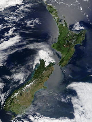
New Zealand is an island country located in the southwestern Pacific Ocean, near the centre of the water hemisphere. It consists of a large number of islands, estimated around 700, mainly remnants of a larger landmass now beneath the sea. The land masses by size are the South Island and the North Island, separated by the Cook Strait. The third-largest is Stewart Island / Rakiura, located 30 kilometres off the tip of the South Island across Foveaux Strait. Other islands are significantly smaller in area. The three largest islands stretch 1,600 kilometres across latitudes 35° to 47° south. New Zealand is the sixth-largest island country in the world, with a land size of 268,680 km2 (103,740 sq mi).

The South Island is the largest of the three major islands of New Zealand in surface area, the other being the smaller but more populous North Island and sparsely populated Stewart Island. It is bordered to the north by Cook Strait, to the west by the Tasman Sea, to the south by the Foveaux Strait and Southern Ocean, and to the east by the Pacific Ocean. The South Island covers 150,437 square kilometres (58,084 sq mi), making it the world's 12th-largest island, constituting 56% of New Zealand's land area. At low altitudes, it has an oceanic climate.

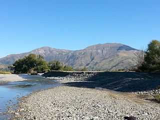
The Southern Alps are a mountain range extending along much of the length of New Zealand's South Island, reaching its greatest elevations near the range's western side. The name "Southern Alps" generally refers to the entire range, although separate names are given to many of the smaller ranges that form part of it.

Queenstown is a resort town in Otago in the south-west of New Zealand's South Island. It is the seat and largest town in the Queenstown-Lakes District.

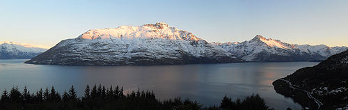
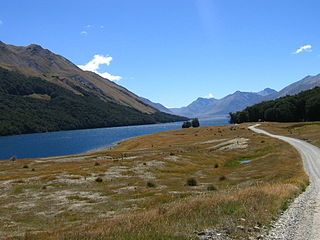
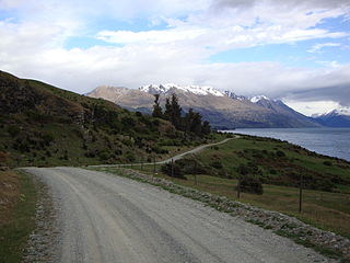
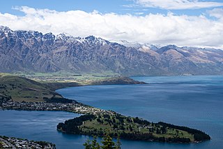
Lake Wakatipu is an inland lake in the South Island of New Zealand. It is in the southwest corner of the Otago region, near its boundary with Southland. Lake Wakatipu comes from the original Māori name Whakatipu wai-māori.
Mavora Lakes is a protected area in the South Island of New Zealand consisting of two lakes: North Mavora and South Mavora. The lakes are drained by the Mararoa River. The area is managed by the Department of Conservation, and is part of Te Wahipounamu, a World Heritage Area.

TSS Earnslaw is a 1912 Edwardian twin screw steamer based at Lake Wakatipu in New Zealand. She is one of the oldest tourist attractions in Central Otago, and the only remaining commercial passenger-carrying coal-fired steamship in the southern hemisphere.
Lake Gunn is a lake in the South Island of New Zealand, located at 44°53′S168°05′E.

Ben Lomond is a mountain close to Queenstown, New Zealand. It was named after Ben Lomond in Scotland by the early shepherd Duncan McAusland. The summit is approximately 4 km (2.5 mi) northwest of the town centre and reaches a height of 1,748 metres (5,735 ft). Connected to Ben Lomond are the large but slightly shorter Bowen Peak and Bob's Peaks, while nearby is the dominant feature of Queenstown Hill. There are scenic views available from a range of places on the mountain with the top giving a 360-degree panorama of much of the Wakatipu Basin including Lake Wakatipu, The Remarkables Mountains, Cecil Peak and Walter Peak.

The Rees River is a headwater tributary of the Clutha River / Mata-Au that drains eastward of the main divide of the Southern Alps / Kā Tiritiri o te Moana in New Zealand. The river runs 41 km, drains an area of 406 km2, and discharges into the head of Lake Wakatipu at Glenorchy. Bound by the Richardson (Whakaari) Mountains to the east and the Forbes Mountains to the west, its snow-covered headwaters rise above 2000 m.
The Around the Mountains Cycle Trail is a cycle trail set in the remote wilderness of southern New Zealand. 186 km in length, it can be ridden in either direction, starting at Kingston or Walter Peak and taking three to five days at a relaxed pace to complete. The Around the Mountains Cycle Trail is recognised as one of New Zealand's 23 Great Rides.
The Wakatipu Basin is a plain surrounded by mountains in Queenstown Lakes District, in the southern South Island of New Zealand.

Queenstown Hill, also known by its Māori name of Te Tapu-nui, is a small 907 metres (2,976 ft) mountain near Queenstown, New Zealand in the South Island.

The Queenstown Trail is a cycle and walking trail funded as one of the projects of the New Zealand Cycle Trail (NZCT) system in Otago, New Zealand. It links the towns of Queenstown, Arrowtown, the suburb of Jack's Point and the area of Gibbston. It is at least 110 km in length but is not linear and instead follows the terrain often near rivers and lakes to link key places in a series of tracks that also access public land. In some places it also passes through private land such as working farms and users are encouraged to stay on the trail. The trail is a joint venture between the Government, Queenstown Lakes District Council and the Queenstown Trails Trust.
The Eyre Creek is a river in the Southland region of New Zealand's South Island. It is a tributary of the Mataura River with a braided channel and with its confluence near the small town of Athol. It rises on the eastern side of Jane Peak in the Eyre Mountains south-west of Lake Wakatipu. It has been identified as an Important Bird Area by BirdLife International because it supports breeding colonies of the endangered black-billed gull. West of Athol it is crossed by State Highway 6 and the Around the Mountains Cycle Trail.

Hidden Island is located in the middle of Lake Wakatipu in New Zealand and is very close to Cecil Peak. Its name is because from many parts of Queenstown the island is invisible.

The Humboldt Mountains or Humboldt Range are one of the many ranges which make up the Southern Alps / Kā Tiritiri o te Moana in the South Island of New Zealand. They lie to the northwest of Lake Wakatipu in the Otago Region. Parts of the range lie within Fiordland National Park, and they form the southern extremity of Mount Aspiring National Park. The range was named by early explorer James McKerrow, and like many geographic features worldwide, it was named in honour of notable scientist Alexander von Humboldt.

Skyline Queenstown is a tourist attraction service in Queenstown, New Zealand. Skyline provides a gondola, a restaurant at the top station, and a luge back to the base station. It is owned by Skyline Enterprises.
The Tapuae-o-Uenuku / Hector Mountains are a mountain range in the New Zealand region of Otago, near the resort town of Queenstown and just south of the more famous Remarkables. For most of its length, the mountains run adjacent to the southern reaches of Lake Wakatipu, before extending approximately 14 kilometres (8.7 mi) further south, past the glacial moraine at Kingston on the southern end of the lake. On their eastern side, the mountains mark the edge of the Nevis valley, a largely tussocked area which saw significant activity during the Otago Gold Rush of the 1860s. Historically, the mountains were an important mahinga kai for Ngāi Tahu and other local Māori iwi, who used the area to hunt for weka and gather tikumu while visiting the region.