Central Mamberamo Regency

Last updated
Central Mamberamo Regency
Kabupaten Mamberamo Tengah
Lambang Kabupaten Mamberamo Tengah.webp
Motto: 
Nabuwa Kubuwa Yabu Eruwok
Lokasi Papua Pegunungan Kabupaten Mamberamo Tengah.svg
Location in Highland Papua
Indonesia Highland Papua location map.svg
Red pog.svg
Central Mamberamo Regency
Location in Indonesian Papua
Indonesia Western New Guinea location map.png
Red pog.svg
Central Mamberamo Regency
Location in Indonesia
Indonesia location map.svg
Red pog.svg
Central Mamberamo Regency
Central Mamberamo Regency (Indonesia)
Coordinates: 3°39′50″S139°03′54″E / 3.664°S 139.065°E / -3.664; 139.065
Country Flag of Indonesia.svg  Indonesia
Province Highland Papua
Capital Kobakma
Government
  RegentManogar Sirait
  Vice Regent-
Area
  Total3,743.64 km2 (1,445.43 sq mi)
Population
 (mid 2022 estimate) [1]
  Total51,719
  Density14/km2 (36/sq mi)
Time zone UTC+9 (Indonesia Eastern Time)
Area code (+62) 969
Website mamberamotengahkab.go.id

Central Mamberamo Regency (Indonesian : Kabupaten Mamberamo Tengah) is one of the regencies (kabupaten) in the Indonesian province of Highland Papua. It covers an area of 3,743.64 km2, and had a population of 39,537 at the 2010 Census [2] and 50,685 at the 2020 Census. [3] The official estimate as at mid 2022 was 51,719 - comprising 27,285 males and 24,434 females. [1] The administrative centre is at Kobakma.

Contents

Administrative Districts

Mamberamo Tengah Regency comprises five districts (distrik), tabulated below with their areas and their populations at the 2010 Census [2] and the 2020 Census, [3] together with the official estimate for mid 2022. [1] The table also includes the locations of the district administrative centres, the number of administrative villages (kampung) in each district, and its postal code.
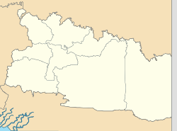
Kode
Wilayah
Name of
District
(distrik)
Area
in
km2
Pop'n
2010
Census
Pop'n
2020
Census
Pop'n
mid 2022
estimate
Admin
centre
No.
of
villages
Post
code
95.05.01Kobagma565.4618,41813,50411,876Kobakma1599074
95.05.05Ilugwa80.372,16013,85517,458Ilugwa699073
95.05.02Kelila165.957,86113,49713,179Kelila1999072
95.05.03Eragayam662.005,9138,5738,101Wurigelobar1599071
95.05.04Megambilis2,269.865,1851,2561,105Taria499075
Totals3,743.6439,53750,68551,719Kobagma59

The sparsely-populated Megambilis District, with over 60% of the regency's area but just 2.14% of its 2022 population, occupies the entire northern portion of the regency.

Related Research Articles

<span class="mw-page-title-main">Sampang Regency</span> Regency of Indonesia

Sampang Regency is a regency of East Java province, Indonesia. It is situated on Madura Island, bordering on Pamekasan Regency to the east, the Java Sea to the north, Bangkalan Regency to the west, and Madura Strait to the south. It covers an area of 1,233.3 km2, and had a population of at the 2010 census 877,772 and at the 2020 census 969,694; the official estimate as of mid-2022 was 984,162 - comprising 488,673 males and 495,489 females. The administrative centre is the port of Sampang, on the south coast of Madura.

<span class="mw-page-title-main">Central Hulu Sungai Regency</span> Regency in South Kalimantan, Indonesia

Central Hulu Sungai Regency is one of the regencies in the Indonesian province of South Kalimantan. The area is 1,770.77 km2 and the population was 243,460 at the 2010 Census and 258,721 at the 2020 Census; the official estimate as at mid 2022 was 263,061. The administrative centre is the town of Barabai.

<span class="mw-page-title-main">North Bengkulu Regency</span> Regency in Bengkulu, Indonesia

North Bengkulu is a regency of Bengkulu Province, Indonesia, on the island of Sumatra. It originally covered much of the northern part of Bengkulu Province, but on 25 February 2003 the most northwesterly districts were split off to form a separate Mukomuko Regency, and on 24 June 2008 the most southeastern districts were likewise split off to create a new Central Bengkulu Regency. The residual regency now covers an area of 4,424.59 km2, and it had a population of 257,675 at the 2010 Census and 296,523 at the 2020 Census; the official estimate as at mid 2022 was 302,833. The administrative centre is at the town of Arga Makmur.

<span class="mw-page-title-main">Sorong Regency</span> Regency in Southwest Papua, Indonesia

Sorong Regency is a regency of the Southwest Papua province of Indonesia. It covers an area of 13,075.28 km2, and had a population of 70,619 at the 2010 Census, and 118,679 at the 2020 Census; the official estimate as of mid-2022 was 125,949. Its administrative centre is the town of Aimas. Sorong Regency surrounds Sorong City (Kota) on the landward side; the city is administratively independent of the Regency and is not included in the above statistics; Sorong City has an airport, Sorong Airport, which also serves the Regency.

<span class="mw-page-title-main">Sragen Regency</span> Regency in Java, Indonesia

Sragen Regency is a regency in the eastern part of Central Java province in Indonesia. It covers an area of 994.57 km2 and had a population of 858,266 at the 2010 Census and 976,951 at the 2020 Census; the official estimate as at mid 2022 was 992,243. Its capital is the town of Sragen, located about 30 km to the northeast of Surakarta. Sragen is bordered by East Java Province to the east.

<span class="mw-page-title-main">Central Bangka Regency</span> Regency in Bangka Belitung Islands, Indonesia

Central Bangka Regency is a regency (kabupaten) of the Bangka Belitung Islands Province, Indonesia. It covers an area of 2,155.77 km2 and had a population of 161,075 at the 2010 Census, rising to 198,946 at the 2020 Census; the official estimate as at mid 2022 was 205,510 - comprising 106,340 males and 99,170 females. The town of Koba is its regency seat.

<span class="mw-page-title-main">Dogiyai Regency</span> Regency in Central Papua, Indonesia

Dogiyai Regency is one of the regencies (kabupaten) in the Indonesian province of Central Papua. It covers an area of 7,052.92 km2, and had a population of 84,230 at the 2010 Census and 116,206 at the 2020 Census; the official estimate as at mid 2022 was 119,815, comprising 62,373 males and 57,442 females. The administrative centre is the town of Kigamani.

<span class="mw-page-title-main">Intan Jaya Regency</span> Regency in Central Papua, Indonesia

Intan Jaya Regency is one of the regencies (kabupaten) in the Indonesian province of Central Papua; it was formed in 2008 from part of Paniai Regency. It covers an area of 3,922 km2, and had a population of 40,490 at the 2010 Census, but this greatly increased to 135,043 at the 2020 Census; the official estimate as at mid 2022 was 139,236. The administrative centre is the town of Sugapa.

<span class="mw-page-title-main">Yalimo Regency</span> Regency in Highland Papua, Indonesia

Yalimo Regency is one of the regencies in the Indonesian province of Highland Papua. It covers an area of 4,320.29 km3, and had a population at the 2010 Census of 50,763 which doubled to reach 101,973 at the 2020 Census; the official estimate as at mid 2022 was 105,139. The administrative centre is at Elelim. The indigenous inhabitants of this well-forested mountainous area are the Yali people.

<span class="mw-page-title-main">Puncak Regency</span> Regency in Central Papua, Indonesia

Puncak Regency is one of the regencies (kabupaten) in the Indonesian province of Central Papua; it is not to be confused with Puncak Jaya Regency, which is within the same province, and from whose western districts those districts now forming Puncak Papua Regency were separated in 2008. It covers an area of 7,396.47 km2, and had a population of 93,218 at the 2010 Census and 114,741 at the 2020 Census; the official estimate as of mid-2022 was 116,279. The administrative centre is at Ilaga. The name of the regency is currently being changed to Puncak Papua Regency.

<span class="mw-page-title-main">Nduga Regency</span> Regency in Highland Papua, Indonesia

Nduga Regency is one of the regencies (kabupaten) in the Indonesian province of Highland Papua. Nduga Regency was created on 4 January 2008 by separation from Jayawijaya Regency in accordance with Law No. 6/2008. It covers an area of 12,941 km2, and had a population of 79,053 at the 2010 Census and 106,533 at the 2020 Census; the official estimate as at mid 2022 was 109,630 - comprising 59,587 males and 50,043 females. The administrative centre is at the town of Kenyam.

<span class="mw-page-title-main">Nabire Regency</span> Regency in Papua, Indonesia

Nabire Regency is one of the regencies (kabupaten) in the Indonesian province of Central Papua. It covers an area of 12,010.65 km2, and had a population of 129,893 at the 2010 Census and 169,136 at the 2020 Census, comprising 87,688 males and 81,448 females. The official estimate as at mid 2022 was 173,043 - comprising 90,823 males and 82,220 females. The administrative centre is the town of Nabire, which faces onto Cenderawasih Bay.

<span class="mw-page-title-main">Mimika Regency</span> Regency in Central Papua, Indonesia

Mimika Regency is one of the regencies (kabupaten) in the Indonesian province of Central Papua. It covers an area of 21,693.51 km2, and had a population of 182,001 at the 2010 Census, but grew to 311,969 at the 2020 Census. The official estimate as at mid 2022 was 321,657. The administrative centre is the town of Timika, which lies within Mimika Baru District, which had 144,893 inhabitants in mid 2021.

<span class="mw-page-title-main">Mamberamo Raya Regency</span> Regency in Papua, Indonesia

Mamberamo Raya Regency is one of the regencies (kabupaten) in Papua Province, Indonesia; it was created on 15 March 2007 from parts of Sarmi Regency and Waropen Regency. It covers an area of 23,813.91 km2, and had a population of 18,365 at the 2010 Census which had virtually doubled to 36,483 at the 2020 Census; the official estimate as at mid 2022 was 37,616. The administrative centre is at the town of Burmeso in Mamberamo Tengah District.

<span class="mw-page-title-main">Jayawijaya Regency</span> Regency in Papua, Indonesia

Jayawijaya Regency is one of the regencies (kabupaten) in the Indonesian province of Highland Papua. It occupies an area of 13,925.31 km2 in the Baliem Valley, situated in the central highlands of the province. It had a population of 196,085 at the 2010 Census, and 269,553 at the 2020 Census; the official estimate as of mid-2022 was 277,923 - comprising 144,500 males and 133,423 females. Its capital is the town of Wamena.

<span class="mw-page-title-main">Lanny Jaya Regency</span> Regency in Highland Papua, Indonesia

Lanny Jaya Regency is a regency (kabupaten) located in the Indonesian province of Highland Papua. It covers an area of 6,077.4 km2, and had a population of 148,522 at the 2010 Census and 196,399 at the 2020 Census; the official estimate as at mid 2022 was 201,461. The administrative centre is the town of Tiom.

West Halmahera Regency is a regency in North Maluku Province, Indonesia. It covers an area of 2,153.04 km2, and it had a population of 100,424 people at the 2010 Census and 132,349 at the 2020 Census; the official estimate as at mid 2022 was 136,282. The capital lies at Jailolo.

Central Halmahera Regency is a regency in North Maluku Province, Indonesia. It covers a land area of 2,485.76 km2, and had a population of 42,815 at the 2010 Census and 56,802 at the 2020 Census; the official estimate as at mid 2022 was 59,096. The capital lies at Weda.

<span class="mw-page-title-main">Central Mamuju Regency</span> Regency in West Sulawesi, Indonesia

Central Mamuju Regency is a regency in the province of West Sulawesi, Indonesia. The regency was established on 14 December 2012, comprising five districts (kecamatan) which had formerly been part of Mamuju Regency. It covers an area of 3,015.95 km2 and had a population of 105,495 at the 2010 Census and 135,280 at the 2020 Census; the official estimate as at mid 2022 was 140,028.

<span class="mw-page-title-main">Central Buton Regency</span> Regency in Southeast Sulawesi, Indonesia

Central Buton Regency is a new regency of Southeast Sulawesi established by separation from Buton Regency under Act No.15 of 2014, dated 23 July 2014. It covers an area of 837.16 km2 comprising the southern parts of Muna Island and Kabaena Island, together with several small offshore islands adjacent to the two main islands, with no territory located on Buton Island. It had a population of 86,112 at the 2010 Census and 114,773 at the 2020 Census; the official estimate as at mid 2022 was 118,904. The administrative centre lies at Labungkari in Lakudo District.

References

  1. 1 2 3 Badan Pusat Statistik, Jakarta, 2023, Kabupaten Mamberamo Tengah Dalam Angka 2023 (Katalog-BPS 1102001.9505)
  2. 1 2 Biro Pusat Statistik, Jakarta, 2011.
  3. 1 2 Badan Pusat Statistik, Jakarta, 2021.