Tolikara Regency

Last updated
Tolikara Regency
Kabupaten Tolikara
Lambang Kabupaten Tolikara.tif
Motto: 
Nawi Arigi
91.14.00 Papua Tolikara.svg
Indonesia Western New Guinea location map.png
Red pog.svg
Tolikara Regency
Location in Western New Guinea and Indonesia
Indonesia location map.svg
Red pog.svg
Tolikara Regency
Tolikara Regency (Indonesia)
Coordinates: 3°25′36″S137°25′01″E / 3.4266°S 137.4170°E / -3.4266; 137.4170
Country Flag of Indonesia.svg  Indonesia
Province Highland Papua
Capital Karubaga
Government
  RegentUsman Wanimbo
  Vice RegentDenis Wanimbo
Area
  Total14,564.0 km2 (5,623.2 sq mi)
Population
 (mid 2022 estimate) [1]
  Total244,345
  Density17/km2 (43/sq mi)
Time zone UTC+9 (Indonesia Eastern Time)
Area code (+62) 969
Website www.tolikarakab.go.id

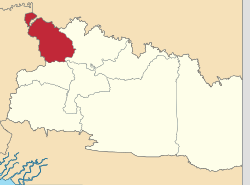
Tolikara Regency is one of the regencies (kabupaten) in the Indonesian province of Highland Papua. It covers an area of 14,564 km2, and had a population of 114,427 at the 2010 Census [2] and 239,543 at the 2020 Census; [3] the official estimate as at mid 2022 was 244,345. [4] The administrative centre of Tolikara Regency is the town of Karubaga.

Contents

Administrative Districts

Tolikara Regency in 2010 comprised 35 districts (distrik), but the number of districts was increased (by 2018) to 46, subdivided into 545 administrative villages. The districts are tabulated below with their areas and their populations at the 2010 Census [5] and the 2020 Census, [6] together with the official estimates as at mid 2021. [7] Recent population growth has been concentrated in relatively few districts, with the majority of districts suffering population decline between 2020 and 2022. The districts have the same names as their administrative centres, except for Wakuo (centre, Wonitu), Wunin (centre, Wurineri), Bewani (centre, Bilubaga) and Kai (centre, Kaiga) Districts. The table also includes the number of villages in each district (totaling 541 rural kampung and 4 urban kelurahan), and its post code.

DistrictArea
in
km2
Pop'n
2010
Census
Pop'n
2020
Census
Pop'n
mid 2022
Estimate
No.
of
villages
Post
code
Kanggime3086,54010,78710,48510 (a)99044
Woniki3687,3854,5134,0321099048
Nabunage2817,5404,6733,9901199045
Gilubandu4395,7654,7154,0261099043
Wakuo2312,1374,3954,3041299047
Aweku234(b)1,9801,9251099041
Bogonuk210(b)4,8454,3291099042
Karubaga3126,70316,41119,07423 (a)99027
Goyage4313,4589,91510,3741999025
Wunin2253,7055,9206,156999036
Kondaga2332,5495,2695,1761199028
Nelawi2453,2577,4528,3361299032
Kuari4456,7037,9066,9561799029
Lianogoma252(b)4,5215,2561099031
Biuk215(b)5,7106,3871199023
Bokondini4334,9426,0005,34411 (a)99012
Bokoneri3473,7846,4916,1501799013
Bewani5833,8244,2303,6671499011
Kembu4623,9396,8476,49911 (a)99056
Wina4353,2005,3295,0201399063
Umagi3753,1827,0827,0571299061
Panaga2441,7173,5773,872999057
Poganeri2791,0517,1569,3101099058
Kamboneri3838791,8581,829899015
Air Garam4253,0514,5444,182899021
Dow4185463,6164,6361199051
Wari / Taiyeve4435843,5524,2871799062
Egiam4672703,2824,5371099053
Nunggawi2366,24512,90012,6482699046
Kubu2333,0933,5153,071999030
Anawi189(b)3,0923,5951099022
Wugi192(b)4,0894,7541199035
Geya3422,8915,6015,4611299024
Wenam231(b)4,9925,8041099034
Numba4522,0704,7864,8041099033
Kai221(b)4,0694,2311099026
Dundu4031,6133,6223,6201099052
Gundagi3973,7274,6174,1081799055
Timori4543,2063,5973,1401299060
Yuneri2473,7687,0946,8441199037
Tagime232(b)2,4652,9451099016
Danime212(b)9501,1351099014
Yuko172(b)2,1162,7521199064
Telenggeme219(b)3,3523,60741099059
Gika186(b)2,3012,4921099054
Tagineri2239211,7892,1381099017
Total14,564114,427239,543244,345545

Notes: (a) including 1 kelurahan (in each case the district administrative centre. (b) the 2010 population of the areas now forming these new districts are included in the figures for the districts from which they were subsequently cut out. Since 2010, the former districts of Dorman (which had 171 inhabitants in 2010) and Sbey (which had 111 inhabitants in 2010) have ceased to exist, while thirteen new districts have been created, which are: Aweku, Bogonuk, Lianogoma, Biuk, Anawi, Wugi, Wenam, Kai, Tagime, Danime, Yuko, Telenggeme and Gika.

History

The VI Asian-Pacific Astronomy Olympiad took place in Tolikara in November–December 2010. [8]

The regency was the scene of a riot against Muslims during Eid prayer in 2015.

Climate

Karubaga has a cool tropical rainforest climate (Af) with heavy rainfall year-round.

Climate data for Karubaga
MonthJanFebMarAprMayJunJulAugSepOctNovDecYear
Average high °C (°F)25.4
(77.7)
25.2
(77.4)
25.0
(77.0)
25.0
(77.0)
24.8
(76.6)
24.0
(75.2)
23.4
(74.1)
23.4
(74.1)
24.1
(75.4)
25.1
(77.2)
25.4
(77.7)
25.3
(77.5)
24.7
(76.4)
Daily mean °C (°F)19.8
(67.6)
19.7
(67.5)
19.8
(67.6)
19.8
(67.6)
19.7
(67.5)
19.1
(66.4)
18.7
(65.7)
18.5
(65.3)
18.9
(66.0)
19.5
(67.1)
19.7
(67.5)
19.9
(67.8)
19.4
(67.0)
Average low °C (°F)14.3
(57.7)
14.3
(57.7)
14.6
(58.3)
14.6
(58.3)
14.6
(58.3)
14.3
(57.7)
14.0
(57.2)
13.7
(56.7)
13.7
(56.7)
13.9
(57.0)
14.0
(57.2)
14.5
(58.1)
14.2
(57.6)
Average rainfall mm (inches)278
(10.9)
283
(11.1)
320
(12.6)
264
(10.4)
205
(8.1)
173
(6.8)
175
(6.9)
178
(7.0)
185
(7.3)
234
(9.2)
217
(8.5)
233
(9.2)
2,745
(108)
Source: Climate-Data.org [9]

Related Research Articles

<span class="mw-page-title-main">Klaten Regency</span> Regency in Indonesia

Klaten Regency is a regency in Central Java province in Indonesia. It covers an area of 655.56 km2 and had a population of 1,130,047 at the 2010 Census and 1,260,506 at the 2020 Census; the official estimate as at mid 2022 was 1,275,850. Its capital is the town of the same name; the town extends over 33.73 km2 to encompass three of the regency's districts, with a combined total of 134,423 inhabitants in mid 2022; a fourth district (Kalikotes) is part of its urban area.

<span class="mw-page-title-main">Purbalingga Regency</span> Regency in Indonesia

Purbalingga Regency is an inland regency in the southwestern part of Central Java province in Indonesia. Purbalingga Regency has an area of 777.64 km2 and population of 848,952 at the 2010 census and 998,561 at the 2020 census, comprising 505,281 male and 493,280 female inhabitants; the official estimate as at mid 2022 was 1,019,840. The administrative capital is the town of Purbalingga.

<span class="mw-page-title-main">Sukoharjo Regency</span> Regency of Indonesia

Sukoharjo Regency is a regency in the Central Java province in Indonesia. It covers an area of 493.23 km2 and had a population of 824,238 at the 2010 Census and 907,587 at the 2020 Census; the official estimate as at mid 2022 was 916,627. Its capital is Sukoharjo, about 10 km south from Surakarta. This regency is bordered by the city of Surakarta in the north, Karanganyar Regency in the east, Wonogiri Regency and Yogyakarta in the south as well as Klaten Regency in the west. The regency is part of the metropolitan zone of Surakarta, which is known as Subosukawonosraten.

<span class="mw-page-title-main">Tapin Regency</span> Regency in South Kalimantan, Indonesia

Tapin Regency is one of regencies in the Indonesian province of South Kalimantan; the capital is the town of Rantau. The regency's motto is "Ruhui Rahayu", and it is also shared by another Indonesian province East Kalimantan. It covers an area of 2,174.95 km2 and had a population of 167,877 at the 2010 Census and 189,475 at the 2020 Census; the official estimate as at mid 2022 was 194,628. The administrative centre of the regency is at Rantau.

<span class="mw-page-title-main">Rembang Regency</span> Regency of Indonesia

Rembang Regency is a regency on the extreme northeast coast of Central Java Province, on the island of Java in Indonesia. The regency covers an area of 1,036.70 km2 on Java, and it had a population of 591,359 at the 2010 Census and 645,333 at the 2020 Census; the official estimate as at mid 2022 was 650,770, of whom 327,196 were males and 323,574 were females. Its administrative capital is the town of Rembang.

<span class="mw-page-title-main">Sragen Regency</span> Regency in Java, Indonesia

Sragen Regency is a regency in the eastern part of Central Java province in Indonesia. It covers an area of 994.57 km2 and had a population of 858,266 at the 2010 Census and 976,951 at the 2020 Census; the official estimate as at mid 2022 was 992,243. Its capital is the town of Sragen, located about 30 km to the northeast of Surakarta. Sragen is bordered by East Java Province to the east.

<span class="mw-page-title-main">Kabaena</span> Island in Southeast Sulawesi, Indonesia

Kabaena or Tokotua is an island in the Flores Sea, Indonesia, off the coast of Sulawesi. Most of it is a part of Bombana Regency within Southeast Sulawesi province, although the southernmost district is administratively part of Central Buton Regency. The island's area is 891.36 km2 and its total population at the 2010 Census was 35,558 and at the 2020 Census was 42,877; the official estimate as at mid 2021 was 43,464.

<span class="mw-page-title-main">Nabire Regency</span> Regency in Central Papua, Indonesia

Nabire Regency is one of the regencies (kabupaten) in the Indonesian province of Central Papua. It covers an area of 12,010.65 km2, and had a population of 129,893 at the 2010 Census and 169,136 at the 2020 Census, comprising 87,688 males and 81,448 females. The official estimate as at mid 2021 was 170,914. The administrative centre is the town of Nabire, which faces onto Cenderawasih Bay.

<span class="mw-page-title-main">Mimika Regency</span> Regency in Central Papua, Indonesia

Mimika Regency is one of the regencies (kabupaten) in the Indonesian province of Central Papua. It covers an area of 21,693.51 km2, and had a population of 182,001 at the 2010 Census, but grew to 311,969 at the 2020 Census. The official estimate as at mid 2022 was 321,657. The administrative centre is the town of Timika, which lies within Mimika Baru District, which had 144,893 inhabitants in mid 2021.

<span class="mw-page-title-main">Mappi Regency</span> Regency in South Papua, Indonesia

Mappi Regency is a regency (kabupaten) in the Indonesian province of South Papua. It was split off from Merauke Regency on 12 November 2002. It covers an area of 25,609.94 km2, and had a population of 81,658 at the 2010 Census and 108,295 at the 2020 Census; the official estimate as at mid 2022 was 111,141. The administrative centre is the town of Kepi.

<span class="mw-page-title-main">East Luwu Regency</span> Regency in South Sulawesi, Indonesia

East Luwu Regency is the most easterly of the twenty-one regencies in South Sulawesi Province of Indonesia. The regency was created on 25 February 2003 by separation of the eastern districts from North Luwu Regency. It covers an area of 6,944.88 km2. The administrative capital of the regency is the coastal town of Malili on the Bay of Usu, itself an inlet in the northeast corner of the Gulf of Bone; the town, with its port of Balantang, is the shipping port for one of the world's major nickel-producing plants. The population of the Regency was 243,069 at the 2010 Census and 296,741 at the 2020 Census; the official estimate as at mid 2022 was 305,521.

<span class="mw-page-title-main">Bulukumba Regency</span> Regency in South Sulawesi, Indonesia

Bulukumba Regency is a regency in the southeast corner of South Sulawesi Province, Indonesia. It covers an area of 1,170.10 km2, and had a population of 394,757 at the 2010 Census and 437,607 at the 2020 Census. The official estimate for mid 2022 was 443,292. The town of Ujung Bulu is its capital.

<span class="mw-page-title-main">Pasangkayu Regency</span> Regency in Sulawesi, Indonesia

Pasangkayu Regency is one of the six regencies which comprise West Sulawesi Province, Indonesia, on the island of Sulawesi. It covers an area of 3,043.75 km2 and had a population of 134,303 at the 2010 Census and 188,861 at the 2020 Census. The official estimate as at mid 2022 was 198,608. The town of Pasangkayu is the capital of the regency, and its only urban community (kelurahan).

<span class="mw-page-title-main">Lamandau Regency</span> Regency in Kalimantan, Indonesia

Lamandau Regency is one of the thirteen regencies which comprise the Central Kalimantan Province on the island of Kalimantan (Borneo), Indonesia. It was created on 10 April 2002 from the former northwest part of West Kotawaringin Regency. The town of Nanga Bulik is the capital of Lamandau Regency, which covers an area of 7,673.56 km2. The population of Lamandau Regency was 63,199 at the 2010 census, and 97,611 at the 2020 census; the official estimate as at mid 2022 was 104,387.

<span class="mw-page-title-main">Sukamara Regency</span> Regency of Indonesia

Sukamara Regency is one of the thirteen regencies which comprise the Central Kalimantan Province on the island of Kalimantan (Borneo), Indonesia. It was created on 10 April 2002 from the former southwest part of West Kotawaringin Regency. The town of Sukamara is the capital of Sukamara Regency, which covers an area of 3,827 km2. The population of the Regency was 44,952 at the 2010 Census and 63,464 at the 2020 Census; the official estimate as at mid 2022 was 66,845.

<span class="mw-page-title-main">Ketapang Regency</span> Regency in West Kalimantan, Indonesia

Ketapang Regency is a regency in the south of the province of West Kalimantan, on the island of Borneo in Indonesia. Ketapang Regency occupies an area of 31,588 km2, and at the census in 2010 it had 427,460 inhabitants following the splitting off of five districts in the north-west of the regency on 2 January 2007 to form the new North Kayong Regency; the 2020 census revealed a growth in population to 570,657 over the intervening decade; the official estimate as at mid 2021 was 591,917. The principal town lies at Ketapang.

<span class="mw-page-title-main">Bantaeng Regency</span> Regency in South Sulawesi, Indonesia

Bantaeng Regency is a regency of South Sulawesi Province in Indonesia. It covers an area of 395.83 km2 and had a population of 176,984 at the 2010 Census, rising to 196,716 at the 2020 Census. The official estimate as at mid 2022 was 199,399. The administrative centre is the town of Bantaeng, which lies on the south coast of the southern peninsula of Sulawesi island.

<span class="mw-page-title-main">Enrekang Regency</span> Regency in South Sulawesi, Indonesia

Enrekang Regency is an inland regency of South Sulawesi Province of Indonesia. It covers an area of 1,821.53 km2 and had a population of 190,175 at the 2010 census and 225,172 at the 2020 census; the official estimate as at mid 2022 was 228,554. The principal town lies at Enrekang.

<span class="mw-page-title-main">Tolitoli Regency</span> Regency in Central Sulawesi, Indonesia

Tolitoli Regency is a regency of Central Sulawesi Province of Indonesia. It was previously part of a larger Buol Tolitoli Regency, but this was split into two on 4 October 1999 after rapid decentralization of the Indonesian government. The present Tolitoli Regency covers an area of 3,701.54 km2 and had a population of 211,296 at the 2010 Census and 225,154 at the 2020 Census; the official estimate as at mid 2022 was 228,641, comprising 116,514 male and 112,127 female inhabitants. Its regency seat is located at the town of Tolitoli, which is a port town and where its population is concentrated.

<span class="mw-page-title-main">South Minahasa Regency</span> Regency in North Sulawesi, Indonesia

South Minahasa Regency is a regency in North Sulawesi, Indonesia. Its capital is Amurang. It was originally part of the Minahasa Regency until it was established as a separate regency on 25 February 2003. In turn, a Southeast Minahasa Regency was established as a separate regency from part of the South Minahasa Regency on 2 January 2007. The residual Regency now covers an area of 1,456.46 km2, and had a population of 195,553 at the 2010 Census; this had risen to 236,463 at the 2020 Census; the official estimate as at mid 2022 was 241,680.

References

  1. Badan Pusat Statistik, Jakarta, 2023.
  2. Biro Pusat Statistik, Jakarta, 2011.
  3. Badan Pusat Statistik, Jakarta, 2021.
  4. Badan Pusat Statistik, Jakarta, 2023.
  5. Biro Pusat Statistik, Jakarta, 2011.
  6. Badan Pusat Statistik, Jakarta, 2021.
  7. Badan Pusat Statistik, Jakarta, 2022.
  8. The VI Asian-Pacific Astronomy Olympiad
  9. "Climate: Karubaga". Climate-Data.org. Retrieved 26 November 2020.