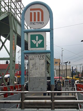
Cerro de la Estrella metro station

Last updated
Metro Cerro de la Estrella pictogram.svg Cerro de la Estrella
Mexico City Metro.svg
STC rapid transit
Metro Cerro de la Estrella 02.jpg
General information
Coordinates 19°21′22″N99°05′08″W / 19.356012°N 99.085522°W / 19.356012; -99.085522
Line(s) MetroDF Linea 8.svg (Garibaldi / Lagunilla - Constitución de 1917)
Platforms2 side platforms
Tracks2
Construction
Structure typeUnderground
History
Opened20 July 1994
Passengers
20233,831,839 [1] Increase2.svg 11.39%
Rank115/195 [1]
Services
Preceding station Mexico City Metro.svg Mexico City Metro Following station
Iztapalapa Line 8 UAM-I
Location
Location map Mexico City.png
Red pog.svg
Metro Cerro de la Estrella pictogram.svg Cerro de la Estrella
Location within Mexico City
Cerro de la Estrella metro station
Area map

Cerro de la Estrella (English: Hill of the Star) is an underground station along Line 8 of the metro of Mexico City. [2] [3] [4] The station is located along the Calzada Ermita-Iztapalapa and serves the Colonia Hidalgo y Mina neighborhood within the Iztapalapa borough on the east side of the city. [2] The station is named for the Cerro de la Estrella a mesoamerican archaeological site located nearby. [2] [5] It was opened on 20 July 1994. [6]

Contents

The station's logo is the silhouette of a hill with three crosses on it and a star in the sky. [2] [3] In spring during Easter the station sees heavy traffic for spectators who travel to Cerro de la Estrella to watch Passion of the Christ procession events. [7] [8]

From 23 April to 18 June 2020, the station was temporarily closed due to the COVID-19 pandemic in Mexico. [9] [10]

Ridership

Annual passenger ridership
YearRidershipAverage dailyRank % changeRef.
20233,831,83910,498115/195 [1]
20223,440,1519,425122/195 [1]
20212,606,6727,141120/195 [11]
20202,205,3996,025147/195 [12]
20194,074,99911,164148/195 [13]
20184,326,05911,852141/195 [14]
20174,062,51111,130141/195 [15]
20164,022,01310,989143/195 [16]
20153,692,48210,116139/195 [17]
20144,152,71811,377131/195 [18]

Related Research Articles

<span class="mw-page-title-main">Escuadrón 201 metro station</span> Mexico City metro station

Escuadrón 201 is a metro station in Mexico City, Mexico. It is located in the city's eastern Iztapalapa borough, close to the intersection of Eje 3 Oriente and Eje 8 Sur.

<span class="mw-page-title-main">Tasqueña metro station</span> Mexico City metro station

Tasqueña is a station on Line 2 of the Mexico City Metro system. It is located in the Campestre Churubusco neighborhood, within the Coyoacán borough of Mexico City, directly south of the city centre on Avenida Tasqueña and Canal de Miramontes. It is a surface station and the southern terminus of the line. In 2019, the station had an average ridership of 83,463 passengers per day, making it the seventh busiest station in the network.
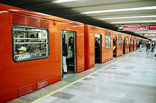
<span class="mw-page-title-main">Merced metro station</span> Mexico City metro station

Merced is an underground station on Line 1 of the Mexico City Metro. It is located in the Venustiano Carranza borough, slightly to the east of the centre of Mexico City. The station building was designed by Félix Candela, and it was opened on 4 September 1969. From July 2022 to October 2023, the station was closed due to modernization works on the tunnel and the line's technical equipment.

<span class="mw-page-title-main">Martín Carrera metro station</span> Mexico City metro station

Martín Carrera is a station on the Mexico City Metro. It is located at the borders of the Colonia Martín Carrera, Colonia 15 de Agosto, and Colonia Díaz Mirón districts in the Gustavo A. Madero borough, in the north of Mexico City. The station logo depicts bust of General Martín Carrera, a national hero who fought in the Mexican–American War of 1846–48.

<span class="mw-page-title-main">Copilco metro station</span> Mexico City metro station

Copilco is a station along Line 3 on the Mexico City Metro. Located in the Coyoacán borough, in the south of Mexico City, on Avenida Enríquez Ureña. It is the penultimate station along the southern portion of Line 3.

<span class="mw-page-title-main">Ermita metro station</span> Mexico City metro station

Ermita is a station on Line 2 and Line 12 of the Mexico City Metro system. According to the Sistema de Transporte Colectivo, Ermita serves as a transfer station of Line 12. It is located in the Benito Juárez borough of Mexico City, directly south of the city centre on Calzada de Tlalpan.
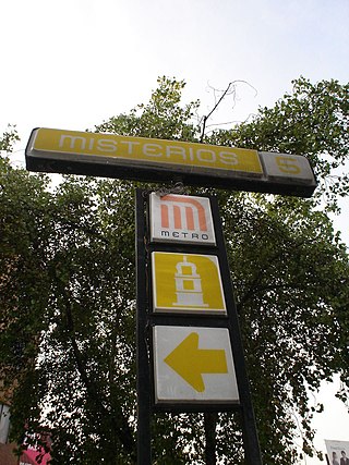
<span class="mw-page-title-main">Misterios metro station</span> Mexico City Metro station

Misterios metro station is a Mexico City Metro station within the limits of Cuauhtémoc and Gustavo A. Madero, in Mexico City. It is an underground station with two side platforms, served by Line 5, between La Raza and Valle Gómez stations. Misterios station serves the colonias (neighborhoods) of Peralvillo and Vallejo.
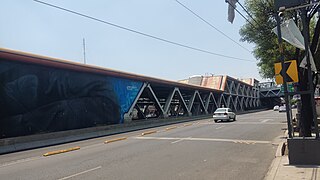
<span class="mw-page-title-main">Aculco metro station</span> Mexico City metro station

Aculco is a station along Line 8 of the metro of Mexico City. It is located under the bridge where the Trabajadoras Sociales passes over the Eje 3 Ote in the Colonia Pueblo Aculco neighborhood of the Iztapalapa borough of Mexico City. The station's logo is a water wave in a canal. In Nahuatl it means "where the water twists". The name is also the name of the Aculco municipality in the State of Mexico.

<span class="mw-page-title-main">Atlalilco metro station</span> Mexico City metro station

Atlalilco is a station along Line 8 and Line 12 of the metro of Mexico City. Atlalilco is a transfer station between the Line 12 and Line 8. Line 8 station is located on the Calzada Ermita Iztapalapa, while Line 12 station is located on Avenida Tláhuac, in the Colonia Santa Isabel Industrial neighbourhood.
<span class="mw-page-title-main">Iztapalapa metro station</span> Mexico City metro station

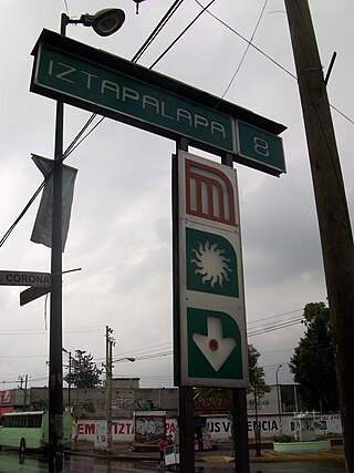
Iztapalapa is a station along Line 8 of the metro of Mexico City. It is located on the Calzada Ermita Iztapalapa in the Colonia El Santuario neighborhood of Iztapalapa borough on the southeast side of the city.
<span class="mw-page-title-main">UAM-I metro station</span> Mexico City metro station

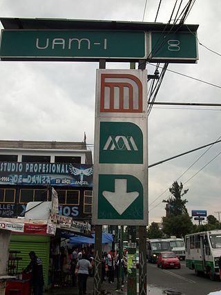
UAM-I is a station along Line 8 of the Mexico City Metro.
<span class="mw-page-title-main">Tepalcates metro station</span> Mexico City metro station

Tepalcates is a station on the Line A of the Mexico City Metro. It is located in the Iztapalapa municipality, to the east of downtown Mexico City. In 2019, the station had an average ridership of 19,326 passengers per day.

<span class="mw-page-title-main">Guelatao metro station</span> Mexico City Metro station

Guelatao metro station is a Mexico City Metro station in the Iztapalapa borough of Mexico City. It is an at-grade station that serves Line A between Tepalcates and Peñón Viejo stations.
<span class="mw-page-title-main">Peñón Viejo metro station</span> Mexico City metro station

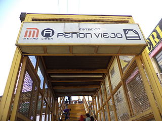
Peñon Viejo is a station along Line A of the Mexico City Metro. It is located in the Colonia Santa Martha Acatitla Norte and Colonia Santa Martha Acatitla Sur neighborhoods of the Iztapalapa borough of Mexico City.
<span class="mw-page-title-main">Santa Marta metro station</span> Mexico City metro station

Santa Marta is a station along Line A of the Mexico City Metro. It is located in the Colonia Ermita Zaragoza neighborhood of the Iztapalapa borough in Mexico City.
<span class="mw-page-title-main">Mexicaltzingo metro station</span> Mexico City metro station

Mexicaltzingo is a station on Line 12 of the Mexico City Metro. The station is located between Ermita and Atlalilco. It was opened on 30 October 2012 as a part of the first stretch of Line 12 between Mixcoac and Tláhuac.

<span class="mw-page-title-main">Culhuacán metro station</span> Mexico City metro station

Culhuacán is a station on Line 12 of the Mexico City Metro. The station is located between Atlalilco and San Andrés Tomatlán. It was opened on 30 October 2012 as a part of the first stretch of Line 12 between Mixcoac and Tláhuac.

<span class="mw-page-title-main">San Andrés Tomatlán metro station</span> Mexico City metro station

San Andrés Tomatlán is a station on Line 12 of the Mexico City Metro. The station is located between Culhuacán and Lomas Estrella. It was opened on 30 October 2012 as a part of the first stretch of Line 12 between Mixcoac and Tláhuac.

<span class="mw-page-title-main">Lomas Estrella metro station</span> Metro station in Mexico City, Mexico

Lomas Estrella is a station on Line 12 of the Mexico City Metro. The station is located between San Andrés Tomatlán and Calle 11. It was opened on 30 October 2012 as a part of the first stretch of Line 12 between Mixcoac and Tláhuac.

<span class="mw-page-title-main">Calle 11 metro station</span> Mexico City metro station

Calle 11 is a station on Line 12 of the Mexico City Metro. The station is located between Lomas Estrella and Periférico Oriente. It was opened on 30 October 2012 as a part of the first stretch of Line 12 between Mixcoac and Tláhuac.

References

  1. 1 2 3 4 "Afluencia de estación por línea 2023" [Station traffic per line 2023] (in Spanish). Sistema Transporte Colectivo Metro. 2024. Archived from the original on 27 January 2024. Retrieved 24 January 2024.
  2. 1 2 3 4 "Cerro de la Estrella" (in Spanish). Archived from the original on 8 August 2011. Retrieved 30 July 2011.
  3. 1 2 Archambault, Richard. "Cerro de la Estrella - Mexico City Metro System" . Retrieved 30 July 2011.
  4. "Secretaría de Turismo - Gobierno del Distrito Federal" . Retrieved 30 July 2011.
  5. "Zona arqueologica - Cerro de la estrella, Distrito Federal - Ciudad de México, México - Viajeros.com" . Retrieved 30 July 2011.
  6. "Transporte" (in Spanish). Delegación Iztapalapa. Archived from the original on 4 October 2011. Retrieved 30 July 2011.
  7. "Metro operará desde las 07:00 jueves y viernes santos". SDP Noticias (in Spanish). 20 April 2011. Archived from the original on 7 October 2011. Retrieved 30 July 2011.
  8. "El Metro tendrá horario especial (festivo) en Semana Santa". MX-DF.net .:. México-Distrito Federal (in Spanish). 14 April 2011. Archived from the original on 5 October 2011. Retrieved 30 July 2011.
  9. "Cierre temporal de estaciones" (PDF) (in Spanish). Metro CDMX. Retrieved 25 April 2020.
  10. Hernández, Eduardo (13 June 2020). "Coronavirus. Este es el plan para reabrir estaciones del Metro, Metrobús y Tren ligero". El Universal (in Spanish). Retrieved 15 June 2020.
  11. "Afluencia de estación por línea 2021" [Station traffic per line 2021] (in Spanish). Sistema Transporte Colectivo Metro. 2020. Archived from the original on 7 March 2022. Retrieved 7 March 2022.
  12. "Afluencia de estación por línea 2020" [Station traffic per line 2020] (in Spanish). Sistema Transporte Colectivo Metro. 2021. Archived from the original on 21 June 2021. Retrieved 21 June 2021.
  13. "Afluencia de estación por línea 2019" [Station traffic per line 2019] (in Spanish). Sistema Transporte Colectivo Metro. 2020. Archived from the original on 8 April 2020. Retrieved 3 May 2020.
  14. "Afluencia de estación por línea 2018" [Station traffic per line 2018] (in Spanish). Sistema Transporte Colectivo Metro. 2019. Archived from the original on 6 June 2019. Retrieved 7 April 2020.
  15. "Afluencia de estación por línea 2017" [Station traffic per line 2017] (in Spanish). Sistema Transporte Colectivo Metro. 2019. Archived from the original on 3 May 2020. Retrieved 3 May 2020.
  16. "Afluencia de estación por línea 2016" [Station traffic per line 2016] (in Spanish). Sistema Transporte Colectivo Metro. 2017. Archived from the original on 3 May 2020. Retrieved 3 May 2020.
  17. "Afluencia de estación por línea 2015" [Station traffic per line 2015] (in Spanish). Sistema Transporte Colectivo Metro. 2016. Archived from the original on 3 May 2020. Retrieved 6 May 2020.
  18. "Afluencia de estación por línea 2014" [Station traffic per line 2014] (in Spanish). Sistema Transporte Colectivo Metro. 2015. Archived from the original on 3 May 2020. Retrieved 6 May 2020.