Santa Anita metro station

Last updated
Metro Santa Anita pictogram.svg Santa Anita
Mexico City Metro.svg
STC rapid transit
Estacion Santa Anita - Linea 8 - Metro de la Ciudad de Mexico - Mosaico embarcadero.jpg
Stairs leading to Line 8 platforms showing mosaic of men in boats.
General information
LocationSanta Anita, Iztacalco
Mexico City
Mexico
Coordinates 19°24′10″N99°07′18″W / 19.40273°N 99.121699°W / 19.40273; -99.121699
Operated by Sistema de Transporte Colectivo (STC)
Line(s) MetroDF Linea 4.svg (Martín Carrera - Santa Anita)
MetroDF Linea 8.svg (Garibaldi / Lagunilla - Constitución de 1917)
Platforms4 side platforms
Tracks4
Construction
Structure type MetroDF Linea 4.svg At grade
MetroDF Linea 8.svg Underground
ParkingNo
Bicycle facilitiesNo
Other information
StatusIn service
History
Opened MetroDF Linea 4.svg 26 May 1982
MetroDF Linea 8.svg 20 July 1994
Previous namesPlutarco E. Calles (planned)
Passengers
2023Total: 2,356,166
MetroDF Linea 4.svg 655,751 [1]
MetroDF Linea 8.svg 1,700,415 [1] Increase2.svg 10.97%
Rank MetroDF Linea 4.svg 185/195 [1]
MetroDF Linea 8.svg 165/195 [1]
Services
Preceding station Mexico City Metro.svg Mexico City Metro Following station
Jamaica Line 4 Terminus
La Viga Line 8 Coyuya
Location
Location map Mexico City.png
Red pog.svg
Metro Santa Anita pictogram.svg Santa Anita
Location within Mexico City
Santa Anita metro station
Area map

Santa Anita is a station on the Mexico City Metro. Located in Mexico City's Iztacalco borough, the station is the current terminal of Line 4.

Contents

General information

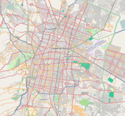
The station logo depicts a man sailing a canoe. This is because in the early 20th century, in the area where the station now stands, was the Santa Anita canal a place used for chinampa -based agriculture. Today the canal has long since vanished, but the name Santa Anita is still used by the surrounding neighborhood.

Metro Line 4 was originally projected to end in the Villa Coapa neighborhood, in the southern borough of Coyoacán. Since the inauguration of Line B, however, no more lines have been constructed or extended, so Metro Santa Anita and other stations, such as Metro Barranca del Muerto officially remain provisional terminals. Metro Santa Anita is the least busy station on the Mexico City Metro, with only 621,867 passenger boardings in 2008. [2]

Santa Anita was originally to be named "Plutarco E. Calles", in honor of President Plutarco Elías Calles, according to early plans for Line 4.

Ridership

Annual passenger ridership (Line 4)
YearRidershipAverage dailyRank % changeRef.
2023655,7511,796185/195 [1]
2022599,8481,643174/195 [1]
2021391,0051,071193/195 [3]
2020448,9271,226194/195 [4]
2019854,7062,341194/195 [5]
2018921,6102,524194/195 [6]
2017861,9922,361194/195 [7]
2016872,8022,384193/195 [8]
2015884,3212,422186/195 [9]
20141,063,1582,912186/195 [10]
Annual passenger ridership (Line 8)
YearRidershipAverage dailyRank % changeRef.
20231,700,4154,658165/195 [1]
20221,523,4424,173167/195 [1]
20211,025,6392,809174/195 [3]
20201,385,4903,875174/195 [4]
20192,402,8746,583177/195 [5]
20182,463,8416,750176/195 [6]
20172,315,7126,344178/195 [7]
20162,363,2106,456180/195 [8]
20152,347,0626,430170/195 [9]
20142,449,4366,710168/195 [10]

Exits

Line 4

Line 8

Related Research Articles

<span class="mw-page-title-main">Sevilla metro station (Mexico City)</span> Mexico City metro station

Sevilla is a station on Line 1 the Mexico City Metro. It is located in the Cuauhtémoc borough in the centre of Mexico City, on Avenida Chapultepec and Sevilla street. It serves colonias Roma and Juárez. Since 9 November 2023, the station has remained closed for modernization work on the tunnel and the line's technical equipment.

<span class="mw-page-title-main">Insurgentes metro station</span> Mexico City metro station

Insurgentes is a station on the Line 1 of Mexico City Metro. It is located within the Glorieta de los Insurgentes at the intersection of Avenida de los Insurgentes and Avenida Chapultepec in Mexico City's Cuauhtémoc borough, close to the Zona Rosa shopping and entertainment district and the Colonia Roma, two of the most iconic neighborhoods in the city. In 2019, the station had an average ridership of 65,134 passengers per day, making it the 12th busiest station in the network. Since 9 November 2023, the station has remained closed for modernization work on the tunnel and the line's technical equipment.

<span class="mw-page-title-main">Viaducto metro station</span> Mexico City metro station

Viaducto is a station on Line 2 of the Mexico City Metro system. It is located in the border of Benito Juárez and Iztacalco boroughs of Mexico City, south of the city centre on Calzada de Tlalpan. It is a surface station.

<span class="mw-page-title-main">Coyuya metro station</span> Mexico City metro station

Coyuya is a station on the Mexico City Metro.

<span class="mw-page-title-main">Candelaria metro station</span> Mexico City metro station

Candelaria is a Mexico City Metro rail station. It is located in Venustiano Carranza municipality east of downtown Mexico City. It lies along Lines 1 and 4. From July 2022 to October 2023, the Line 1 station was closed due to modernization works on the tunnel and the line's technical equipment.

<span class="mw-page-title-main">Cuitláhuac metro station</span> Mexico City metro station

Cuitláhuac is a station on the Mexico City Metro. It is located in the Colonia Popotla and Colonia San Álvaro districts in the Miguel Hidalgo borough of Mexico City, to the northwest of the city center. It lies along Line 2. In 2019, the station had an average ridership of 18,615 passengers per day.

<span class="mw-page-title-main">Miguel Ángel de Quevedo metro station</span> Mexico City metro station

Miguel Ángel de Quevedo is a station along Line 3 of the Mexico City Metro. It is located in Mexico City's southern Coyoacán borough, at the junction of Avenida Miguel Ángel de Quevedo and Avenida Universidad.

<span class="mw-page-title-main">San Cosme metro station</span> Mexico City metro station

San Cosme is a station on Line 2 of the Mexico City Metro system. It is located in the Cuauhtémoc municipality of Mexico City, northwest of the city centre, on Avenue Ribera de San Cosme a few blocks before it becomes Calzada México-Tacuba. The southern exit leads to Colonia San Rafael while the Northern one leads to Colonia Santa María la Ribera. It is two blocks from the Mercado de San Cosme. In 2019, the station had an average ridership of 22,891 passengers per day.

<span class="mw-page-title-main">Revolución metro station (Mexico City)</span> Mexico City metro station

Revolución is a station on Line 2 of the Mexico City Metro system. It is located in the Colonia Tabacalera and Colonia Buenavista districts in the Cuauhtémoc borough of Mexico City, northwest of the city centre, on Avenida México - Tenochtitlan. It was first opened to the public on 14 September 1970.

<span class="mw-page-title-main">San Antonio Abad metro station</span> Mexico City metro station

San Antonio Abad is a station on Line 2 of the Mexico City Metro system. It is located in the Colonia Tránsito and Colonia Obrera neighborhoods of the Cuauhtémoc borough of Mexico City, to the south of the city centre, in the median of Calzada San Antonio Abad.

<span class="mw-page-title-main">Niños Héroes / Poder Judicial CDMX metro station</span> Mexico City metro station

Niños Héroes / Poder Judicial CDMX is a metro station along Line 3 of the Mexico City Metro. It is located in the Cuauhtémoc borough of Mexico City.

<span class="mw-page-title-main">Etiopía / Plaza de la Transparencia metro station</span> Mexico City metro station

Etiopía / Plaza de la Transparencia is a metro station on the Mexico City Metro. It is located in the Benito Juárez borough of Mexico City.

<span class="mw-page-title-main">Viveros / Derechos Humanos metro station</span> Mexico City metro station

Viveros / Derechos Humanos is a metro station along Line 3 of the Mexico City Metro. It is located between the Álvaro Obregón and Coyoacán boroughs of Mexico City.

<span class="mw-page-title-main">Coyoacán metro station</span> Mexico City metro station

Coyoacán is a metro station along Line 3 of the Mexico City Metro. It is located in the Benito Juárez borough of Mexico City. It is at the intersection of Universidad and Coyoacán avenues. Right outside the station lies the Centro Coyoacán shopping mall, Radio Fórmula and Bancomer headquarters. It is also close to the Cineteca Nacional and Coyoacán district.

<span class="mw-page-title-main">Zapata metro station</span> Mexico City metro station

Zapata is a station on Line 3 and Line 12 of the Mexico City Metro, in the Benito Juárez borough of Mexico City. The station logo depicts Emiliano Zapata, a national hero from the Mexican Revolution of 1910–1921.

<span class="mw-page-title-main">División del Norte metro station</span> Mexico City metro station

División del Norte is a metro station along Line 3 of the Mexico City Metro. It is located in the Benito Juárez borough of Mexico City.

<span class="mw-page-title-main">Bondojito metro station</span> Mexico City metro station

Bondojito is a metro station along Line 4 of the Mexico City Metro. It is located in the Gustavo A. Madero borough of Mexico City.

<span class="mw-page-title-main">Jamaica metro station</span> Mexico City metro station

Jamaica is a station of the Mexico City Metro. It is located in Venustiano Carranza borough in Mexico City and serves the Sevilla neighbourhood.

<span class="mw-page-title-main">Tezozómoc metro station</span> Mexico City metro station

Tezozómoc is a metro station on Mexico's Line 6. It is located in the Azcapotzalco borough. In 2019, the station had an average ridership of 5,757 passengers per day.

<span class="mw-page-title-main">San Joaquín metro station (Mexico City)</span> Mexico City metro station

San Joaquín is a station along Line 7 of the metro of Mexico City.

References

  1. 1 2 3 4 5 6 7 8 "Afluencia de estación por línea 2023" [Station traffic per line 2023] (in Spanish). Sistema Transporte Colectivo Metro. 2024. Archived from the original on 27 January 2024. Retrieved 24 January 2024.
  2. "Index del Sistema de Transporte Colectivo, acciones, cultura, niños". Archived from the original on 2013-10-14. Retrieved 2014-12-08.
  3. 1 2 "Afluencia de estación por línea 2021" [Station traffic per line 2021] (in Spanish). Sistema Transporte Colectivo Metro. 2020. Archived from the original on 7 March 2022. Retrieved 7 March 2022.
  4. 1 2 "Afluencia de estación por línea 2020" [Station traffic per line 2020] (in Spanish). Sistema Transporte Colectivo Metro. 2021. Archived from the original on 21 June 2021. Retrieved 21 June 2021.
  5. 1 2 "Afluencia de estación por línea 2019" [Station traffic per line 2019] (in Spanish). Sistema Transporte Colectivo Metro. 2020. Archived from the original on 8 April 2020. Retrieved 3 May 2020.
  6. 1 2 "Afluencia de estación por línea 2018" [Station traffic per line 2018] (in Spanish). Sistema Transporte Colectivo Metro. 2019. Archived from the original on 6 June 2019. Retrieved 7 April 2020.
  7. 1 2 "Afluencia de estación por línea 2017" [Station traffic per line 2017] (in Spanish). Sistema Transporte Colectivo Metro. 2019. Archived from the original on 3 May 2020. Retrieved 3 May 2020.
  8. 1 2 "Afluencia de estación por línea 2016" [Station traffic per line 2016] (in Spanish). Sistema Transporte Colectivo Metro. 2017. Archived from the original on 3 May 2020. Retrieved 3 May 2020.
  9. 1 2 "Afluencia de estación por línea 2015" [Station traffic per line 2015] (in Spanish). Sistema Transporte Colectivo Metro. 2016. Archived from the original on 3 May 2020. Retrieved 6 May 2020.
  10. 1 2 "Afluencia de estación por línea 2014" [Station traffic per line 2014] (in Spanish). Sistema Transporte Colectivo Metro. 2015. Archived from the original on 3 May 2020. Retrieved 6 May 2020.