Cuatro Caminos metro station (Naucalpan)

Last updated
Metro Cuatro Caminos pictogram.svg Cuatro Caminos
Mexico City Metro.svg
STC rapid transit
Andenes de la estacion Cuatro Caminos del Metro de la Ciudad de Mexico - panoramio.jpg
View of the platforms
General information
Other namesToreo
Location Naucalpan, State of Mexico
Mexico
Coordinates 19°27′35″N99°12′57″W / 19.459592°N 99.215899°W / 19.459592; -99.215899
Operated by Sistema de Transporte Colectivo (STC)
Line(s) MetroDF Linea 2.svg (Cuatro Caminos - Tasqueña)
Platforms2 island platforms
Tracks3
Construction
Structure typeUnderground
AccessibleYes
Other information
StatusIn service
History
Opened22 August 1984
Passengers
202218,285,903 [1] Increase2.svg 20.65%
Rank7/195 [1]
Services
Preceding station Mexico City Metro.svg Mexico City Metro Following station
Terminus Line 2 Panteones
toward Tasqueña
Location
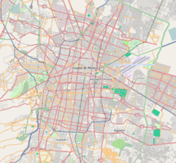
Location map Mexico City.png
Red pog.svg
Metro Cuatro Caminos pictogram.svg Cuatro Caminos
Location within Greater Mexico City
Cuatro Caminos metro station (Naucalpan)
Area map and station layout

Cuatro Caminos (translated from Spanish the name literally means "Four Roads") is a station of the Mexico City metro network. [2] [3] Colloquially known as "Metro Toreo", [4] [5] it is the current north terminus of Line 2. The adjacent Mexipuerto Cementos Fortaleza Cuatro Caminos mixed-use development opened in 2016 [6] and houses, besides a shopping center, residential tower and sports facility, a bus terminal that is a hub for regional bus and minibus transport from and into the State of Mexico. [7] [8] [2] [9] In 2019, the station had an average ridership of 114,947 passengers per day, making it the third busiest station in the network. [10]

Contents

As of 14 September 1970 Line 2 originally terminated at Metro Tacuba, but on 22 August 1984 the line was extended an additional two stations to reach the municipality of Naucalpan. [9] The station sits on the dividing line between the Mexico City and the neighboring State of Mexico and as such was the first station of the network to be built outside the limits of the Federal District.
General information

The station logo is a large geodesic dome depicting the former nearby Toreo de Cuatro Caminos bull fighting ring, which the station takes its name from, [2] however the bullring was torn down in 2008. [11] The station's surroundings (popularly known as the paradero), are the main public transport hub to Toluca and northwestern municipalities in the State of Mexico, such as Naucalpan, Atizapán, Tlalnepantla or Huixquilucan, as well as a major connection point to several destinations within the Mexico City proper and it also serves as the housing of a large street market, which is known largely because of its poor general conditions. [12] Officially, no private vehicles are allowed in the area.

Upon leaving the station, there are two main corridors, labeled "North" and "South". North corridor (denoted by the exits A to K), is mainly used for transportation to State of Mexico, while the "South" corridor is mainly aimed at passengers going to the city (denoted by exit letters J to Z), though this is not strictly the case.

The South corridor (if walked) leads to the Mexipuerto bus terminal, the Toreo Parque Central and Pericentro shopping malls, the Anillo Periférico, and various military facilities, while the North corridor leads to the industrial complex of Naucalpan.

In 2003, the Mexican popular music group Café Tacuba produced an album with the title "Cuatro Caminos" in homage to this part of the city. [13]

Exits

Ridership

Annual passenger ridership
YearRidershipAverage dailyRank % changeRef.
202218,285,90350.0987/195 [1]
202115,156,14941,5236/195 [14]
202022,591,02161,7243/195 [15]
201939,378,128107,8852/195 [16]
201839,886,917109,2793/195 [17]
201739,364,914107,8493/195 [18]
201638,962,862106,4553/195 [19]
201540,423,144110,7482/195 [20]
201441,904,523114,8062/195 [21]
201346,056,083126,1811/195 [22]
201242,933,161117,3031/195 [23]
201145,242,105123,9501/175 [24]
201044,425,920121,7141/175 [25]

See also

Related Research Articles

<span class="mw-page-title-main">Merced metro station</span> Mexico City metro station

Merced is an underground station on Line 1 of the Mexico City Metro. It is located in the Venustiano Carranza borough, slightly to the east of the centre of Mexico City. The station building was designed by Félix Candela, and it was opened on 4 September 1969. Starting 11 July 2022, the station will remain closed for at least eight months for modernization work on the tunnel and the line's technical equipment.

<span class="mw-page-title-main">Pino Suárez metro station</span> Mexico City metro station

Pino Suárez is a station on Line 1 and Line 2 of the Mexico City Metro system. It is located in the Cuauhtémoc borough of Mexico City, on the southern part of the city center. Starting 11 July 2022, the Line 1 station will remain closed for at least eight months for modernization work on the tunnel and the line's technical equipment.

<span class="mw-page-title-main">Martín Carrera metro station</span> Mexico City metro station

Martín Carrera is a station on the Mexico City Metro. It is located at the borders of the Colonia Martín Carrera, Colonia 15 de Agosto, and Colonia Díaz Mirón districts in the Gustavo A. Madero borough, in the north of Mexico City. The station logo depicts bust of General Martín Carrera, a national hero who fought in the Mexican–American War of 1846–48.

<span class="mw-page-title-main">Chapultepec metro station</span> Mexico City metro station

Chapultepec is a station on the Mexico City Metro. It is located in the Cuauhtémoc borough in the center of Mexico City. In 2019, the station had an average ridership of 57,873 passengers per day, making it the 14th busiest station in the network.

<span class="mw-page-title-main">Tacuba metro station</span> Mexico City metro station

Tacuba is a station of the Mexico City Metro. It is located in the Tacuba district of the Miguel Hidalgo borough, to the west of downtown Mexico City. It lies along Lines 2 and 7.

<span class="mw-page-title-main">Cuitláhuac metro station</span> Mexico City metro station

Cuitláhuac is a station on the Mexico City Metro. It is located in the Colonia Popotla and Colonia San Álvaro districts in the Miguel Hidalgo borough of Mexico City, to the northwest of the city center. It lies along Line 2. In 2019, the station had an average ridership of 18,615 passengers per day.

<span class="mw-page-title-main">Popotla metro station</span> Mexico City metro station

Popotla is a station on Line 2 of the Mexico City Metro system. It is located in the Colonia Popotla neighborhood of the Miguel Hidalgo borough of Mexico City, northwest of the city center, on the Calzada México-Tacuba. In 2019 the station had an average ridership of 10,000 passengers per day, making it the least used station on Line 2.

<span class="mw-page-title-main">Colegio Militar metro station</span> Mexico City metro station

Colegio Militar is a station on Line 2 of the Mexico City Metro system. It is located in the Miguel Hidalgo borough of Mexico City, northwest of the city centre, on Calzada México-Tacuba. In 2019 the station had an average ridership of 15,275 passengers per day.

<span class="mw-page-title-main">Normal metro station</span> Mexico City metro station

Normal is a station on Line 2 of the Mexico City Metro system. It is located in the Miguel Hidalgo municipality of Mexico City, northwest of the city centre, near the Calzada México-Tacuba. In 2019, the station had an average ridership of 35,260 passengers per day.

<span class="mw-page-title-main">San Cosme metro station</span> Mexico City metro station

San Cosme is a station on Line 2 of the Mexico City Metro system. It is located in the Cuauhtémoc municipality of Mexico City, northwest of the city centre, on Avenue Ribera de San Cosme a few blocks before it becomes Calzada México-Tacuba. The southern exit leads to Colonia San Rafael while the Northern one leads to Colonia Santa María la Ribera. It is two blocks from the Mercado de San Cosme. In 2019, the station had an average ridership of 22,891 passengers per day.

<span class="mw-page-title-main">Revolución metro station (Mexico City)</span> Mexico City metro station

Revolución is a station on Line 2 of the Mexico City Metro system. It is located in the Colonia Tabacalera and Colonia Buenavista districts in the Cuauhtémoc borough of Mexico City, northwest of the city centre, on Avenida México - Tenochtitlan. It was first opened to the public on 14 September 1970.

<span class="mw-page-title-main">Allende metro station</span> Mexico City metro station

Allende is a station on Line 2 of the Mexico City Metro system. It is located in the Colonia Centro district of the Cuauhtémoc municipality of Mexico City, on Tacuba street west of the main square in downtown. In 2019 the station had an average ridership of 28,873 passengers per day.

<span class="mw-page-title-main">Viveros / Derechos Humanos metro station</span> Mexico City metro station

Viveros / Derechos Humanos is a metro station along Line 3 of the Mexico City Metro. It is located between the Álvaro Obregón and Coyoacán boroughs of Mexico City.

<span class="mw-page-title-main">Vallejo metro station</span> Mexico City metro station

Vallejo is a station along Line 6 of the Mexico City Metro. It is located in the Colonia Vallejo neighborhood of the Azcapotzalco borough of northwestern Mexico City.

<span class="mw-page-title-main">Refinería metro station</span> Mexico City metro station

Refinería is a station along Line 7 of the metro of Mexico City. The station is located close to the Pemex 18 de marzo refinery in the Colonia Ángel Zimbrón neighborhood of the Azcapotzalco borough northwest of the city center, between the stations of Camarones and Tacuba. Its logo represents three containers of the Pemex refinery.

<span class="mw-page-title-main">Velódromo metro station</span> Mexico City metro station

Velódromo is a metro station located on Line 9 of the Mexico City Metro. It is named after the nearby Agustín Melgar Olympic Velodrome, or bicycle-racing venue, built for the 1968 Summer Olympics that were held in Mexico City.

<span class="mw-page-title-main">Ciudad Azteca metro station</span> Mexico City Metro station

Ciudad Azteca metro station is a station of the Mexico City Metro along Carlos Hank González Avenue, in Ecatepec de Morelos, State of Mexico, in the metropolitan area of Mexico City. It is an at-grade station with two island platforms that serves as the northern terminus of Line B. It is followed by Plaza Aragón metro station. It serves the colonia (neighborhood) of Ciudad Azteca (es), from which the station takes its name. It is also adjacent to the north end of Mexico's busiest mall, Multiplaza Aragón. The station's pictogram features the silhouette of the neighborhood's glyph.

<span class="mw-page-title-main">Lindavista metro station</span> Mexico City metro station

Lindavista is a metro station along Line 6 of the Mexico City Metro. It is located in the Gustavo A. Madero borough. In 2019, the station had an average ridership of 17,878 passengers per day.

<span class="mw-page-title-main">Eje Central metro station</span> Mexico City metro station

Eje Central is a station on Line 12 of the Mexico City Metro. The station is located between Parque de los Venados and Ermita. It was opened on 30 October 2012 as a part of the first stretch of Line 12 between Mixcoac and Tláhuac.

<span class="mw-page-title-main">Calle 11 metro station</span> Mexico City metro station

Calle 11 is a station on Line 12 of the Mexico City Metro. The station is located between Lomas Estrella and Periférico Oriente. It was opened on 30 October 2012 as a part of the first stretch of Line 12 between Mixcoac and Tláhuac.

References

  1. 1 2 3 "Afluencia de estación por línea 2022" [Station traffic per line 2022] (in Spanish). Sistema Transporte Colectivo Metro. 2023. Archived from the original on 5 March 2023. Retrieved 5 March 2023.
  2. 1 2 3 "Cuatro Caminos" (in Spanish). Archived from the original on 27 September 2011. Retrieved 16 August 2011.
  3. Archambault, Richard. "Cuatro Caminos » Mexico City Metro System" . Retrieved 16 August 2011.
  4. Tomasini, Carlos (14 June 2017). "Estaciones del Metro con nombres de lugares que ya no existen". Chilango (in Spanish). Retrieved 2 June 2020.
  5. "Se inunda estación del Metro Toreo". Milenio (in Spanish). 26 May 2014. Retrieved 2 June 2020.
  6. "Se inaugurará Mexipuerto Cuatro Caminos" ("Mexipuerto Cuatro Caminos to be inaugurated"), Quadratín (State of Mexico), November, 2016
  7. "Mexipuerto Cementos Fortaleza Cuatro Caminos", text from Grupo Carso, published in RealEstateMarket.com.mx
  8. "Directorio" ("Directory"), Mexipuerto Cementos Fortaleza Cuatro Caminos official website
  9. 1 2 Monroy, Marco. Schwandl, Robert (ed.). "Opening Dates for Mexico City's Subway" . Retrieved 15 August 2011.
  10. "Estaciones de mayor afluencia 2019" (in Spanish). Metro CDMX. Retrieved 29 March 2020.
  11. Chávez, Silvia (6 September 2008). "Inicia demolición del Toreo de Cuatro Caminos". La Jornada . Retrieved 19 August 2011.
  12. "Califican de 'bomba de tiempo' al paradero de Cuatro Caminos" . Retrieved October 18, 2010.
  13. Jurek, Thom. "Cuatro Caminos - Café Tacuba". AllMusic. Retrieved 19 August 2011.
  14. "Afluencia de estación por línea 2021" [Station traffic per line 2021] (in Spanish). Sistema Transporte Colectivo Metro. 2020. Archived from the original on 7 March 2022. Retrieved 7 March 2022.
  15. "Afluencia de estación por línea 2020" [Station traffic per line 2020] (in Spanish). Sistema Transporte Colectivo Metro. 2021. Archived from the original on 21 June 2021. Retrieved 21 June 2021.
  16. "Afluencia de estación por línea 2019" [Station traffic per line 2019] (in Spanish). Sistema Transporte Colectivo Metro. 2020. Archived from the original on 8 April 2020. Retrieved 3 May 2020.
  17. "Afluencia de estación por línea 2018" [Station traffic per line 2018] (in Spanish). Sistema Transporte Colectivo Metro. 2019. Archived from the original on 6 June 2019. Retrieved 7 April 2020.
  18. "Afluencia de estación por línea 2017" [Station traffic per line 2017] (in Spanish). Sistema Transporte Colectivo Metro. 2019. Archived from the original on 3 May 2020. Retrieved 3 May 2020.
  19. "Afluencia de estación por línea 2016" [Station traffic per line 2016] (in Spanish). Sistema Transporte Colectivo Metro. 2017. Archived from the original on 3 May 2020. Retrieved 3 May 2020.
  20. "Afluencia de estación por línea 2015" [Station traffic per line 2015] (in Spanish). Sistema Transporte Colectivo Metro. 2016. Archived from the original on 3 May 2020. Retrieved 6 May 2020.
  21. "Afluencia de estación por línea 2014" [Station traffic per line 2014] (in Spanish). Sistema Transporte Colectivo Metro. 2015. Archived from the original on 3 May 2020. Retrieved 6 May 2020.
  22. "Afluencia de estación por línea 2013" [Station traffic per line 2013] (in Spanish). Sistema Transporte Colectivo Metro. 2014. Archived from the original on 3 May 2020. Retrieved 6 May 2020.
  23. "Afluencia de estación por línea 2012" [Station traffic per line 2012] (in Spanish). Sistema Transporte Colectivo Metro. 2013. Archived from the original on 3 May 2020. Retrieved 6 May 2020.
  24. "Afluencia de estación por línea 2011" [Station traffic per line 2011] (in Spanish). Sistema Transporte Colectivo Metro. 2012. Archived from the original on 7 May 2020. Retrieved 6 May 2020.
  25. "Afluencia de estación por línea 2010" [Station traffic per line 2010] (in Spanish). Sistema Transporte Colectivo Metro. 2011. Archived from the original on 7 May 2020. Retrieved 6 May 2020.