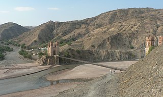
Mizque is a province in the Cochabamba Department, Bolivia. Its capital is Mizque.

Quillacollo is a province in the Cochabamba Department, Bolivia. It is known for its festival in August where people from all over Bolivia come and pay homage to the Virgin of Urqupiña. Quillacollo is said to be one of the fastest growing cities in Bolivia.

Cornelio Saavedra is a province in the north-eastern parts of the Bolivian Potosí Department. The capital of the province is Betanzos with 4,168 inhabitants in the year 2001.

José María Linares is a province in the eastern parts of the Bolivian department of Potosí. Its capital is Puna.

Oropeza is a province in the Chuquisaca Department, Bolivia. Its seat is Sucre which is also the constitutional capital of Bolivia and the capital of the Chuquisaca Department.

Rocha River or Kunturillu River which upstream is called Mayllanku(Maylanco) is a Bolivian river in the Cochabamba Department, Quillacollo Province. From the point of the confluence with the Arque River the river is called Caine River.
Kachi Mayu is a Bolivian river in the Chuquisaca Department, Oropeza Province, in the Sucre and Yotalla Municipalities. It is a left tributary of the Pillku Mayu, not to be confused with the Kachi Mayu in the Oruro Department which is the headwater of the Pillku Mayu. The confluence is on the border of the Yotalla Municipality and the Potosí Department, west of the village of Tasapampa.
Ch'aki Mayu, also Kachi Mayu, is a Bolivian river in the Potosí Department. It flows towards the Pillku Mayu.
Jatun Mayu which downstream successively is named Challajtiri Mayu, Rosario, Agua Castilla, Jatun Mayu again and Qaysa is a Bolivian river in the provinces of Antonio Quijarro, José María Linares and Tomás Frías of the Potosí Department. It belongs to the Pillku Mayu river basin.
T'uruchipa is a Bolivian river in the Potosí Department, José María Linares Province, Ckochas Municipality, T'uruchipa Canton. It is a right tributary to the Pillku Mayu.
Ch'aki Mayu is a Bolivian river in the Cochabamba Department, Quillacollo Province, Sipe Sipe Municipality. It is a right affluent of the Rocha River which belongs to the Amazon river basin. Ch'aki Mayu flows in a large bow from the west to the east around Sipe Sipe. The confluence with the Rocha River is south east of the town.
Ch'aki Mayu may refer to:

Wayra Wasi is a 4,416-metre-high (14,488 ft) mountain in the Bolivian Andes. It is situated in the Potosí Department, Tomás Frías Province, Potosí Municipality. Wayra Wasi lies west of Jatun Q'asa and the Ch'aki Mayu. The river originates southeast of the mountain. It flows to the north.

Jatun Q'asa is a 4,590-metre-high (15,059 ft) mountain in the Bolivian Andes. It is situated in the Potosí Department, Tomás Frías Province, Potosí Municipality. Some of the nearest settlements are Umallani and Salla K'uchu. Jatun Q'asa lies east Wayra Wasi, between the Ch'aki Mayu in the west and the Challwiri River (Challviri) in the east. Both rivers flow to the north as right tributaries of the Pillku Mayu.

Lluxita is a mountain in the Bolivian Andes which reaches a height of approximately 4,100 m (13,500 ft). It is located in the Potosí Department, Chayanta Province, Ocurí Municipality. It lies southeast of the village of Ch'aki Mayu (Chaqui Mayu).

Siwinqani is a 4,202-metre-high (13,786 ft) mountain in the Bolivian Andes. It is located in the Potosí Department, Chayanta Province, Ocurí Municipality. It lies northwest of Lluxita, northeast of the village of Ch'aki Mayu (Chaqui Mayu).

Uritu Mayu is a Bolivian river in the Chuquisaca Department, Jaime Zudáñez Province, Icla Municipality. It is a left affluent of the Pillku Mayu.

Wañuma is a 4,202-metre-high (13,786 ft) mountain in the Andes of Bolivia. It is located in the Potosí Department, Cornelio Saavedra Province, Tacobamba Municipality. Wañuma lies on the right bank of the Ch'aki Mayu. Its waters flow to the Pillku Mayu :

Qiñwa Qullu is a mountain in the Andes of Bolivia which reaches a height of approximately 4,160 m (13,650 ft). It is located in the Potosí Department, Cornelio Saavedra Province, Tacobamba Municipality. Qiñwa Qullu lies on the left bank of the Ch'aki Mayu. Its waters flow to the Pillku Mayu :

T'uqu Chaka is a 4,164-metre-high (13,661 ft) mountain in the Andes of Bolivia. It is located in the Potosí Department, Cornelio Saavedra Province, Tacobamba Municipality. T'uqu Chaka lies between Qiñwa Qullu in the northeast and Wañuma Q'asa in the southwest. It is west of the Ch'aki Mayu. Its waters flow to the Pillku Mayu.


