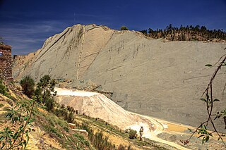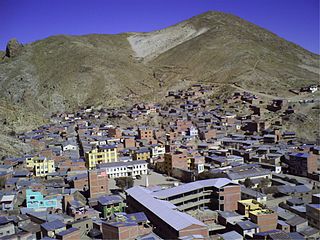
Arani is a province in Cochabamba Department, Bolivia. Its capital is Arani, situated about 53 km from Cochabamba. Arani is known for its bread and its artisan wickerwork.

Mizque is a province in the Cochabamba Department, Bolivia. Its capital is Mizque.

Quillacollo is a province in the Cochabamba Department, Bolivia. It is known for its festival in August where people from all over Bolivia come and pay homage to the Virgin of Urqupiña. Quillacollo is said to be one of the fastest-growing cities in Bolivia.

Tomás Frías is a province in the northern parts of the Bolivian Potosí Department. Its capital is Potosí which is also the capital of the department. The province is named after the former president Tomás Frías Ametller.

José María Linares is a province in the eastern parts of the Bolivian department of Potosí. Its capital is Puna.

Nor Chichas is a province in the Eastern parts of the Bolivian Potosí Department. Its seat is Cotagaita.

Oropeza is a province in the Chuquisaca Department, Bolivia. Its seat is Sucre which is also the constitutional capital of Bolivia and the capital of the Chuquisaca Department.

Tomina is a province in the Chuquisaca Department in Bolivia. Its seat is Padilla.

Azurduy Province is a province in the Chuquisaca Department in Bolivia. Its seat is the town of Azurduy. It was named in honor of revolutionary guerrilla Juana Azurduy de Padilla. In the 2024 census it had a population of 24,331.

Chayanta is a province in the northern parts of the Bolivian Potosí Department. Its capital is Colquechaca.

Vacas Municipality is the second municipal section of the Arani Province in the Cochabamba Department in central Bolivia. Its capital is Vacas known as the "Land of the potato". During the Inca Empire Vacas served as a tampu along the Inca road system that led to Inkallaqta and Pocona.

Quillacollo Municipality is the first municipal section of the Quillacollo Province in the Cochabamba Department, Bolivia. Its capital is Quillacollo. At the time of census 2001 the municipality had 104,206 inhabitants.
Sipe Sipe Municipality is the second municipal section of the Quillacollo Province in the Cochabamba Department, Bolivia. Its seat is Sipe Sipe. At the time of census 2001 the municipality had 31,337 inhabitants.

Potosí Municipality is the capital municipality of the Tomás Frías Province in the Potosí Department in Bolivia. Its seat is Potosí which is the capital of the department as well.

Yocalla Municipality is the second municipal section of the Tomás Frías Province in the Potosí Department in Bolivia. Its seat is Yocalla.

Porco Municipality is the third municipal section of the Antonio Quijarro Province in the Potosí Department in Bolivia. Its seat is Porco.

Ravelo Municipality is the second municipal section of the Chayanta Province in the Potosí Department in Bolivia. Its seat is Ravelo.

The Potosí mountain range in Bolivia is situated east and southeast of the city of Potosí. It is at least 25 km long stretching from north to south. Its highest mountain is Khunurana (Anaruyu) rising up to 5,071 m (16,637 ft). The features of the range are considered the product of volcanic activity known as the Khari Khari caldera. The caldera is about 40 km long and 25 km at its widest point.
Jatun Kunturiri is a mountain in the Potosí mountain range of the Bolivian Andes, about 5,008 m (16,430 ft) high. It is situated south-east of Potosí in the Potosí Department, José María Linares Province, in the south-west of the Puna Municipality. It lies between the Sip'uruni River in the north and the Khunurana in the south, north-west of the lake T'ala Qucha and the village Talaco.
Chawpi Urqu is a mountain in the Bolivian Andes which reaches a height of approximately 4,460 m (14,630 ft). It is located in the Potosí Department, Tomás Frías Province, Potosí Municipality. It lies southeast of Jatun Q'asa.


