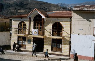
Ayopaya or Independencia is a town in the Cochabamba Department, Bolivia. It is the capital of the Ayopaya Province and Ayopaya Municipality. At the time of census 2001 it had a population of 2,014.
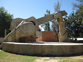
Aiquile is a town in the Cochabamba Department, Bolivia. It is the capital of the Narciso Campero Province and Aiquile Municipality. Most of its population is Quechua, and its residents are reputed to be the best charango makers in the country.
Pocona is a location in the Cochabamba Department in central Bolivia. It is the seat of the Pocona Municipality, the third municipal section of the Carrasco Province. At the time of census 2001 it had a population of 244.
Batallas is a location in the La Paz Department in Bolivia. It is the seat of the Batallas Municipality, one of the four municipalities of the Los Andes Province.
Caquiaviri is a location in the La Paz Department in Bolivia. It is the seat of the Caquiaviri Municipality, the second municipal section of the Pacajes Province.
Coripata is a town in the La Paz Department, Bolivia.

Irupana is a location in the La Paz Department in Bolivia. It is the seat of the Irupana Municipality, the second municipal section of the Sud Yungas Province.
Luribay is a location in the La Paz Department in Bolivia. It is the seat of the Luribay Municipality, the first municipal section of the José Ramón Loayza Province, and of the province.

Puerto Acosta or Waychu (Aymara) is a town in the La Paz Department, Bolivia.
Carangas (Oruro) is a small village in Bolivia. In 2010 it had an estimated population of 47.
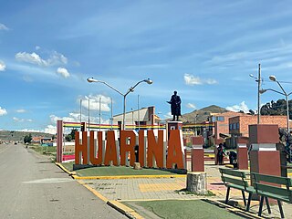
Huarina is a location in the La Paz Department in Bolivia. It is the seat of the Huarina Municipality, one of the four municipalities of the Omasuyos Province. President of Peru Andrés de Santa Cruz was born here.
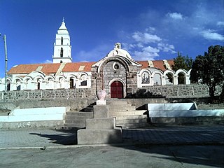
Santuario de Quillacas is a small town in the Oruro Department in Bolivia. It is situated south east of Poopó Lake.
Villa Vaca Guzmán is a small town in Bolivia.

Vitichi is a location in the Potosí Department in Bolivia. It is the capital of the Vitichi Municipality, the second municipal section of the Nor Chichas Province.

San Agustín is a village located in the Potosí Department of Bolivia. It is the capital of the San Agustín Canton, San Agustín Municipality and Enrique Baldivieso Province.
Villa Orias (Tarvita) is a town and administrative centre in Tarvita Municipality, Azurduy Province, Chuquisaca Department of Bolivia. It is in the Cordillera Oriental of the Andes, where the Puca Mayu River and the Cruz Mayu River meet to form the Tarvita River.
Puna is a village and the capital of the José María Linares Province in the Potosí Department of Bolivia.
Colcha K is a village serving as the capital of Nor Lípez Province, in the Potosí Department of Bolivia. It is also the capital of the Colcha "K" Canton and Colcha "K" Municipality.
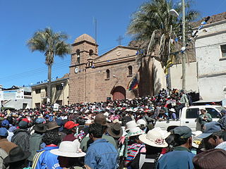
Betanzos is a town located in the Potosí Department of Bolivia. It is the capital of the Betanzos Canton, Betanzos Municipality and Cornelio Saavedra Province.
Canasmoro is a town in the Tarija Department of Bolivia.


