
Arani is a province in Cochabamba Department, Bolivia. Its capital is Arani, situated about 53 km from Cochabamba. Arani is known for its bread but also for the town's artisan wickerwork.

Azurduy Province is a province in the Chuquisaca Department in Bolivia. Its seat is the town of Azurduy. It was named in honor of revolutionary guerrilla Juana Azurduy de Padilla. In the 2012 census it had a population of 24,855.
Isla Incahuasi, Inkawasi or Inka Wasi is a hilly and rocky outcrop of land and former island in Bolivia situated in the middle of Salar de Uyuni, the world's largest salt flat, at an elevation of 3,656 meters. It is located in the Potosí Department, Daniel Campos Province, Tahua Municipality, Yonza Canton. Isla Incahuasi is the Spanish name where isla means island, Inca stands for Inca, and huasi is derived from the Quechua word wasi meaning house.

Pocona Municipality is the third municipal section of the Carrasco Province in the Cochabamba Department in Bolivia. Its seat is Pocona. At the time of census 2001 the municipality had 13,488 inhabitants.
The Tumusla River is a river of Bolivia in the Potosí Department as well as in the Chuquisaca Department. It gets waters from the Los Frailes and Chichas mountain ranges. Upstream the river is named Yura and Toropalca. Cotagaita, a right affluent, is its most important tributary.

Potosí Municipality is the capital municipality of the Tomás Frías Province in the Potosí Department in Bolivia. Its seat is Potosí which is the capital of the department as well.

Inka Wasi or Inkawasi is an archaeological site in Peru. It is located in the Ayacucho Region, Parinacochas Province, Pullo District.

Inka Wasi is an archaeological site in the Huancavelica Region in Peru. The Inca palace is considered one of the most important monuments of the Huancavelica Region. Inka Wasi is located in the Huaytará Province, Huaytará District, about 25 km from Huaytará. It is situated at a height of 3,804 m (12,480 ft).
Inka Raqay or Inkaraqay is a small archaeological complex in Peru. It lies in the Apurímac Region, Abancay Province, Cachora District. Inka Raqay is situated at a height of 3,590 metres (11,778 ft) on the northern slope of Inka Wasi south of the archaeological site of Choquequirao, above the Apurímac River.

Incahuasi is a mountain in the Vilcabambamountain range in the Andes of Peru whose summit reaches 4,315 metres (14,157 ft) above sea level. It is situated in the Apurímac Region, Abancay Province, Cachora District. The mountain lies on the bank of the Apurímac River, opposite the archaeological site of Choquequirao. On its northern slope there is a small archaeological site named Inka Raqay. Tourists are also attracted by the viewpoint of Incahuasi which provides good views of the Apurímac valley, Choquequirao and Padreyoc.

Wayra Wasi is a 4,416-metre-high (14,488 ft) mountain in the Bolivian Andes. It is situated in the Potosí Department, Tomás Frías Province, Potosí Municipality. Wayra Wasi lies west of Jatun Q'asa and the Ch'aki Mayu. The river originates southeast of the mountain. It flows to the north.
Jatun Wasi is a 4,361-metre-high (14,308 ft) mountain in the Andes of Bolivia. It is located in the Potosí Department, Nor Chichas Province, Cotagaita Municipality. Jatun Wasi lies at the Agua Castilla River, east of Yaritayuq.
T'ika Wasi is a 4,105-metre-high (13,468 ft) mountain in the Andes of Bolivia. It is located in the Potosí Department, Nor Chichas Province, Cotagaita Municipality. T'ika Wasi lies north of the Jara Wayq'u, an affluent of the Caiti River.
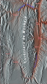
Inka Q'asa is a mountain in the Bolivian Andes which reaches a height of approximately 4,160 m (13,650 ft). It is located in the Cochabamba Department, Ayopaya Province, Morochata Municipality. The Ch'uya Mayu originates west of the mountain. It flows to the west as a left tributary of the Río Negro.
Inka Wasi is a 3,146-metre-high (10,322 ft) mountain in the Bolivian Andes. It is located in the Chuquisaca Department, Azurduy Province, Tarvita Municipality. Inka Wasi lies southwest of Muyu Urqu and north of Pukara. The Laqha Mayu originates north of the mountain. Its waters flow to the Pillku Mayu.


