The Hereford Inlet Lighthouse is a historic lighthouse located in North Wildwood, New Jersey, situated on the southern shore of Hereford Inlet at the north end of Five Mile Beach. Its construction was completed and it became operational in 1874.

The West Point Light, also known as the Discovery Park Lighthouse, is an active aid to navigation on Seattle, Washington's West Point, which juts into Puget Sound and marks the northern extent of Elliott Bay. The lighthouse is similar in design to the Point No Point Light and was added to the National Register of Historic Places in 1977. It is a main feature of Seattle's Discovery Park.

Throgs Neck Light in Throggs Neck, the Bronx, New York, was a wooden lighthouse that was replaced by an iron skeletal tower that is still there. The lighthouse protects ships in the Long Island Sound from running up against the rocks.

Barnegat Lighthouse is a historic lighthouse located in Barnegat Lighthouse State Park on the northern tip of Long Beach Island, in the borough of Barnegat Light, Ocean County, New Jersey, United States, on the south side of Barnegat Inlet.

Wood Island Light is an active lighthouse on the eastern edge of Wood Island in Saco Bay, on the southern coast of Maine. The light is just outside the entrance to Biddeford Pool and the end of the Saco River. The lighthouse is a 47-foot (14 m) conical white tower of granite rubble. The light itself sits 71 feet (22 m) above mean high water. Its automated beacon alternates between green and white every 10 seconds.

The Point Wilson Light is an active aid to navigation located in Fort Worden State Park near Port Townsend, Jefferson County, Washington. It is one of the most important navigational aids in the state, overlooking the entrance to Admiralty Inlet, the waterway connecting the Strait of Juan de Fuca and Puget Sound. The lighthouse was listed on the Washington State Heritage Register and the National Register of Historic Places in 1971.

Fowey Rocks Light is located seven miles southeast of Cape Florida on Key Biscayne. The lighthouse was completed in 1878, replacing the Cape Florida Light. It was automated on May 7, 1975, and as of 2021 is still in operation. The structure is cast iron, with a screw-pile foundation, a platform and a skeletal tower. The light is 110 feet above the water. The tower framework is painted brown, while the dwelling and enclosed circular stair to the lantern is painted white. The original lens was a first-order drum Fresnel lens which stood about 12 feet (4 m) high and weighed about a ton (tonne). The light has a nominal range of 15 miles in the white sectors, and 10 miles in the red sectors. It serves as a maker for the entrance to the Hawk Channel passage through the Florida Keys.

The St. Johns Light is an active lighthouse in Jacksonville, Florida, marking the mouth of the St. Johns River. Built in 1954, it is located on Naval Station Mayport in the Mayport area. It was erected to replace a lightship, which itself replaced the still-standing Old St. Johns River Light. It is the fourth lighthouse built at the mouth of the St. Johns since 1830. It was listed on the National Register of Historic Places in 2018.

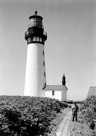
Destruction Island Lighthouse is a decommissioned lighthouse on Destruction Island, a rocky island that is part of the Quillayute Needles National Wildlife Refuge lying about 3 miles (4.8 km) off the coast of Jefferson County, Washington, in the northwest of the United States.

The Alki Point Light is an active aid to navigation located on Puget Sound's Alki Point, the southern entrance to Seattle's Elliott Bay, King County, Washington. It is listed as Alki Point Light number 16915 in the USCG light lists.

The Morris Island Lighthouse is a lighthouse on Morris Island in South Carolina. The light stands on the southern side of the entrance to Charleston Harbor, north of the City of Folly Beach. At 161 ft, it is the tallest lighthouse in South Carolina. The lighthouse was named to the National Register of Historic Places in 1982.

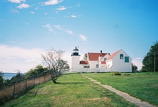
The Fort Point Light, or Fort Point Light Station, is located in Fort Point State Park, in Stockton Springs, Maine. A lighthouse at this point has served as an active aid to navigation since 1835; the present lighthouse dates to 1857, and is listed on the National Register of Historic Places.

Cleveland East Ledge Light is a historic lighthouse in Falmouth, Massachusetts. It sits on a man-made island in shallow water on the eastern of the two halves of Cleveland Ledge, which is said to have been named for President Grover Cleveland because he owned the nearby Gray Gables estate and used to fish in the area. It marks the east side of the beginning of the dredged channel leading to the Cape Cod Canal and is the first fixed mark when going northbound through the canal. As it is an important mark in an area subject to fog, it has a racon showing the letter "C".

Plum Island Light is located on the western end of Plum Island, which lies in the Long Island Sound, east of Orient Point at the end of the North Fork of Long Island, New York. An historic granite lighthouse originally built in 1869 sits at the site, but no longer serves as an active aid to navigation. It was listed on the National Register of Historic Places in 2011.

The Sullivan's Island Range Lights were range lights on the southern end of Sullivan's Island in Charleston County, South Carolina. The light station was first established in 1848 and was destroyed in 1861 during the Civil War. It was rebuilt after the war and the lights were in existence at least as late as 1901. Neither of the range lights still remains today.

The Fort Sumter Range Lights are range lights to guide ships through the main channel of the Charleston Harbor, South Carolina. The original front light was built at Fort Sumter and the original rear light was in the steeple of St. Philip's Church in Charleston, South Carolina. Both lights were lit from 1893 to 1915 to make range lights. Today the Fort Sumter Range is the main approach channel to Charleston Harbor.

The Owls Head Light is an active aid to navigation located at the entrance of Rockland Harbor on western Penobscot Bay in the town of Owls Head, Knox County, Maine. The lighthouse is owned by the U.S. Coast Guard and licensed to the American Lighthouse Foundation. It is the centerpiece of 13-acre (5.3 ha) Owls Head State Park and was added to the National Register of Historic Places as Owls Head Light Station in 1978.

Fort Wadsworth Light is a 1903 lighthouse built atop Battery Weed on Staten Island in New York Harbor. The light illuminates the Narrows, the entrance to the harbor. It is located under the Verrazzano-Narrows Bridge. Fort Wadsworth Light was part of the transfer of Fort Wadsworth from the Navy to the National Park Service in March 1995 as part of Gateway National Recreation Area.

Blackwell Island Lighthouse, now known as Roosevelt Island Lighthouse, also was known as Welfare Island Lighthouse, is a stone lighthouse built by the government of New York City in 1872. It is within Lighthouse Park at the northern tip of Roosevelt Island in the East River. It was named to the National Register of Historic Places on March 16, 1972 and was designated a New York City Landmark on March 23, 1976.

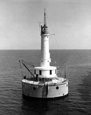
The Green Bay Harbor Entrance Light is an offshore lighthouse near Green Bay, Wisconsin. Located 10 miles (16 km) from the mouth of the Fox River, it was erected to signal the entrance to Green Bay.


