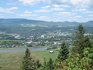
Charlevoix is a cultural and natural region in Quebec, on the north shore of the Saint Lawrence River as well as in the Laurentian Mountains area of the Canadian Shield. This dramatic landscape includes rolling terrain, fjords, headlands, and bays; the region was designated a World Biosphere Reserve by UNESCO in 1989. Administratively, it comprises the Charlevoix and Charlevoix-Est regional county municipalities within the larger Capitale-Nationale administrative region.

The Hautes-Gorges-de-la-Rivière-Malbaie National Park is a provincial park in the Charlevoix region of Quebec, Canada. Centring on the Malbaie River Gorge, it is the centrepiece of the UNESCO Charlevoix biosphere reserve. Despite its name, it is not in Canada's national park system, nor administered by Parks Canada. It is administered by the Société des établissements de plein air du Québec (Sépaq). The park can be reached via a local road, 30 kilometers (19 mi) northwards from Route 138 in Saint-Aimé-des-Lacs.

Grands-Jardins National Park is a provincial park, located in the Unorganized Territory of Lac-Pikauba, in the Charlevoix Regional County Municipality, an administrative region of Capitale-Nationale, in Quebec, Canada.

Lac-Pikauba is an unorganized territory in the Capitale-Nationale region of Quebec, Canada. It is a large, unpopulated, undeveloped territory that makes up two-thirds of the Charlevoix Regional County Municipality.

Mont-Élie is an unorganized territory in the Capitale-Nationale region of Quebec, Canada. It makes up almost 38% of the Charlevoix-Est Regional County Municipality.
The Montagne des Érables, also known as Mont des Érables, is a massif located in the Charlevoix-Est regional county municipality in the Charlevoix region of Quebec, Canada. It lies in the Hautes-Gorges-de-la-Rivière-Malbaie National Park and is home to l'Acropole des Draveurs, a popular hike in the province. It is accessible via the entrances to the park, the main one being located in Saint-Aimé-des-Lacs.

The Zec of Martens is a "zone d'exploitation contrôlée" (ZEC), in the unorganized territory of Lac-Pikauba, in Charlevoix Regional County Municipality, in the administrative region of Capitale-Nationale, Quebec, Canada.

The rivière du Gouffre is a tributary of the left bank of the Saint-Laurent river, flowing into the Capitale-Nationale administrative region, Quebec (Canada). This watercourse flows through Regional County Municipality from:
The Malbaie is a freshwater body located in the administrative region of Capitale-Nationale, in the province of Quebec, in Canada. Lac Malbaie straddles the regional county municipalities (RCMs) of:
The Petite rivière Malbaie is a tributary of the east bank of the Malbaie River, flowing in the unorganized territory of Lac-Pikauba, in the Charlevoix Regional County Municipality, in the administrative region of Capitale-Nationale, in the province of Quebec, in Canada. This watercourse crosses zec des Martres and Grands-Jardins National Park.
The Petit lac Malbaie is a freshwater body of the unorganized territory of Lac-Pikauba, in the Charlevoix Regional County Municipality, in the administrative region of Capitale-Nationale, in the province of Quebec, in Canada. This lake, which is located in a forest and mountainous area, is part of the zec des Martres, that is to the northeast of Grands-Jardins National Park.
L Étang Malbaie is a freshwater body crossed by the Petite rivière Malbaie, in the unorganized territory of Lac-Pikauba, in the regional county municipality (MRC) of Charlevoix Regional County Municipality, in the administrative region of Capitale-Nationale, in the province of Quebec, in Canada. This lake which is located in a forest and mountainous area, in the eastern part of Grands-Jardins National Park.
The Rivière de l'Enfer is a tributary of the eastern bank of the Malbaie River, flowing in the unorganized territory of Lac-Pikauba, in the regional county municipality (MRC) of Charlevoix Regional County Municipality, in the administrative region of Capitale-Nationale, in the province of Quebec, in Canada. This watercourse crosses the Laurentides Wildlife Reserve and Grands-Jardins National Park.
The Barley River is a tributary of the eastern bank of the upper part of the Malbaie River, flowing in the unorganized territory of Lac-Pikauba, in the Charlevoix Regional County Municipality, in the administrative region of Capitale-Nationale, in the province of Quebec, in Canada. This watercourse successively crosses zec des Martres, then the Laurentides Wildlife Reserve.
The rivière des Martres is a tributary of the west bank of the intermediate part of the Malbaie River, flowing in the administrative region of Capitale-Nationale, in the province from Quebec, to Canada. This watercourse crosses the regional county municipalities of:
Lesclache Lake is a freshwater body located in the unorganized territory of Lac-Pikauba, in the Charlevoix Regional County Municipality, in the administrative region of Capitale-Nationale, in the province of Quebec, in Canada. This body of water is located in zec des Martres, outside Laurentides Wildlife Reserve.
The Rivière des Îlets is a tributary of the southern bank of the upper part of the Rivière du Gouffre, flowing in the unorganized territory of Lac-Pikauba, in the Charlevoix Regional County Municipality, in the administrative region of Capitale-Nationale, in the province of Quebec, in Canada.
The Rivière du Gouffre Sud-Ouest is a tributary of the eastern bank of the intermediate part of the Rivière du Gouffre, flowing in the unorganized territory of Lac-Pikauba and the municipality of Saint-Urbain, in the Charlevoix Regional County Municipality, in the administrative region of the Capitale-Nationale, in the province of Quebec, in Canada.
Le Gros Bras is a tributary of the eastern bank of the lower part of the rivière du Gouffre, flowing in the unorganized territory of Lac-Pikauba and the municipality of Saint-Urbain, in the Charlevoix Regional County Municipality, in the administrative region of Capitale-Nationale, in the province of Quebec, in Canada. The upper part of this watercourse begins in Grands-Jardins National Park.
The Rivière des Monts is a tributary of the southwest bank of the lower part of the watercourse Le Gros Bras, flowing in the non organized from Lac-Pikauba and the municipality of Saint-Urbain, in the Charlevoix Regional County Municipality, in the administrative region of Capitale-Nationale, in the province of Quebec, in Canada.


