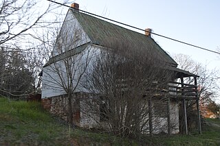
Swoope(pronounced S-W-O-P-E) is an unincorporated community in Augusta County, Virginia, United States. Swoope is located on State Routes 703 and 860 7.4 miles (11.9 km) west of Staunton. Swoope has a post office with ZIP code 24479, which opened on March 6, 1838. Polyface Farm, a sustainable farm run by Joel Salatin, is also near Swoope.

Gladys is an unincorporated community in Campbell County, Virginia, United States. Gladys is located on U.S. Route 501 10.6 miles (17.1 km) northwest of Brookneal. Gladys has a post office with ZIP code 24554, which opened on April 4, 1836.

Studley is an unincorporated community in Hanover County, Virginia, United States. Studley is 12 miles (19 km) northeast of downtown Richmond. Studley has a post office with ZIP code 23162.

Gardner is an unincorporated community in Rapides Parish, Louisiana, United States. Gardner is part of the Alexandria Metropolitan Statistical Area. It is located at the junction of Louisiana highways 28 and 121, 15 miles (24 km) west-southwest of Alexandria. Gardner has a population of 1,965. Gardner's post office ZIP code 71431. China Grove, a house listed on the National Register of Historic Places, is located in Gardner.

Glade Hill is an unincorporated community in Franklin County, Virginia, United States. Glade Hill is located on Virginia State Route 40 7.2 miles (11.6 km) east of Rocky Mount. Glade Hill has a post office with ZIP code 24092, which opened on April 1, 1837.

Pilot is an unincorporated community in Montgomery County, Virginia, United States. Pilot is 5.9 miles (9.5 km) south-southeast of Christiansburg. Pilot has a post office with ZIP code 24138.

Wirtz is an unincorporated community in Franklin County, Virginia, United States. Wirtz is located along a railroad 5.4 miles (8.7 km) north of Rocky Mount. Wirtz has a post office with ZIP code 24184, which opened on April 20, 1893.

Wagontown is an unincorporated community in West Caln Township, Chester County, Pennsylvania, United States. Wagontown is located along Pennsylvania Route 340 2.15 miles (3.46 km) north-northwest of Coatesville. Wagontown has a post office with ZIP code 19376. The Hibernia House, which is listed on the National Register of Historic Places, is located near Wagontown.

Fishers Hill is an unincorporated community in Shenandoah County, Virginia, United States. Fishers Hill is 2.1 miles (3.4 km) west of Strasburg. Fishers Hill has a post office with ZIP code 22626, which opened on July 28, 1882.

Vernon Hill is an unincorporated community in Halifax County, Virginia, United States. Vernon Hill is located on Virginia State Route 360 9.7 miles (15.6 km) west of Halifax. Vernon Hill has a post office with ZIP code 24597, which opened on September 8, 1856.

Red Oak is an unincorporated community in Charlotte County, Virginia, United States. Red Oak is located on U.S. Route 15 8.8 miles (14.2 km) west of Chase City. Red Oak has a post office with ZIP code 23964, which opened on July 31, 1839. The Salem School and the Toombs Tobacco Farm, both of which are listed on the National Register of Historic Places, are located in Red Oak.

Saxe is an unincorporated community in Charlotte County, Virginia, United States. Saxe is 5.6 miles (9.0 km) southwest of Drakes Branch. Saxe has a post office with ZIP code 23967, which opened on May 2, 1889. Annefield and Roanoke Plantation, both of which are listed on the National Register of Historic Places, are located near Saxe.

Clifford is an unincorporated community in Amherst County, Virginia, United States. Clifford is located on Virginia State Route 151 4.3 miles (6.9 km) north-northeast of Amherst. Clifford has a post office with ZIP code 24533, which opened on March 23, 1883. Five sites in the vicinity of Clifford are listed on the National Register of Historic Places: Brick House, Clifford-New Glasgow Historic District, Geddes, Mountain View Farm, and Winton.

Laughlintown is an unincorporated community in Ligonier Township, Westmoreland County, Pennsylvania, United States. Laughlintown is located on U.S. Route 30 3 miles (4.8 km) southeast of Ligonier. Laughlintown has a post office with ZIP code 15655, which opened on May 16, 1825.

Little York is an unincorporated community located along the border of Alexandria and Holland townships in Hunterdon County, New Jersey, United States. Little York is located on County Route 614 3.1 miles (5.0 km) north-northeast of Milford. Little York has a post office with ZIP code 08834.

Wallpack Center is an unincorporated community located within Walpack Township, Sussex County, New Jersey, United States. Wallpack Center is located in the Flat Brook Valley 6.7 miles (10.8 km) west of Branchville. Wallpack Center has a post office with ZIP code 07881.

San Fidel is a census-designated place in Cibola County, New Mexico, United States. Its population was 138 as of the 2010 census. San Fidel has a post office with ZIP code 87049, which opened on December 24, 1910. New Mexico State Road 124 passes through the community.

Woodleaf is an unincorporated community in Rowan County, North Carolina, United States. The community is located on North Carolina Highway 801 9.5 miles (15.3 km) northwest of Salisbury. Woodleaf has a post office with ZIP code 27054.

Manson is an unincorporated community in Warren County, North Carolina, United States. The community is located on U.S. Route 1 5 miles (8.0 km) west-southwest of Norlina. Manson has a post office with ZIP code 27553.

Ridgeway is an unincorporated community in Warren County, North Carolina, United States. The community is located on U.S. Route 1 2.25 miles (3.62 km) west-southwest of Norlina. Ridgeway has a post office with ZIP code 27570.


