Gilboa, New York

Last updated

Gilboa, New York
Gilboa Town Hall, Gilboa, New York.jpg
Gilboa Town Hall
Schoharie County NY Gilboa town highlighted.svg
Location in Schoharie County and the state of New York.
Coordinates: 42°25′45″N74°28′3″W / 42.42917°N 74.46750°W / 42.42917; -74.46750
Country United States
State New York
County Schoharie
Area
[1]
  Total59.38 sq mi (153.80 km2)
  Land57.81 sq mi (149.72 km2)
  Water1.58 sq mi (4.08 km2)
Elevation
912 ft (278 m)
Population
 (2020)
  Total1,111
Time zone UTC-5 (Eastern (EST))
  Summer (DST) UTC-4 (EDT)
ZIP code
12076
Area code 607
FIPS code 36-28981
GNIS feature ID0979001

Gilboa is a town in Schoharie County, New York, United States. The population was 1,111 at the 2020 census. [2]

Contents

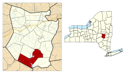
The Town of Gilboa is in the southern part of the county and is southwest of Albany.

History

The Gilboa Fossils from the Wattieza tree located in Gilboa, New York discovered in 1920. The Gilboa Fossils from the Wattieza tree located in Gilboa, New York.jpg
The Gilboa Fossils from the Wattieza tree located in Gilboa, New York discovered in 1920.

The town was first settled around 1760.

The Town of Gilboa was formed in 1848 from regions taken from the Towns of Blenheim and Broome. The name "Gilboa" is from Mount Gilboa, [3] a biblical site in Israel, where King Saul's sons were killed by the Philistines, and Saul killed himself (1 Samuel 31:4)

A cotton mill in the community of Gilboa was a major contributor to the early economy of the town, but it was destroyed by a flood in 1869.

In 1926, the Schoharie Creek was dammed to form the Schoharie Reservoir. The original settlement of Gilboa was razed and flooded as part of this project. A new settlement was established north of the reservoir.

Fossil Forest

In 1870, workers blasting a site for a stone quarry found fossilized remains of tree stumps. In 2004, the tops and fronds of the trees were discovered and, in 2007, the fern-like trees, named Wattieza, were pronounced the oldest known trees on earth.

Geography

According to the United States Census Bureau, the town has a total area of 59.3 square miles (154 km2), of which 57.8 square miles (150 km2) is land and 1.6 square miles (4.1 km2) of it (2.63%) is water.

The southern town line forms a border with Delaware County and Greene County.

The Schoharie Creek flows northward through the town.

New York State Route 30 is a north-south highway in Gilboa. New York State Route 23 cuts through the southwestern corner of the town. New York State Route 990V is a highway running eastward from NY-30 in the southeastern part of Gilboa.

Demographics

Historical population
CensusPop.Note
1850 3,024
1860 2,541−16.0%
1870 2,227−12.4%
1880 2,040−8.4%
1890 1,718−15.8%
1900 1,448−15.7%
1910 1,4671.3%
1920 1,5415.0%
1930 978−36.5%
1940 1,0618.5%
1950 943−11.1%
1960 782−17.1%
1970 8549.2%
1980 1,07826.2%
1990 1,20712.0%
2000 1,2150.7%
2010 1,3077.6%
2020 1,111−15.0%
U.S. Decennial Census [4] 2020 [5]

As of the census [6] of 2000, there were 1,215 persons, 478 households, and 355 families residing in the town. The population density was 21.0 people per square mile (8.1/km2). There were 992 housing units at an average density of 17.2 per square mile (6.6/km2). The racial makeup of the town was 95.80% White, 0.91% African American, 0.25% Native American, 0.82% Asian, 1.23% from other races, and 0.99% from two or more races. Hispanic or Latino of any race were 1.98% of the population.

There were 478 households, out of which 31.0% had children under the age of 18 living with them, 60.7% were married couples living together, 9.0% had a female householder with no husband present, and 25.7% were non-families. 20.3% of all households were made up of individuals, and 9.8% had someone living alone who was 65 years of age or older. The average household size was 2.54 and the average family size was 2.92.

In the town, the population was spread out, with 23.2% under the age of 18, 5.6% from 18 to 24, 24.8% from 25 to 44, 29.9% from 45 to 64, and 16.5% who were 65 years of age or older. The median age was 43 years. For every 100 females, there were 94.7 males. For every 100 females age 18 and over, there were 102.8 males.

The median income for a household in the town was $35,156, and the median income for a family was $38,214. Males had a median income of $31,635 versus $25,278 for females. The per capita income for the town was $18,561. About 9.6% of families and 11.9% of the population were below the poverty line, including 11.4% of those under age 18 and 7.4% of those age 65 or over.

Gilboa Historical Sign Gilboa New York historical sign cropped.jpg
Gilboa Historical Sign

Communities and locations in Gilboa

Related Research Articles

<span class="mw-page-title-main">Westerlo, New York</span> Town in New York, United States

Westerlo is a town in Albany County, New York, United States. The population was 3,194 at the 2020 census.

Harpersfield is a town in Delaware County, New York, United States. The population was 1,442 at the 2020 census. The town is on the northern border of the county.

<span class="mw-page-title-main">Tompkins, New York</span> Town in Delaware County, New York, US

Tompkins is a town in Delaware County, New York, United States. The population was 1,290 at the 2020 census. The town is named after Daniel D. Tompkins, the fourth governor of New York and sixth vice president of the United States.

<span class="mw-page-title-main">Jewett, New York</span> Town in New York, United States

Jewett is a town centrally located in Greene County, New York, United States. The population was 879 at the 2020 census. The town is named for Freeborn G. Jewett, justice of the New York Supreme Court.

<span class="mw-page-title-main">Petersburgh, New York</span> Town in New York, United States

Petersburgh is a town located in the northeast section of Rensselaer County, New York, United States. The population was 1,372 at the 2020 census. The town was named after an early settler named Peter Simmons.

<span class="mw-page-title-main">Carlisle, New York</span> Town in New York, United States

Carlisle is a town in northern Schoharie County, New York, United States. The population was 1,768 at the 2020 census.

<span class="mw-page-title-main">Conesville, New York</span> Town in New York, United States

Conesville is a town in Schoharie County, New York, United States. The population was 687 at the 2020 census. The town is named after Jonathan Cone, an early resident.

<span class="mw-page-title-main">Fulton, Schoharie County, New York</span> Town in Schoharie County, New York, US

Fulton is a town in Schoharie County, New York, United States. The population was 1,199 at the 2020 census. Within the town of Fulton are the hamlets of Breakabeen and Fultonham. The town is in the center of the county and is also one of the larger towns in the county. Fulton is west of Albany.

<span class="mw-page-title-main">Jefferson, New York</span> Town in Schoharie County, New York, US

Jefferson is a town in Schoharie County, New York, United States. The population was 1,333 at the 2020 census.The town is on the southwestern border of the county and is east of Oneonta.

<span class="mw-page-title-main">Seward, New York</span> Town in New York, United States

Seward is a town in Schoharie County, New York, United States. The population was 1,583 at the 2020 census. The town is named after senator, governor, and secretary of state William H. Seward.

<span class="mw-page-title-main">Sharon, New York</span> Town in New York, United States

Sharon is a town in Schoharie County, New York, United States. The population was 1,697 at the 2020 census. The town is named after a location in Connecticut, whence some early settlers came. The town of Sharon is in the northwestern corner of the county and is southwest of Amsterdam.

<span class="mw-page-title-main">Summit, New York</span> Town in New York, United States

Summit is a town in Schoharie County, New York, United States. The population was 1,072 at the time of the 2020 census. The name is derived from a peak that was thought to be the highest elevation in the county.

<span class="mw-page-title-main">Wright, New York</span> Town in New York, United States

Wright is a town in Schoharie County, New York, United States. The population was 1,516 at the 2020 census. The town was named after governor Silas Wright.

<span class="mw-page-title-main">Olive, New York</span> Town in New York, United States

Olive is a town in Ulster County, New York, United States. The town is west of Kingston, New York and is inside the Catskill Park. The population was 4,226 at the 2020 census.

<span class="mw-page-title-main">Hartford, New York</span> Town in New York, United States

Hartford is a town centrally located in Washington County, New York, United States. It is part of the Glens Falls Metropolitan Statistical Area. The town population was 2,193 at the 2020 census.

Greenville is a hamlet and census-designated place (CDP) in the town of Greenville, in Greene County, New York, United States. The population of the CDP was 688 at the 2020 census,out of a total 3,741 people in the town as a whole.

<span class="mw-page-title-main">Middleburgh, New York</span> Town in New York, United States

Middleburgh is a town in Schoharie County, New York, United States. The population was 3,112 at the 2000 census.

<span class="mw-page-title-main">Schoharie, New York</span> Town in New York, United States

Schoharie is an incorporated town in and the county seat of Schoharie County, New York. The population was 3,107 at the 2020 census.

Deposit is a town in Delaware County, New York, United States. As of the 2020 census, the town's population was 1,427.

<span class="mw-page-title-main">Plattekill, New York</span> Place in New York, United States

Plattekill is a town in Ulster County, New York, United States. The population was 10,424 in 2020, a slight decrease from 10,499 at the 2010 census. The name is derived from a stream, the Platte Kill.

References

  1. "2016 U.S. Gazetteer Files". United States Census Bureau. Retrieved July 5, 2017.
  2. US Census Bureau, 2020 Census Report, Gilboa town, Schoharie County, New York https://www.census.gov/search-results.html?searchType=web&cssp=SERP&q=Gilboa%20town,%20Schoharie%20County,%20New%20York Accessed, January 3, 2023
  3. Gannett, Henry (1905). The Origin of Certain Place Names in the United States. Govt. Print. Off. pp.  137.
  4. "Census of Population and Housing". Census.gov. Retrieved June 4, 2015.
  5. US Census Bureau, 2020 Census Report, Gilboa town, Schohaire County, New York https://www.census.gov/search-results.html?searchType=web&cssp=SERP&q=Gilboa%20town,%20Schoharie%20County,%20New%20York Accessed, January 3, 2023
  6. "U.S. Census website". United States Census Bureau . Retrieved January 31, 2008.
  7. "National Register Information System". National Register of Historic Places . National Park Service. March 13, 2009.

42°23′50″N74°26′46″W / 42.39722°N 74.44611°W / 42.39722; -74.44611