A request that this article title be changed to Chatswood West is under discussion . Please do not move this article until the discussion is closed. |
| Chatswood West Sydney, New South Wales | |||||||||||||||
|---|---|---|---|---|---|---|---|---|---|---|---|---|---|---|---|
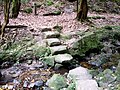
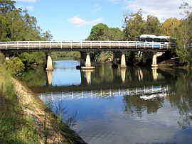 Fullers Bridge, Chatswood West | |||||||||||||||
 | |||||||||||||||
| Population | 1,521 (2021 census) [1] | ||||||||||||||
| • Density | 543/km2 (1,407/sq mi) | ||||||||||||||
| Established | 20 January 2006 | ||||||||||||||
| Postcode(s) | 2067 [2] | ||||||||||||||
| Area | 2.8 km2 (1.1 sq mi) | ||||||||||||||
| Location | 10 km (6 mi) north-west of Sydney CBD | ||||||||||||||
| LGA(s) | City of Willoughby, City of Ryde | ||||||||||||||
| State electorate(s) | |||||||||||||||
| Federal division(s) | |||||||||||||||
| |||||||||||||||
Chatswood West is a suburb on the Lower North Shore of Sydney, in the state of New South Wales, Australia. Chatswood West is located 11 kilometres north-west of the Sydney central business district, in the local government areas of the City of Willoughby and City of Ryde. Chatswood is a separate suburb to the east. The locality of Chatswood located west of the Pacific Highway is informally known as West Chatswood, and should not be confused with the separate suburb of Chatswood West, nor should it be confused with the West Chatswood Post Office on Railway Street in the suburb of Chatswood. Chatswood West shares the same postcode as Chatswood which is 2067. [2]
Contents
- History
- Commercial area
- Houses
- Schools
- Facilities
- Transport
- Population
- Demographics
- Notable residents
- Parks
- References
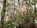
Chatswood West is located between the bigger suburbs of Chatswood and North Ryde. It straddles the Lane Cove River, occupying the valley flats and ridges leading down to the river.