Cheviot is a town in the Hurunui District of north Canterbury, on the east coast of the South Island of New Zealand. It is on State Highway 1 approximately 110 kilometres (68 mi) north of Christchurch.
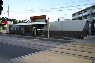
Elsternwick railway station is located on the Sandringham line in Victoria, Australia. It opened on 19 December 1859, serving the south-eastern Melbourne suburb of Elsternwick.
Grovedale is a mainly residential southern suburb of Geelong, Victoria, Australia. At the 2016 census, Grovedale had a population of 14,308.
Yea is a town in Victoria, Australia 100 kilometres (62 mi) north-east of the state capital Melbourne at the junction of the Goulburn Valley Highway and the Melba Highway, in the Shire of Murrindindi local government area. In an area originally inhabited by the Taungurong people, it was first visited by Europeans of the Hume and Hovell expedition in 1824, and within 15 years most of the land in the area had been taken up by graziers. Surveyed in 1855, the township grew as a service centre for grazing, gold-mining and timber-getting in the area.

Alexandra is a significant regional centre in Victoria, Australia and 130 kilometres north east of the State Capital, Melbourne. It is located at the junction of the Goulburn Valley Highway (B340) and Maroondah Highway (B360), in the Shire of Murrindindi local government area. At the 2016 census, the town of Alexandra had a population of 2,695. The area has expanded since and is developing steadily. Postcode is 3714.
Mount Duneed is a suburb of Geelong, Victoria, Australia. It is divided between the City of Greater Geelong and Surf Coast Shire local government areas. Mount Duneed itself is an extinct volcano and the remains of the crater can be seen in the Mount Duneed Recreation Reserve.

Old Toongabbie is a suburb of Greater Western Sydney, in the state of New South Wales, Australia 29 kilometres west of the Sydney central business district in the local government area of the City of Parramatta.
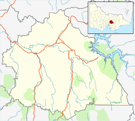
The Mansfield railway line was a branch line in the Goulburn Valley of northern Victoria, Australia, branching from the main North East line at Tallarook station and heading east into mountainous territory.

Bakers Creek is a town and coastal locality in the Mackay Region, Queensland, Australia.
Murrindindi is a locality along the valley of the Murrindindi River in Victoria, in eastern Australia in the Murrindindi local government area. The nearest town is Yea. At the 2016 Census, the suburb of Murrindindi had a population of 107.
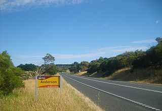
Anderson is a locality in Victoria, Australia. The roundabout which the locality is centralised around has been named the Anderson Roundabout which is all the town is thought of today.

Maryvale is a town and a locality in the Southern Downs Region, Queensland, Australia.

Moorabool is a bounded rural locality of the City of Greater Geelong local government area in Victoria, Australia.
Barraba is a town in the New England region of northern New South Wales, Australia. It was formerly the centre of Barraba Shire local government area, but most of this, including Barraba, was absorbed into Tamworth Regional Council in 2004. On Census night 2016, Barraba had a population of approximately 1,400 people. It is part of the Bundarra-Barraba Important Bird Area which is important for the conservation of the endangered regent honeyeater.

Victoria has only ever had about 10 tunnels on its railway network, with some others on private narrow gauge tramways. This is due to the relatively easy terrain through which most of the lines were built.

Mywee is a locality in northern Victoria, Australia. It is in the local government area of Shire of Moira. Mywee was also known as "Sheepwash Creek".

Buckley is a rural locality in the Surf Coast Shire, Victoria, Australia. It was formerly known as Laketown. In the 2016 census, Buckley had a population of 211 people.
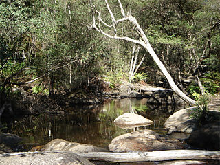
Pennyroyal is a rural locality in Victoria, Australia. Most of the locality is situated in the Surf Coast Shire; a small section is situated in the Shire of Colac Otway. In the 2016 census, Pennyroyal had a population of 86.
Wondecla is a locality in the Tablelands Region, Queensland, Australia.

Flynn is a locality in Victoria, Australia, situated on the border of the City of Latrobe and Shire of Wellington. In the 2016 census, Flynn had a population of 180.