The City of Whittlesea is a local government area located in the outer northern suburbs of Melbourne, the state capital of Victoria, Australia. The city covers an area of 490 square kilometres (189.2 sq mi), and in June 2018, it had a population of 223,322.

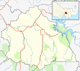
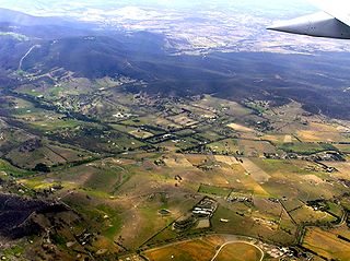
The Shire of Murrindindi is a local government area in the Hume region of Victoria, Australia, located in the north-east part of the state. It covers an area of 3,880 square kilometres (1,500 sq mi) and, in June 2018, had a population of 14,478. It includes the towns of Alexandra, Buxton, Eildon, Flowerdale, Kinglake, Marysville, Molesworth, Strath Creek, Taggerty, Yarck and Yea. It was formed in 1994 from the amalgamation of the Shire of Alexandra, Shire of Yea, and parts of the Shire of Broadford, Shire of Eltham, Shire of Euroa, Shire of Healesville and City of Whittlesea.

Bundoora is a suburb in Melbourne, Victoria, Australia, 15 km (9.3 mi) north-east of Melbourne's Central Business District, located within the Cities of Banyule, Darebin and Whittlesea local government areas. Bundoora recorded a population of 28,068 at the 2021 census.
Kingsbury is a suburb in Melbourne, Victoria, Australia, 12 km (7.5 mi) north-east of Melbourne's Central Business District, located within the City of Darebin local government area. Kingsbury recorded a population of 3,460 at the 2021 census.

Preston is a suburb in Melbourne, Victoria, Australia, 9 km (5.6 mi) north-east of Melbourne's Central Business District, located within the City of Darebin local government area. Preston recorded a population of 33,790 at the 2021 census.

Reservoir is a suburb in Melbourne, Victoria, Australia, 11 km (6.8 mi) north of Melbourne's Central Business District, located within the City of Darebin local government area. Reservoir recorded a population of 51,096 at the 2021 census.
Doreen is a suburb in Melbourne, Victoria, Australia, 29 km (18 mi) north-east of Melbourne's Central Business District, located within the City of Whittlesea and Shire of Nillumbik local government areas. Doreen recorded a population of 27,122 at the 2021 census.

Epping is a suburb in Melbourne, Victoria, Australia, 18 km (11 mi) north of Melbourne's Central Business District, located within the City of Whittlesea local government area. Epping recorded a population of 33,489 at the 2021 census.

Lalor is a suburb in Melbourne, Victoria, Australia, 17 km (11 mi) north of Melbourne's Central Business District, located within the City of Whittlesea local government area. Lalor recorded a population of 23,219 at the 2021 census.

Greensborough railway station is located on the Hurstbridge line in Victoria, Australia. It serves the north-eastern Melbourne suburb of Greensborough, and it opened on 5 June 1902.

Thomastown railway station is located on the Mernda line in Victoria, Australia. It serves the northern Melbourne suburb of Thomastown, and it opened on 23 December 1889.

Lalor railway station is located on the Mernda line in Victoria, Australia. It serves the northern Melbourne suburb of Lalor, and it opened in October 1949 as Rail Motor Stopping Place 77. It was renamed Lalor on 27 August 1952.
Epping railway station is located on the Mernda line in Victoria, Australia. It serves the northern Melbourne suburb of Epping, and it opened on 23 December 1889.

The Mernda railway line is a commuter rail passenger train service in Melbourne, Australia. It operates between Flinders Street in the Melbourne central business district and Mernda through the northern suburbs including East Melbourne, Richmond, Abbotsford, Clifton Hill, Fitzroy North, Northcote, Preston, Reservoir, Thomastown, Lalor, Epping, South Morang and Mernda. The service is part of the Public Transport Victoria metropolitan rail network.

South Morang is a suburb of Melbourne, Victoria, Australia, 21 km north-east of Melbourne's central business district, located within the City of Whittlesea local government area. South Morang recorded a population of 24,989 at the 2021 census.

South Morang railway station is located on the Mernda line in Victoria, Australia. It serves the north-eastern Melbourne suburb of South Morang, and opened on 22 April 2012.
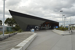
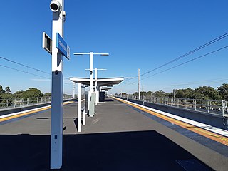
Mernda railway station is the terminus of the suburban electrified Mernda line in Victoria, Australia. It serves the north-eastern Melbourne suburb of Mernda, and it opened on 26 August 2018.
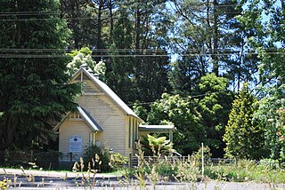
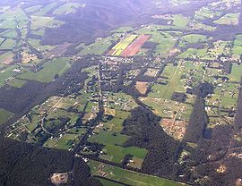
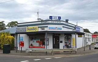
Kinglake West is a town in Victoria, Australia, 45 km (28 mi) north-east of Melbourne's Central Business District, located within the City of Whittlesea and the Shires of Murrindindi and Nillumbik local government areas. Kinglake West recorded a population of 1,305 at the 2021 census.
Humevale is a rural locality in Victoria, Australia, 39 km (24 mi) north-east of Melbourne's Central Business District, located within the City of Whittlesea local government area. Humevale recorded a population of 352 at the 2021 census.
Hawkstowe railway station is located on the Mernda line in Victoria, Australia. It serves the north-eastern Melbourne suburb of South Morang, and it opened on 26 August 2018.