Rowville is a suburb in Melbourne, Victoria, Australia, 27 km south-east of Melbourne's Central Business District, located within the City of Knox local government area. Rowville recorded a population of 33,571 at the 2021 census.

Mount Evelyn is a suburb in Melbourne, Victoria, Australia, 37 km north-east of Melbourne's central business district, located within the Shire of Yarra Ranges local government area. Mount Evelyn recorded a population of 9,799 at the 2021 census.

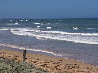
Torquay is a seaside resort in Victoria, Australia, which faces Bass Strait, 21 km south of Geelong and is the gateway to the Great Ocean Road. It is bordered on the west by Spring Creek and its coastal features include Point Danger and Zeally Bay. At the 2021 census, Torquay had a population of 18,534.
Ocean Grove is a seaside town in Victoria, Australia, located on the Bellarine Peninsula. At the 2016 census, Ocean Grove had a population of 14,165.
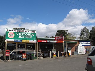
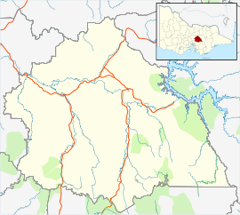
Anakie is a rural township between Geelong and Bacchus Marsh, in Victoria, Australia. At the 2021 census, Anakie and the surrounding area had a population of 734. The area is divided between the City of Greater Geelong and Golden Plains Shire local government areas.

Anglesea is a town in Victoria, Australia. It is located on the Great Ocean Road in the Surf Coast Shire local government area. In the 2016 census, Anglesea had a population of 2,545 people.

Avenel is a small town in Victoria, Australia. It is in the Shire of Strathbogie local government area. At the 2016 census, Avenel had a population of 1,048, up from 728 at the 2006 census and 552 at the 2001 census.
Eildon is a town in central Victoria, Australia. It is located near Lake Eildon, on the Goulburn Valley Highway, in the Shire of Murrindindi local government area. At the 2016 census, Eildon had a population of 974.

Alexandra is a town in north-east Victoria, Australia, 130 kilometres north-east of the State Capital, Melbourne. It is located at the junction of the Goulburn Valley Highway (B340) and Maroondah Highway (B360), in the Shire of Murrindindi local government area. At the 2016 census, the town had a population of 2,695 and the broader area a population of 6420.
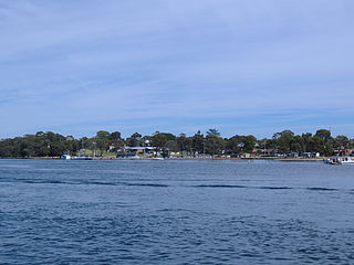
Paynesville is a tourist/holiday resort town in the Gippsland region of Victoria, Australia. At the 2016 census, Paynesville had a population of 3,480. The town is located 293 kilometres (182 mi) by road east of the state capital, Melbourne. It is known as the boating capital of Victoria.

Merbein is a town just north of Mildura, Victoria, in the Sunraysia region of Australia. It is on the Calder Highway between Mildura and the Murray River crossing at the Abbotsford Bridge to Curlwaa. At the 2016 census, the town had a population of 1,981. Merbein is 12 kilometres from Mildura, 553 km from Melbourne and 389 km from Adelaide.

Swifts Creek is a town in the Tambo Valley of East Gippsland, Victoria, Australia. The town is on the Great Alpine Road between Omeo and Ensay, 379 kilometres (235 mi) east of the state capital Melbourne and 300 metres (980 ft) above sea level. The area was originally settled by Europeans in the gold rushes of the mid-1800s. At the 2011 census, Swifts Creek and the surrounding area had a population of 419, with a median age of 47.
Dunkeld is a town in Victoria, Australia, at the southern end of the Grampians National Park, in the Shire of Southern Grampians. It is approx 283 km west of Melbourne on the Glenelg Highway. The town's population is holding steady but ageing. At the 2016 census, Dunkeld had a population of 678.
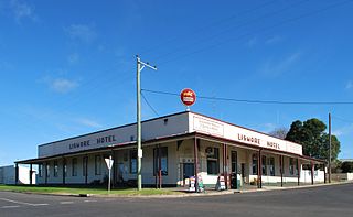
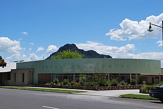
Lismore is a town in Victoria, Australia, located on the Hamilton Highway 170 kilometres (106 mi) west of Melbourne. It is part of the Corangamite Shire local government area. At the 2016 census, Lismore had a population of 420.

Bruthen is a small town located alongside the Tambo River between Bairnsdale and Ensay on the Great Alpine Road in East Gippsland, Victoria, Australia. At the 2016 census, Bruthen had a population of 814. Bruthen is 26 km (16 mi) east of Bairnsdale and 311 km (193 mi) east of the state capital Melbourne.

Poowong is a small dairying town located in South Gippsland, in the Australian state of Victoria. At the 2016 census, Poowong had a population of 360.

Tooleybuc is a town in the western Riverina district of New South Wales, Australia. The town is located on the Mallee Highway, 919 kilometres (571 mi) southwest of the state capital, Sydney and 381 kilometres (237 mi) north west of Melbourne. Situated on the banks of the Murray River across from Piangil in the neighbouring state of Victoria, at the 2011 census, Tooleybuc has a population of 277. The town is in the Murray River Council local government area. The Tooleybuc Bridgekeepers Cottage close to the Tooleybuc Bridge is of particular local historic interest. It is open to the public.
Pimpinio is a township in the Rural City of Horsham, Victoria, Australia. It is 15 km from the City of Horsham and 317 km from the Victorian capital city Melbourne. As of the 2021 Australian census, Pimpinio had a population of 191 people.
The AFL Yarra Ranges was an Australian rules football and netball organisation based in the Yarra Valley and Dandenong Ranges within Victoria. The organisation operated the Yarra Ranges Senior Football league and the Yarra Ranges Junior Football league.

Mitiamo is a town in northern Victoria, Australia. It is in the Shire of Loddon, 222 kilometres (138 mi) north of the state capital, Melbourne. At the 2016 census, Mitiamo had a population of 117.