Glenburn is a town in Penobscot County, Maine, United States. The population was 4,648 at the 2020 census. When originally incorporated in 1822, it was called "Dutton" in honor of Bangor's Samuel Dutton, a judge and founder of the Bangor Theological Seminary. It was renamed the Town of Glenburn on March 18, 1837.

Glenburn is a city in Renville County, North Dakota, United States. The population was 380 at the 2010 census. It is part of the Minot Micropolitan Statistical Area. Glenburn was founded in 1903.
Glenburn is a census-designated place (CDP) in Glenburn Township, Lackawanna County, Pennsylvania, United States. The population was 953 at the 2010 census. It is approximately 10 miles (16 km) north of downtown Scranton, in the growing suburban area known as the "Abingtons". Glenburn is located north of Clarks Summit and south of Dalton.

Glenburn Township is a township in Lackawanna County, Pennsylvania, founded in 1877. The population was 1,246 at the 2010 census.

Alfred and Plantagenet is a Franco-Ontarian township in eastern Ontario, Canada, in the United Counties of Prescott and Russell. Located approximately 70 km (43 mi) from downtown Ottawa at the confluence of the Ottawa River and the South Nation River.

Ultima is a town in northern Victoria, Australia. The town is in the Rural City of Swan Hill local government area, 353 kilometres (219 mi) north-west of the state capital, Melbourne and 35 kilometres (22 mi) south of Swan Hill. At the 2016 census, Ultima had a population of 174, down from 333 in 2011.
Melba Highway connects the outer eastern suburb of Coldstream, near Lilydale, and the town of Yea, in Victoria's Upper Goulburn on the Goulburn Valley Highway. The road is named after Dame Nellie Melba, a famed Australian opera singer of the early 20th century, whose former country estate lies at the southern end of the highway, at the junction of the Melba and Maroondah highways in Coldstream.
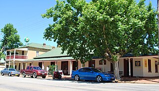
Marrar is a town in the central east part of the Riverina region of New South Wales. Australia. The town is situated about 21 kilometres (13 mi) west of Old Junee and 32 kilometres (20 mi) north of Downside. At the 2016 census, Marrar had a population of 368.
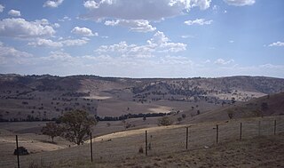
Gobarralong is a rural community in the central east part of the Riverina. It is situated about 16 kilometres southeast of Coolac and 27 kilometres northwest of Adjungbilly. At the 2016 census, Gobarralong and the surrounding area had a population of 52 people.

Oakwood Township is a township in Vermilion County, Illinois, USA. As of the 2010 census, its population was 3,507 and it contained 1,518 housing units.

Table Top is an outer suburb of the city of Albury, New South Wales, located 16 kilometres (10 mi) north of Albury and 19 kilometres (12 mi) west of Bowna. At the 2011 census, Table Top had a population of 1253. The area used to be part of the Greater Hume Shire but was recently integrated into the City of Albury.
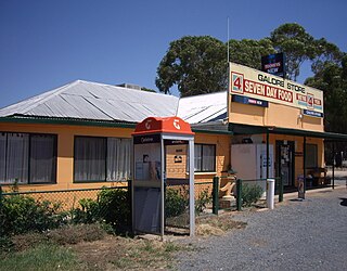
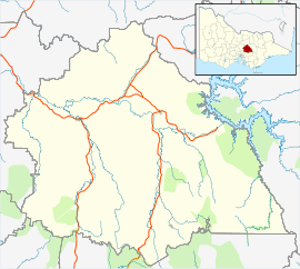
Galore is a rural community in the central east part of the Riverina. It is situated by road, about 22 kilometres north west of Collingullie and 28 kilometres south east of Sandigo. At the 2016 census, Galore had a population of 95 people.

Delungra is a small town on the Gwydir Highway, 33 kilometres (21 mi) from Inverell and 43 kilometres (27 mi) from Bingara in Inverell Shire, New South Wales, Australia. At the 2016 census, Delungra and the surrounding area had a population of 647. The urban centre had a population of 285.

Nullawil is a locality in Victoria, Australia, located approximately 302 kilometres (188 mi) from the state capital, Melbourne. At the 2016 census, Nullawil had a population of 93.
Waitchie is a locality in Victoria, Australia, located approximately 44 km (27 mi) from Swan Hill, Victoria. At the 2006 census, Waitchie had a population of 118, decreasing to 48 at the 2016 census.
Tresco is a locality in Victoria, Australia, located approximately 23 km from Swan Hill. It was named after Tresco, Isles of Scilly, England. At the 2016 census, Tresco had a population of 209.
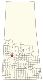
The Rural Municipality of Glenside No. 377 is a rural municipality (RM) in the Canadian province of Saskatchewan within Census Division No. 12 and SARM Division No. 6.
The Kowen District was designated by the Districts Act of 1966 as one of the 18 districts of the Australian Capital Territory (ACT). It is situated in the northeast corner of the ACT, to the east of Sutton Road and the town of Queanbeyan, New South Wales. Kowen is primarily covered by pine forests, and is also used for farming. The main highway between the ACT and the south coast region, the Kings Highway, runs directly through the Kowen District.

Wisemans Creek is a locality in the Oberon Shire of New South Wales, Australia. The area has also been known as Glenburn. It had a population of 113 people as of the 2016 census.

Glenburn Sports College was an 11–16 mixed, foundation secondary school in Skelmersdale, Lancashire, England. It was established in 1967 and was part of the Glenburn Education Trust. It closed in 2016 due to consistently poor results and low pupil numbers, and was noted for having the worst GCSE results in Lancashire.