
Georgian Bay is a large bay of Lake Huron, in the Laurentia bioregion. It is located entirely within the borders of Ontario, Canada. The main body of the bay lies east of the Bruce Peninsula and Manitoulin Island. To its northwest is the North Channel.

Simcoe County is located in the central portion of Southern Ontario, Canada. The county is just north of the Greater Toronto Area, stretching from the shores of Lake Simcoe in the east to Georgian Bay in the west. Simcoe County forms part of the Greater Golden Horseshoe area, a densely populated and industrialized region, centred on the Greater Toronto Area.
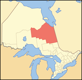
Cochrane District is a district and census division in Northeastern Ontario in the Canadian province of Ontario. It was created in 1921 from parts of Timiskaming and Thunder Bay districts.

Simcoe North is a federal electoral district in central Ontario, Canada. It was established as a federal riding in 1867.

The Chippewas of Georgina Island First Nation are an Ojibwa people located on Georgina Island in Lake Simcoe, Ontario, Canada. In 2008, of the First Nation's registered population of 666 people, 181 lived on, and 485 lived outside, their reserve. As of 2020, the band has a total population of 923 members. They are one of a handful of First Nations in the Toronto Census Metropolitan Area.

Christian Island is a large island in Georgian Bay close to the communities of Penetanguishene and Midland, Ontario. The island, with its neighbours Hope Island and Beckwith Island, is a 5,428.1 hectares Ojibwa reserve, known as Christian Island Indian Reserve No. 30. Together with the 7.5 hectares Christian Island Indian Reserve No. 30A located at Cedar Point, Ontario and the 3.1 hectares Chippewa Island Indian Reserve located in Twelve Mile Sound, 27.5 kilometres (17.1 mi) north of Christian Island, it forms the land base for the Beausoleil First Nation. Christian Islands' highest elevation is 209 metres above sea level.

St. Theresa Point First Nation is a First Nations community in northern Manitoba. It has 3 reserves in total, the largest and most populated of which is St. Theresa Point, which is bordered by the unorganized portion of Division No. 22, Manitoba, and by the Wasagamack First Nation.
Beausoleil, beau soleil or variants may refer to:
Chippewas of Rama First Nation, also known as Chippewas of Mnjikaning and Chippewas of Rama Mnjikaning First Nation, is an Anishinaabe (Ojibway) First Nation located in the province of Ontario in Canada. The name Mnjikaning, or fully vocalized as Minjikaning, refers to the fishing weirs at Atherley Narrows between Lake Simcoe and Lake Couchiching and it means "in/on/at or near the fence".
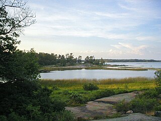
Beausoleil Island; Île Beausoleil; is an 8-kilometre (5.0 mi) long island in the municipality of Georgian Bay, District Municipality of Muskoka in Central Ontario, Canada. The island is named after Louis Beausoleil, a Métis settler whose 1819 homestead stood at the island's southern tip.The name of the island in the Huron-Wendat language is Skiondechiara which means "The land to appear floating afar". Located in the Thirty Thousand Islands in Georgian Bay on Lake Huron, it is the largest island in Georgian Bay Islands National Park and is the only place in the park where camping is allowed. Beausoleil Island is also part of the Georgian Bay Littoral UNESCO Biosphere reserve.
Beausoleil First Nation is an Ojibwe First Nation band government located in Simcoe County, Ontario, Canada. The main settlement of the Beausoleil First Nation is on Christian Island, Ontario, Canada in southern Georgian Bay. As of 2018, the total number of status Indians registered with the First Nation is 2,587. The on-reserve population is 614.

Beckwith Island is the eastern of three islands in southeastern Georgian Bay in Ontario, Canada. Its highest elevation is 226 meters above sea level. Like its populated neighbour Christian Island to the west, and Hope Island to the northwest, the uninhabited island is part of an Ojibwa reserve. On the mainland, Cedar Point lies directly south of the island and Thunder Beach is located to the southeast of Beckwith Island. The island is a pristine, and ecologically sensitive island of over 800 acres (324 ha), featuring sandy beaches and dunes, juniper bushes, as well as the rare and protected three-pronged awn grass, plus forests of oak, maple, birch and conifer trees and no development of any kind except for simple outhouses to serve boaters, campers and picnickers. Camping is permitted but you must obtain permission in advance from the local band council on Christian Island. The eastern side of Beckwith island is often a favourite place for boats to moor. Beckwith Island and the attached "Little Beckwith" are part of the Beausoleil First Nation.
Hatchet Lake Denesuline Nation is a Denesuline First Nation in northern Saskatchewan. The main settlement, Wollaston Lake, is an unincorporated community on Wollaston Lake in the boreal forest of north-eastern Saskatchewan, Canada.
Christian Island 30A is a First Nations reserve in Simcoe County, Ontario. It is one of the reserves of the Beausoleil First Nation. It had a population of 42 in the 2016 Census, up from 36 in the 2011 Census.
Moose Deer Point First Nation is a Potawatomi First Nation in the District Municipality of Muskoka, Ontario. It has a reserve called Moose Point 79. The reserve is located along Twelve Mile Bay.
Chippewa Island is a First Nations reserve consisting of two islands in Twelve Mile Bay of Georgian Bay. The islands are adjacent to the Moose Deer Point First Nation. The islands are shared between the Beausoleil First Nation, the Chippewas of Georgina Island First Nation and the Chippewas of Rama First Nation.

The Thirty Thousand Islands are the world's largest freshwater archipelago, and are located mainly along the east side of Georgian Bay, part of the Great Lakes, in Ontario, Canada.
John Aisance was a chief among the Chippewas of Lakes Huron and Simcoe and leader of the Otter clan of that people from at least 1815 until his death in 1847. He participated in the Lake Simcoe–Lake Huron Purchase in 1815, served the provincial government during the Upper Canada Rebellion, and was the first and founding chief of the Beausoleil First Nation.
