Churchill Mountains

Last updated
Churchill Mountains
Nicholson Peninsula USGS Satellite Image.jpg
North tip of the range, and Byrd Glacier
Highest point
Peak Mount Albert Markham
Elevation 3,205 m (10,515 ft)
Coordinates 81°23′S158°14′E / 81.383°S 158.233°E / -81.383; 158.233 (Mount Albert Markham)
Geography
Antarctica relief location map.jpg
Red triangle with thick white border.svg
Location of Churchill Mountains in SW Antarctica
ContinentAntarctica
Region Ross Dependency
Range coordinates 81°30′S158°30′E / 81.5°S 158.5°E / -81.5; 158.5 (Churchill Mountains) [1]
Parent range Transantarctic Mountains

The Churchill Mountains is a major range of mountains and associated elevations bordering the western side of the Ross Ice Shelf, between Byrd Glacier and Nimrod Glacier. [1] They are south of the Britannia Range and north of the Geologists Range, Miller Range and Queen Elizabeth Range.

Contents

Exploration and naming

Several of the range's highest summits, including Mount Egerton, Mount Field, Mount Nares, Mount Wharton, and Mount Albert Markham were first seen and named by the British National Antarctic Expedition of 1901–1904 under Robert Falcon Scott. The mountains were mapped in detail by the USGS from tellurometer surveys during 1960–61, and by United States Navy air photos in 1960. They were named by the United States US-ACAN for Sir Winston Churchill. [1]

Location

The Churchill mountains extend from the Byrd Glacier south to the Nimrod Glacier. The Antarctic Plateau is to their west, with various groups of nunataks, and the Ross Ice Shelf is to their east.

Mountains and peaks

The higher mountains and peaks include:

MountainMetresFeetCoordinates
Mount Albert Markham 3,20510,515 81°23′S158°14′E / 81.383°S 158.233°E / -81.383; 158.233 (Mount Albert Markham)
Mount Field 3,0109,875 80°53′S158°02′E / 80.883°S 158.033°E / -80.883; 158.033 (Mount Field)
Mount Nares 3,0009,843 81°27′S158°10′E / 81.450°S 158.167°E / -81.450; 158.167 (Mount Nares)
Mount Egerton 2,8309,285 80°50′S157°55′E / 80.833°S 157.917°E / -80.833; 157.917 (Mount Egerton)
Pyramid Mountain 2,8109,219 81°19′S158°15′E / 81.317°S 158.250°E / -81.317; 158.250 (Pyramid Mountain)
Mount Wharton 2,8009,186 81°03′S157°49′E / 81.050°S 157.817°E / -81.050; 157.817 (Mount Wharton)
Mount Isbell 2,3607,743 82°22′S156°24′E / 82.367°S 156.400°E / -82.367; 156.400 (Mount Isbell)
Mount Frost 2,3507,710 81°11′S158°21′E / 81.183°S 158.350°E / -81.183; 158.350 (Mount Frost)
Mount Zinkovich 2,2807,480 81°08′S158°21′E / 81.133°S 158.350°E / -81.133; 158.350 (Mount Zinkovich)
Turk Peak 2,0006,562 81°02′S158°23′E / 81.033°S 158.383°E / -81.033; 158.383 (Turk Peak)
Mount Hamilton 1,9906,529 80°40′S158°17′E / 80.667°S 158.283°E / -80.667; 158.283 (Mount Hamilton)
Mount Tuatara 1,6405,381 80°34′S158°20′E / 80.567°S 158.333°E / -80.567; 158.333 (Mount Tuatara)

Major glaciers

C80202s5 Ant.Map Mount Olympus.jpg C80195s1 Ant.Map Cape Selborne.jpg
Northern part of range south of Byrd Glacier

Sub−ranges

C81202s5 Ant.Map Wilhoite Nunataks.jpg C81195s1 Ant.Map Mount Nares.jpg
Central part of range
Southern part of range north of Nimrod Glacier C82195s1 Ant.Map Nimrod Glacier.jpg
Southern part of range north of Nimrod Glacier

Sub−ranges of the Churchill Mountains include:

Plateaus and snowfields

Related Research Articles

<span class="mw-page-title-main">Nimrod Glacier</span> Glacier in Antarctica

The Nimrod Glacier is a major glacier about 85 nautical miles long, flowing from the polar plateau in a northerly direction through the Transantarctic Mountains into the Ross Ice Shelf, Antarctica.

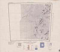
The Geologists Range is a mountain range about 55 km (34 mi) long, standing between the heads of Lucy and Nimrod Glaciers in Antarctica. Seen by the northern party of the New Zealand Geological Survey Antarctic Expedition (NZGSAE) (1961–62) and named to commemorate the work of geologists in Antarctic exploration. The Churchill Mountains are to the north, the Queen Elizabeth Range to the east and the Miller Range to the southeast

Skelton Glacier is a large glacier flowing from the polar plateau into the Ross Ice Shelf at Skelton Inlet on the Hillary Coast, south of Victoria Land, Antarctica.

<span class="mw-page-title-main">Queen Maud Mountains</span> Major feature group in the Transantarctic Mountains

The Queen Maud Mountains are a major group of mountains, ranges and subordinate features of the Transantarctic Mountains, lying between the Beardmore and Reedy Glaciers and including the area from the head of the Ross Ice Shelf to the Antarctic Plateau in Antarctica. Captain Roald Amundsen and his South Pole party ascended Axel Heiberg Glacier near the central part of this group in November 1911, naming these mountains for the Norwegian queen Maud of Wales.

<span class="mw-page-title-main">Byrd Glacier</span> Glacier in Antarctica

The Byrd Glacier is a major glacier in Antarctica, about 136 km (85 mi) long and 24 km (15 mi) wide. It drains an extensive area of the Antarctic plateau, and flows eastward to discharge into the Ross Ice Shelf.

The Britannia Range is a range of mountains bounded by the Hatherton Glacier and Darwin Glacier on the north and the Byrd Glacier on the south, westward of the Ross Ice Shelf in Antarctica.

The Cook Mountains is a group of mountains bounded by the Mulock and Darwin glaciers in Antarctica. They are south of the Worcester Range and north of the Darwin Mountains and the Britannia Range.

<span class="mw-page-title-main">Darwin Glacier (Antarctica)</span> Glacier in Antarctica

The Darwin Glacier is a large glacier in Antarctica. It flows from the polar plateau eastward between the Darwin Mountains and the Cook Mountains to the Ross Ice Shelf. The Darwin and its major tributary the Hatherton are often treated as one system, the Darwin–Hatherton.

Surveyors Range is a 30 miles (48 km) long mountain range in the Churchill Mountains of Antarctica.

The Carlstrom Foothills are a group of peaks and ridges in the Churchill Mountains, Antarctica.

The Carnegie Range is a mountain range in the Churchill Mountains of the Transantarctic Mountains System, in the Ross Dependency of Antarctica.

Chapman Snowfield is a large snowfield lying west of the central ridge in the Churchill Mountains in the Ross Dependency region of Antarctica.

<span class="mw-page-title-main">Nursery Glacier</span> Glacier in Antarctica

Nursery Glacier is a coastal glacier in the Churchill Mountains of Anarctica.

The Nash Range is a mainly ice-covered coastal range in the Churchill Mountains of Antarctica.

Svaton Peaks is a cluster of rugged peaks at the north end of the Queen Elizabeth Range, Antarctica, surmounting the area between the mouths of the Heilman Glacier and Otago Glacier.

Swithinbank Range is a small range from the Churchill Mountains,

The Darley Hills are a range of high, ice-covered coastal hills in the Churchill Mountains, Antarctica.

Starshot Glacier is a glacier 50 nautical miles (90 km) long that flows through the Churchill Mountains to enter the Ross Ice Shelf in Antarctica.

The Holland Range is a rugged coastal mountain range in the Ross Dependency, Antarctica, on the west coast of the Ross Ice Shelf. It is about 60 nautical miles (110 km) long.

Holyoake Range is a mountain range in the Ross Dependency of Antarctice. It is in the southern section of the Churchill Mountains, part of the Transantarctic Mountains System.

References

  1. 1 2 3 Alberts 1995, p. 136.
  2. Alberts 1995, p. 109.
  3. Alberts 1995, p. 535.
  4. Alberts 1995, p. 708.
  5. Alberts 1995, p. 527.
  6. Carlstrom Foothills USGS.
  7. Carnegie Range USGS.
  8. Alberts 1995, p. 142.
  9. Alberts 1995, p. 172.
  10. Alberts 1995, p. 342.
  11. Alberts 1995, p. 517.
  12. Alberts 1995, p. 725.
  13. Alberts 1995, p. 729.
  14. Alberts 1995, p. 389.
  15. Cooper Snowfield USGS.
  16. Chapman Snowfield USGS.

Sources