Ciudad Guadalupe Victoria

Last updated
Guadalupe Victoria
Municipal seat and city
Mexico States blank map.svg
Red pog.svg
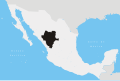
Guadalupe Victoria
Location in Mexico
Coordinates: 24°26′59″N104°7′21″W / 24.44972°N 104.12250°W / 24.44972; -104.12250
CountryFlag of Mexico.svg  Mexico
State Durango
Municipality Guadalupe Victoria
Elevation
2,002 m (6,568 ft)
Population
 (2010)
  Total16,506
Time zone UTC-6 (CST)
  Summer (DST) UTC-5 (CDT)

Guadalupe Victoria is a city and seat of Guadalupe Victoria Municipality, in the state of Durango, north-western Mexico. [1] In 2010, the city of Guadalupe Victoria had a population of 16,506. [2]

Contents

Geography

Climate

Climate data for Guadalupe Victoria (1951-2010)
MonthJanFebMarAprMayJunJulAugSepOctNovDecYear
Record high °C (°F)31.0
(87.8)
30.0
(86.0)
34.0
(93.2)
35.0
(95.0)
40.0
(104.0)
43.0
(109.4)
37.0
(98.6)
35.0
(95.0)
34.0
(93.2)
34.0
(93.2)
32.0
(89.6)
34.0
(93.2)
43.0
(109.4)
Mean daily maximum °C (°F)20.2
(68.4)
21.6
(70.9)
24.5
(76.1)
27.4
(81.3)
29.6
(85.3)
29.4
(84.9)
27.0
(80.6)
26.1
(79.0)
25.5
(77.9)
25.0
(77.0)
23.4
(74.1)
20.5
(68.9)
25.0
(77.0)
Daily mean °C (°F)11.0
(51.8)
12.2
(54.0)
14.8
(58.6)
17.7
(63.9)
20.4
(68.7)
21.4
(70.5)
20.0
(68.0)
19.6
(67.3)
18.7
(65.7)
16.6
(61.9)
13.8
(56.8)
11.4
(52.5)
16.5
(61.7)
Mean daily minimum °C (°F)1.7
(35.1)
2.8
(37.0)
5.1
(41.2)
8.1
(46.6)
11.1
(52.0)
13.4
(56.1)
13.1
(55.6)
13.1
(55.6)
11.9
(53.4)
8.2
(46.8)
4.3
(39.7)
2.4
(36.3)
7.9
(46.2)
Record low °C (°F)−13.0
(8.6)
−10.0
(14.0)
−8.0
(17.6)
−2.0
(28.4)
0.5
(32.9)
4.0
(39.2)
6.0
(42.8)
7.0
(44.6)
2.0
(35.6)
−4.0
(24.8)
−10.0
(14.0)
−14.0
(6.8)
−14.0
(6.8)
Average precipitation mm (inches)18.5
(0.73)
5.4
(0.21)
4.5
(0.18)
5.2
(0.20)
16.1
(0.63)
65.5
(2.58)
113.5
(4.47)
130.3
(5.13)
78.5
(3.09)
32.7
(1.29)
12.6
(0.50)
14.5
(0.57)
497.3
(19.58)
Average precipitation days (≥ 0.1 mm)2.21.20.71.22.57.512.411.88.94.01.32.155.8
Source: Servicio Meteorológico National [3]

Related Research Articles

<span class="mw-page-title-main">Our Lady of Guadalupe</span> Marian apparitions in December 1531

Our Lady of Guadalupe, also known as the Virgin of Guadalupe, is a Catholic title of Mary, mother of Jesus associated with a series of five Marian apparitions to a Mexican peasant named Juan Diego and his uncle, Juan Bernardino, which are believed to have occurred in December 1531, when the Mexican territories were under the Spanish Empire.

<span class="mw-page-title-main">Victoria County, Texas</span> County in Texas, United States

Victoria County is a county located in the U.S. state of Texas. As of the 2020 census, its population was 91,319. Its county seat is also named Victoria. Victoria County is included in the Victoria, TX Metropolitan Statistical Area, and comprises the entirety of the Victoria, TX media market.

<span class="mw-page-title-main">Victoria, Texas</span> City and county seat in Texas, United States

Victoria is a small city in South Texas and county seat of Victoria County, Texas. The population was 65,534 as of the 2020 census. The three counties of the Victoria Metropolitan Statistical Area had a population of 111,163 as of the 2000 census. Its elevation is 95 ft (29 m).

<span class="mw-page-title-main">Aguascalientes (city)</span> City in the Mexican state of Aguascalientes

Aguascalientes is the capital of the Mexican state of the same name and its most populous city, as well as the head of the Aguascalientes Municipality; with a population of 934,424 inhabitants in 2012 and 1,225,432 in the metro area. The metropolitan area also includes the municipalities of Jesús María and San Francisco de los Romo. It is located in North-Central Mexico, which roughly corresponds to the Bajío region (Lowlands) within the central Mexican plateau. The city stands on a valley of steppe climate at 1880 meters above sea level, at 21°51′N102°18′W.

<span class="mw-page-title-main">Ciudad Victoria</span> City in Tamaulipas, Mexico

Ciudad Victoria is the seat of the Municipality of Victoria, and the capital of the Mexican state of Tamaulipas. It is located in the northeast of Mexico at the foot of the Sierra Madre Oriental. It borders the municipality of Güémez to the north, Llera to the south, Casas Municipality to the east, and the municipality of Jaumave to the west. The city is located 246 km (153 mi) from Monterrey and 319 km (198 mi) from the US - Mexico border. Ciudad Victoria is named after the first president of Mexico, Guadalupe Victoria.

<span class="mw-page-title-main">Durango (city)</span> City in Durango, Mexico

Durango is the capital and largest city of the northern Mexican state of Durango and the seat of the Durango municipality. It has a population of 654,876 as of the 2015 census. The city's official name is Victoria de Durango, Victoria having been added in honor of the first president of Mexico, Guadalupe Victoria, a native of the state of Durango. The city is at an altitude of 1,890 m (6,201 ft) in the Valley of Guadiana.

<span class="mw-page-title-main">Gustavo A. Madero, Mexico City</span> Borough in Mexico City, Mexico

Gustavo A. Madero is the northernmost borough of Mexico City.

<span class="mw-page-title-main">Guadalupe Victoria</span> 1st President of Mexico from 1824 to 1829

Guadalupe Victoria, born José Miguel Ramón Adaucto Fernández y Félix, was a Mexican general and politician who fought for independence against the Spanish Empire in the Mexican War of Independence and after the adoption of the Constitution of 1824, was elected as the first president of the United Mexican States. He was a deputy in the Mexican Chamber of Deputies for Durango and a member of the Supreme Executive Power following the downfall of the First Mexican Empire, which was followed by the 1824 Constitution and his presidency. He later served as Governor of Puebla.

<span class="mw-page-title-main">Guadalupe River (California)</span> River in Santa Clara County, California, United States

The Guadalupe River mainstem is an urban, northward flowing 14 miles (23 km) river in California whose much longer headwater creeks originate in the Santa Cruz Mountains. The river mainstem now begins on the Santa Clara Valley floor when Los Alamitos Creek exits Lake Almaden and joins Guadalupe Creek just downstream of Coleman Road in San Jose, California. From here it flows north through San Jose, where it receives Los Gatos Creek, a major tributary. The Guadalupe River serves as the eastern boundary of the City of Santa Clara and the western boundary of Alviso, and after coursing through San José, it empties into south San Francisco Bay at the Alviso Slough.

<span class="mw-page-title-main">Pedro Celestino Negrete</span> Mexican politician

Pedro Celestino Joseph Negrete y Falla was a Spanish politician and military man who served as a member of the interim government of México after the abolition of the First Mexican Empire. He fought alongside of Agustín de Iturbide in the royalist army during the Mexican War of Independence. He was a close collaborator of Iturbide during the empire and then pressured him to abdicate to the Mexican crown.

<span class="mw-page-title-main">Potrero metro station</span> Mexico City Metro station

Potrero metro station is a station of the Mexico City Metro built along Insurgentes Norte Avenue in the colonias (neighborhoods) of Capultitlan and Guadalupe Insurgentes, in Gustavo A. Madero, Mexico City. It is an at-grade station with one island platform served by Line 3 between Deportivo 18 de Marzo and La Raza stations. The station and its surrounding area are named this way because there used to be a hippodrome during the Porfiriato era (1876–1911) and its pictogram features the silhouette of a head of a horse behind a fence. The station was opened on 1 December 1979, on the first day of service between Indios Verdes and Hospital General metro stations.

<span class="mw-page-title-main">Basilica of Our Lady of Guadalupe</span> Church in Mexico City

The Basilica of Santa María de Guadalupe, officially called Insigne y Nacional Basílica de Santa María de Guadalupe is a basilica of the Catholic Church, dedicated to the Virgin Mary in her invocation of Our Lady of Guadalupe, located at the foot of the Hill of Tepeyac in the Gustavo A. Madero borough of Mexico City. It belongs to the Primate Archdiocese of Mexico through the Guadalupana Vicariate, which since November 4, 2018, is in the care of Monsignor Efraín Hernández Díaz, who has the title of general and episcopal vicar of Guadalupe and abbot of the basilica.

<span class="mw-page-title-main">Tamazula de Victoria</span> Municipal seat and city in Durango, Mexico

Tamazula de Victoria is a small town and seat of the municipality of Tamazula in the Mexican state of Durango, near the Sierra Madre Occidental mountains. The town is located about 19 minutes of Culiacán Sinaloa Municipality. General Guadalupe Victoria, the first president of Mexico, was born there, hence the name, as well as his brother, Francisco Victoria. Its official name is Tamazula de Victoria. As of 2010, the town had a population of 2,337 The Tamazula River runs directly north of the town.

Peñón Blanco is a city and seat of the municipality of Peñón Blanco in the Mexican state of Durango.

<span class="mw-page-title-main">Venustiano Carranza, Chiapas</span> Municipality in Chiapas, Mexico

Venustiano Carranza is a city and municipality in the Mexican state of Chiapas in southern Mexico.

Guadalupe Victoria Municipality is one of the 39 municipalities of Durango, in north-western Mexico. The municipal seat lies at Ciudad Guadalupe Victoria. The municipality covers an area of 767.10 km².

Xochistlahuaca Municipality is one of the 81 municipalities of Guerrero, in south-western Mexico. The municipal seat lies at Xochistlahuaca. The municipality covers an area of 321.1 km².

<span class="mw-page-title-main">Guadalupe Bay</span>

Guadalupe Bay is a slender inlet of San Antonio Bay in Calhoun County, Texas, United States, near the settlements of Seadrift and Long Mott. It is fed by the Guadalupe River, and is the site of the river's two mouths.

<span class="mw-page-title-main">Martín De León</span> Rancher and wealthy Mexican empresario

Martín De León (1765–1833) was a rancher and wealthy Mexican empresario in Texas who was descended from Spanish aristocracy. He was the patriarch of one of the prominent founding families of early Texas. De León and his wife Patricia de la Garza established De León's Colony, the only predominantly Mexican colony in Texas. They founded the town of Villa de Nuestra Señora de Guadalupe Victoria Nombre de Jesús on the Guadalupe River. The name referred both to the river and to Mexico's president Guadalupe Victoria.

<span class="mw-page-title-main">Provisional Government of Mexico</span> 1823–1824 government in Mexico

The Supreme Executive Power was the provisional government of Mexico that governed between the fall of the First Mexican Empire in April 1823 and the election of the first Mexican president, Guadalupe Victoria, in October 1824. After Emperor Iturbide abdicated, the sovereignty of the nation passed over to Congress, which appointed a triumvirate, made up of Guadalupe Victoria, Pedro Celestino Negrete, and Nicolas Bravo, to serve as the executive, while a new constitution was being written.

References

  1. Instituto Nacional de Estadística y Geografía. Principales resultados por localidad 2005 (ITER). Retrieved on December 19, 2008
  2. "Guadalupe Victoria". Catálogo de Localidades. Secretaría de Desarrollo Social (SEDESOL). Archived from the original on 21 October 2015. Retrieved 23 April 2014.
  3. "NORMALES CLIMATOLÓGICAS 1951-2010". Servicio Meteorológico National. Retrieved October 9, 2012.