Coneto de Comonfort

Last updated
Coneto de Comonfort
Municipal seat and city
Mexico States blank map.svg
Red pog.svg
Coneto de Comonfort
Location in Mexico
Coordinates: 24°59′N104°56′W / 24.983°N 104.933°W / 24.983; -104.933
CountryFlag of Mexico.svg  Mexico
State Durango
Municipality Coneto de Comonfort
Elevation
1,960 m (6,430 ft)
Population
 (2015)
  Total858

Coneto de Comonfort is a town and seat of the municipality of Coneto de Comonfort, in the state of Durango, north-western Mexico. [1] As of 2015, the town of Coneto de Comonfort had a population of 858. [2]

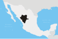
Founded over 450 years ago, the town of Coneto de Comonfort was originally established as a mining community. It is located in the heart of the Coneto Mining District in the "Mexican Silver Trend", on the Mesa Central, east of the Sierra Madre Occidental mountains. This epithermal gold and silver-rich district has a long history of exploration and small scale production, dating back to the mid 16th century. The district is currently being explored by Orex Minerals Inc. (TSX.V: REX) and their project partner Fresnillo plc (LSE: FRES).

Geology

Gold and silver mineralization is hosted in over 40 epithermal quartz veins and breccias of low to intermediate sulfidation. A corridor of veining extends northwesterly for 17 km and has a width of about 4 km. Individual veins can be traced for up to 2 km and vary from 1 to 20 metres thick. These are exposed in an erosional window of Lower Volcanic Series (LVS) andesite domes, flows, tuff and agglomerate, surrounded by Upper Volcanic Series (UVS) rhyolites and dacites. The main silver-bearing mineral is acanthite and native gold is associated with hydrothermal hematite. The base metal minerals galena, sphalerite and minor chalcopyrite increase with depth. Associated with the mineralized structures are hydrothermal alteration zones, including kaolinitization, silicification, and pyritization. [3]

Related Research Articles

<span class="mw-page-title-main">Breccia</span> Rock composed of angular fragments

Breccia is a rock composed of large angular broken fragments of minerals or rocks cemented together by a fine-grained matrix.

<span class="mw-page-title-main">Vein (geology)</span> Sheetlike body of crystallized minerals within a rock

In geology, a vein is a distinct sheetlike body of crystallized minerals within a rock. Veins form when mineral constituents carried by an aqueous solution within the rock mass are deposited through precipitation. The hydraulic flow involved is usually due to hydrothermal circulation.

<span class="mw-page-title-main">Silver mining</span> Extraction silver from the ground

Silver mining is the extraction of silver from minerals, starting with mining. Because silver is often found in intimate combination with other metals, its extraction requires elaborate technologies. In 2008, ca. 25,900 metric tons were consumed worldwide, most of which came from mining.

<span class="mw-page-title-main">Mineral del Monte</span> Municipality and town in Hidalgo, Mexico

Mineral del Monte, commonly called Real del Monte or El Real, is a small mining town, and one of the 84 municipalities of Hidalgo, in the State of Hidalgo in east-central Mexico.

<span class="mw-page-title-main">Doña Ana Mountains</span>

The Doña Ana Mountains are a mountain range in Doña Ana County, New Mexico. The highest elevation in the range is Doña Ana Peak at 5,835 feet, at 32°27′15″N106°47′18″W.

<span class="mw-page-title-main">Mining in Papua New Guinea</span>

Mining in Papua New Guinea is an important part of the Papua New Guinea economy.

<span class="mw-page-title-main">Uranium mining in Colorado</span>

Uranium mining in Colorado, United States, goes back to 1872, when pitchblende ore was taken from gold mines near Central City, Colorado. The Colorado uranium industry has seen booms and busts, but continues to this day. Not counting byproduct uranium from phosphate, Colorado is considered to have the third largest uranium reserves of any US state, behind Wyoming and New Mexico.

<span class="mw-page-title-main">Boulder Batholith</span>

The Boulder Batholith is a relatively small batholith in southwestern Montana, United States, exposed at the surface as granite and serving as the host rock for rich mineralized deposits at Butte and other locations. The batholith lies roughly between Butte and Helena, and between the Deer Lodge Valley and the Broadwater Valley. The volcanic Elkhorn Mountains are a large mass of forested lava associated with the batholith.

<span class="mw-page-title-main">Wonder, Nevada</span> Ghost Town in Nevada, United States

Wonder, Nevada, is a ghost town in Churchill County, Nevada, approximately 39 miles (63 km) east of Fallon.

Coeur Mining, Inc. is a precious metals mining company listed on the New York Stock exchange. It operates five mines located in North America. Coeur employs 2,200 people and in 2012 it was the world's 9th largest silver producer. In 2013 the company changed its name to Coeur Mining, Inc. from Coeur d'Alene Mines and moved its head office to Chicago, Illinois from Coeur d'Alene, Idaho.

<span class="mw-page-title-main">Owyhee Mountains</span> Mountain range in Idaho and Oregon, USA

The Owyhee Mountains are a mountain range in Owyhee County, Idaho and Malheur County, Oregon.

<span class="mw-page-title-main">Orex Exploration</span>

Orex Exploration is a former Canadian gold mining company that conducted exploration work on mining properties it owned in the Goldboro and Guysborough County areas of Nova Scotia. The properties owned by Orex were the sites of the former Boston Richardson Mine, Dolliver Mountain Mine, West Goldbrook Mine, and East Goldbrook Mine which operated between 1892 and 1912. Headquartered in Rouyn-Noranda, Quebec, the company was founded in 1987 and raised funds for exploration work, in part, by issuing stocks traded on the Montreal Stock Exchange and then the TSX Venture Exchange. It became a subsidiary of Anaconda Mining Inc. after Anaconda acquired the company in a stock swap deal in 2017.

<span class="mw-page-title-main">Mines and Geosciences Bureau Region 13 (Philippines)</span>

Caraga Region is located at northeastern part of Mindanao. It includes the five provinces of Dinagat Province, Surigao del Norte, Surigao del Sur, Agusan del Norte and Agusan del Sur. Caraga Region is now hosting several mining projects producing various mineral commodities particularly but not limited to gold, copper, chrome, nickel, iron and limestone for concrete cement production. This makes the Department of Environment and Natural Resources, Mines and Geosciences Bureau, Regional Office No. 13 with Office located in Surigao City plays important role in the region's economy, job generation, social and environmental enhancement and protection and ensuring government shares through royalties and taxes.

<span class="mw-page-title-main">El Indio Gold Belt</span>

The El Indio Gold Belt is a mineral-rich region spanning the border between Chile and Argentina that contains large quantities of gold, silver and copper. On both sides of the border the belt is located within the Andes. The El Indio mine within the district was the first modern mine in Chile to produce gold as its main product. In Chile the main precious metal containing mineral is enargite. The El Indio belt is bordered in the north by another gold-silver mining district known as the Frontera District. Rodalquilarite, alunite and poughite are some of the minerals present in the area. The deposits of the belt formed during the Late Miocene period.

<span class="mw-page-title-main">Klondike Mountain Formation</span>

The Klondike Mountain Formation is an Early Eocene (Ypresian) geological formation located in the northeast central area of Washington state. The formation is comprised of volcanic rocks in the upper unit and volcanic plus lacustrine (lakebed) sedimentation in the lower unit. the formation is named for the type location designated in 1962, Klondike Mountain northeast of Republic, Washington. The formation is a lagerstätte with exceptionally well-preserved plant and insect fossils has been found, along with fossil epithermal hot springs.

AuRico Gold was an intermediate gold mining and exploration company that, until August 2011, operated only in Mexico. It reached intermediate gold producer status in August 2011 when Northgate Minerals agreed to be taken over for C$1.46 billion. Gammon Gold was an exploration company until 2004 when it started producing for the first time. Assets also include silver and copper.

The Quinchía mine is a gold mine in Colombia. The mine is located in Quinchía, Risaralda. The mine has estimated reserves of 390,000 ounces (11 t) of gold and 817,000 ounces (23.2 t) of silver. In 2016, Quinchía produced 73,475.73 kilograms (2,591,780 oz) of gold, and 10,587.99 kilograms (373,480 oz) of silver.

Hydrothermal mineral deposits are accumulations of valuable minerals which formed from hot waters circulating in Earth's crust through fractures. They eventually create metallic-rich fluids concentrated in a selected volume of rock, which become supersaturated and then precipitate ore minerals. In some occurrences, minerals can be extracted for a profit by mining. Discovery of mineral deposits consumes considerable time and resources and only about one in every one thousand prospects explored by companies are eventually developed into a mine. A mineral deposit is any geologically significant concentration of an economically useful rock or mineral present in a specified area. The presence of a known but unexploited mineral deposit implies a lack of evidence for profitable extraction.

<span class="mw-page-title-main">Huarón Mining District</span> Polymetallic deposit cluster

Michel Jébrak is a Franco-Canadian geologist, academic and a researcher. He is an emeritus professor at University of Quebec’s Department of Earth and Atmospheric Sciences. He is a former Vice-Rector for Research and Creation at UQAM and holder of the UQAT-UQAM Mining Entrepreneurship Chair.

References

  1. Instituto Nacional de Estadística y Geografía. Principales resultados por localidad 2005 (ITER). Retrieved on December 19, 2008
  2. "Coneto de Comonfort". Catálogo de Localidades. Secretaría de Desarrollo Social (SEDESOL). Archived from the original on 4 March 2016. Retrieved 23 April 2014.
  3. Whiting, Ben (15 March 2010). "Technical report for the Coneto silver-gold project, Durango, Mexico". Coneto - Technical Reports. Orex Minerals Inc. Retrieved 2 Sep 2015.