Nazas

Last updated
Nazas, Durango
Nazas Camino Real.jpg
Santa Ana Parish in Nazas
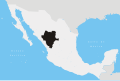
Mexico Durango location map.svg
Red pog.svg
Nazas, Durango
Location in Mexico
Mexico States blank map.svg
Red pog.svg
Nazas, Durango
Nazas, Durango (Mexico)
Coordinates: 24°26′59″N104°7′21″W / 24.44972°N 104.12250°W / 24.44972; -104.12250
CountryFlag of Mexico.svg  Mexico
State Durango
Municipality Nazas
Population
 (2010)
  Total3,622
Time zone UTC-6 (Central)

Nazas is a town in the state of Durango, in north-western Mexico. [1] The town of Nazas is the seat of the municipality of Nazas. As of 2010, the town of Nazas had a population of 3,622. [2]

The "Architectonic ensemble of the Town of Nazas" is one of the sites that form the Camino Real de Tierra Adentro , a UNESCO World Heritage Site since 2010. [3]

The greatest extent of the solar eclipse of 8 April 2024 was near the town of Nazas, with a totality of about 4 minutes and 28 seconds. [4] [5]

Economy

An important agricultural product of the municipality is pecan nut. The town is known as the Paraíso de la Nuez. [6] The pecan varieties grown are Wisha and Western. By planted acreage, pecan is second to alfalfa. [6]

Related Research Articles

<span class="mw-page-title-main">San Elizario, Texas</span> City in Texas, United States

San Elizario is a city in El Paso County, Texas, United States. Its population was 13,603 at the 2010 census. It is part of the El Paso metropolitan statistical area. It lies on the Rio Grande, which forms the border between the United States and Mexico. The city of Socorro adjoins it on the west and the town of Clint lies to the north.

<span class="mw-page-title-main">San Luis Potosí (city)</span> City in San Luis Potosí, Mexico

San Luis Potosí, commonly referred to as San Luis, or by its initials SLP, is the capital and the most populous city of the Mexican state of San Luis Potosí. It is the municipal seat of the surrounding municipality of San Luis Potosí. The city lies at an elevation of 1,864 metres. It has an estimated population of 824,229 in the city proper and a population of approximately 1,221,526 in its metropolitan area, formed with the neighbour city of Soledad de Graciano Sánchez and other surrounding municipalities, which makes the metropolitan area of Greater San Luis Potosí the eleventh largest in Mexico.

<span class="mw-page-title-main">Durango</span> State of Mexico

Durango, officially named Estado Libre y Soberano de Durango, is one of the 31 states which make up the 32 Federal Entities of Mexico, situated in the northwest portion of the country. With a population of 1,832,650, the 8th lowest of Mexico's states, Durango has Mexico's second-lowest population density, after Baja California Sur. The capital city, Victoria de Durango, is named after the first President of Mexico, Guadalupe Victoria.

El Camino Real may refer to:

<span class="mw-page-title-main">Ojuelos de Jalisco</span> Municipality and Town in Jalisco, Mexico

Ojuelos de Jalisco is a town and municipality in the state of Jalisco, Mexico. The town's 1990 population was 7,265, although by the year 2010 it had increased to 11,881.

<span class="mw-page-title-main">Bajío</span> Region in Central Mexico

The Bajío is a cultural and geographical region within the central Mexican plateau which roughly spans from northwest of Mexico City to the main silver mines in the northern-central part of the country. This includes the states of Querétaro, Guanajuato, parts of Jalisco, Aguascalientes and parts of Zacatecas, San Luis Potosí and Michoacán.

<span class="mw-page-title-main">Camino Real de Tierra Adentro</span> Northernmost of Mexico Citys four "royal roads"

The Camino Real de Tierra Adentro, also known as the Silver Route, was a Spanish 2,560-kilometre-long (1,590 mi) road between Mexico City and San Juan Pueblo, New Mexico, that was used from 1598 to 1882. It was the northernmost of the four major "royal roads" that linked Mexico City to its major tributaries during and after the Spanish colonial era.

<span class="mw-page-title-main">Sombrerete, Zacatecas</span> City and municipality in Zacatecas, Mexico

Sombrerete is a town and municipality located in the northwest of the Mexican state of Zacatecas, bordering the state of Durango.

<span class="mw-page-title-main">El Camino Real de los Tejas National Historic Trail</span> Colonial trail in Texas and Louisiana

The El Camino Real de los Tejas National Historic Trail is a national historic trail covering the U.S. section of El Camino Real de Los Tejas, a thoroughfare from the 18th-century Spanish colonial era in Spanish Texas, instrumental in the settlement, development, and history of Texas. The National Park Service designated El Camino Real de los Tejas National Historic Trail as a unit in the National Trails System in 2004.

<span class="mw-page-title-main">Solar eclipse of April 8, 2024</span> Eclipse over North America

The solar eclipse of April 8, 2024, also known as the Great North American Eclipse, was a total solar eclipse visible across a band covering parts of North America, from Mexico to Canada and crossing the contiguous United States. A solar eclipse occurs when the Moon passes between Earth and the Sun, thereby obscuring the Sun. A total solar eclipse occurs when the Moon's apparent diameter is larger than the Sun's, blocking all direct sunlight. Totality occurs only in a limited path across Earth's surface, with the partial solar eclipse visible over a larger surrounding region.

Villa Hidalgo is a town in the Mexican state of Durango. It serves as the head town of Hidalgo Municipality. As of 2010, the town had a population of 614.

<span class="mw-page-title-main">Ahumada Municipality</span> Municipality in the Mexican state of Chihuahua

Ahumada is one of the 67 municipalities of Chihuahua, in northern Mexico. The municipal seat lies at Villa Ahumada. The municipality covers an area of 17,131.5 km2.

Nazas is a municipality in the Mexican state of Durango. The municipal seat lies at Nazas. The municipality covers an area of 2,412.8 km².

The New Mexico State Register of Cultural Properties is a register of historic and prehistoric properties located in the state of New Mexico. It is maintained by the New Mexico Historic Preservation Division of the New Mexico Department of Cultural Affairs. The Cultural Properties Review Committee meets at least six times a year. The committee lists properties in the State Register and forwards nominations to the National Register.

The Camino Real in New Mexico was the northern part of a historic roadway known as the Camino Real de Tierra Adentro that from 1598 ran from Mexico City northward through central and northern Mexico and the Trans-Pecos part of what is now Texas to San Juan Pueblo in Santa Fe de Nuevo Mexico, now the state of New Mexico.

Contadero is a ghost town along the east bank of the Rio Grande in Socorro County, New Mexico, United States.

<span class="mw-page-title-main">Villa González Ortega</span> Municipality in Zacatecas, Mexico

Villa González Ortega is a municipality in the Mexican state of Zacatecas, located approximately 70 kilometres (43 mi) southeast of the state capital of Zacatecas City. It is named after Jesús González Ortega.

<span class="mw-page-title-main">Noria de Ángeles</span> Municipality in Zacatecas, Mexico

Noria de Ángeles is a municipality in the Mexican state of Zacatecas, located approximately 75 kilometres (47 mi) southeast of the state capital of Zacatecas City.

References

  1. Instituto Nacional de Estadística y Geografía. Principales resultados por localidad 2005 (ITER). Retrieved on 20 December 2008
  2. "Nazas". Catálogo de Localidades. Secretaría de Desarrollo Social (SEDESOL). Retrieved 23 April 2014.
  3. "Camino Real de Tierra Adentro". UNESCO World Heritage Centre. Retrieved 8 April 2024.
  4. "Total Solar Eclipse: 8 April 2024". The Sun Today. Retrieved 8 April 2024.
  5. Rivera, Ramón (8 April 2024). "Así se vivió el eclipse solar total en Nazas, epicentro en Durango". Milenio. Retrieved 19 April 2024.
  6. 1 2 Maldonado Varela, Jorge. "El 'Paraíso de la Nuez' en Durango" . Retrieved 8 April 2024.