Vicente Guerrero, Durango

Last updated
Vicente Guerrero
Municipal seat and city
Mexico States blank map.svg
Red pog.svg
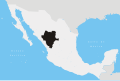
Vicente Guerrero
Location in Mexico
Coordinates: 23°45′N103°59′W / 23.750°N 103.983°W / 23.750; -103.983
CountryFlag of Mexico.svg  Mexico
State Durango
Municipality Vicente Guerrero
Elevation
1,930 m (6,332 ft)
Population
 (2010)
  Total15,982

Vicente Guerrero is a small city and seat of the Vicente Guerrero Municipality in the Mexican state of Durango. As of 2010, the city of Vicente Guerrero had a population of 15,982. [1]

Contents

Geography

Climate

Climate data for Vicente Guerrero, Durango (1951-2010)
MonthJanFebMarAprMayJunJulAugSepOctNovDecYear
Record high °C (°F)29.0
(84.2)
31.0
(87.8)
33.0
(91.4)
36.0
(96.8)
38.0
(100.4)
39.0
(102.2)
36.0
(96.8)
39.0
(102.2)
32.0
(89.6)
33.0
(91.4)
34.0
(93.2)
30.0
(86.0)
39.0
(102.2)
Mean daily maximum °C (°F)21.4
(70.5)
23.1
(73.6)
26.0
(78.8)
28.9
(84.0)
31.2
(88.2)
30.8
(87.4)
27.6
(81.7)
26.9
(80.4)
26.3
(79.3)
26.0
(78.8)
24.5
(76.1)
21.6
(70.9)
26.2
(79.2)
Daily mean °C (°F)11.3
(52.3)
12.7
(54.9)
15.0
(59.0)
17.8
(64.0)
20.4
(68.7)
22.0
(71.6)
20.6
(69.1)
20.1
(68.2)
19.2
(66.6)
17.0
(62.6)
14.1
(57.4)
12.0
(53.6)
16.9
(62.4)
Mean daily minimum °C (°F)1.3
(34.3)
2.2
(36.0)
4.0
(39.2)
6.6
(43.9)
9.7
(49.5)
13.2
(55.8)
13.6
(56.5)
13.3
(55.9)
12.1
(53.8)
8.0
(46.4)
3.8
(38.8)
2.3
(36.1)
7.5
(45.5)
Record low °C (°F)−11.0
(12.2)
−10.0
(14.0)
−7.0
(19.4)
−3.0
(26.6)
1.0
(33.8)
5.0
(41.0)
4.5
(40.1)
4.0
(39.2)
2.0
(35.6)
−2.5
(27.5)
−7.0
(19.4)
−14.0
(6.8)
−14.0
(6.8)
Average precipitation mm (inches)18.4
(0.72)
8.5
(0.33)
4.0
(0.16)
3.5
(0.14)
15.1
(0.59)
64.9
(2.56)
116.7
(4.59)
137.4
(5.41)
90.1
(3.55)
27.8
(1.09)
13.2
(0.52)
14.5
(0.57)
514.1
(20.24)
Average precipitation days (≥ 0.1 mm)2.31.40.60.92.78.314.215.510.74.51.52.465.0
Source: Servicio Meteorológico National [2]

Related Research Articles

<span class="mw-page-title-main">Guerrero</span> State of Mexico

Guerrero, officially the Free and Sovereign State of Guerrero, is one of the 32 states that comprise the 32 Federal Entities of Mexico in Mexico. It is divided in 81 municipalities. The state has a population of about 3.5 million people. It is located in southwest Mexico and is bordered by the states of Michoacán to the north and west, the State of Mexico and Morelos to the north, Puebla to the northeast and Oaxaca to the east. In addition to the capital city, Chilpancingo and the largest city Acapulco, other cities in Guerrero include Petatlán, Ciudad Altamirano, Taxco, Iguala, Ixtapa, and Zihuatanejo. Today, it is home to a number of indigenous communities, including the Nahuas, Mixtecs, Tlapanecs, Amuzgos, and formerly Cuitlatecs. It is also home to communities of Afro-Mexicans in the Costa Chica region.

<span class="mw-page-title-main">Guadalupe Victoria</span> 1st President of Mexico from 1824 to 1829

Guadalupe Victoria, born José Miguel Ramón Adaucto Fernández y Félix, was a Mexican general and politician who fought for independence against the Spanish Empire in the Mexican War of Independence and after the adoption of the Constitution of 1824, was elected as the first president of the United Mexican States. He was a deputy in the Mexican Chamber of Deputies for Durango and a member of the Supreme Executive Power following the downfall of the First Mexican Empire, which was followed by the 1824 Constitution and his presidency. He later served as Governor of Puebla.

<span class="mw-page-title-main">Vicente Guerrero</span> 2nd President of Mexico in 1829

Vicente Ramón Guerrero was a Mexican soldier and statesman who became the nation's second president. He was one of the leading generals who fought against Spain during the Mexican War of Independence. He is the first and so far only Mexican President of African descent and the first black president in North America.

<span class="mw-page-title-main">José María Bocanegra</span> 3rd President of Mexico in 1829

José María de los Dolores Francisco Germán del Espíritu Santo Bocanegra y Villalpando was a Mexican lawyer and statesman who was briefly interim president of Mexico on December, 1829 during a coup attempt against president Vicente Guerrero. He previously served in various government positions, including President of the Chamber of Deputies and as a member of the Chamber of Deputies for Zacatecas.

<span class="mw-page-title-main">Tixtla</span> Municipal seat and city in Guerrero, Mexico

Tixtla is a town and seat of the Tixtla de Guerrero Municipality in the Mexican state of Guerrero. The name is Nahuatl, and means either "maize dough" (masa) from textli; "our valley" from to ixtla; or "temple by the water" from teoixtlen'

<span class="mw-page-title-main">Guerrero metro station</span> Mexico City metro station

Guerrero is a metro station on the Mexico City Metro. It is located in the Colonia Guerrero neighborhood of Cuauhtémoc borough of Mexico City, on the intersection of Zarco street and Eje 1 Norte Mosqueta Avenue. It is a transfer station for both Lines 3 and B.

<span class="mw-page-title-main">Iguala</span> City in Guerrero, Mexico

Iguala, known officially as Iguala de la Independencia, is a historic city located 102 km (63 mi) from the state capital of Chilpancingo, in the Mexican state of Guerrero in southwestern Mexico.

<span class="mw-page-title-main">San Pablo del Monte, Tlaxcala</span> Municipality in Tlaxcala, Mexico

San Pablo del Monte is the largest city in the Mexican state of Tlaxcala, and is the municipal seat of the municipality of San Pablo del Monte. It is located at the southernmost point in the state, near the border with the adjoining state of Puebla. It is a suburb of the city of Puebla and a component of its metropolitan area. At the census of 2005 the population of the city was 55,760.

Nueva Ciudad Guerrero is a city in the Mexican state of Tamaulipas. It lies on the banks of the Rio Grande / Río Bravo, near the US–Mexico border, opposite to Falcon Heights, Texas. The Lake Falcon Dam International Crossing connects Falcon Heights with Nueva Ciudad Guerrero.

<span class="mw-page-title-main">Vicente Riva Palacio</span> Mexican politician

Vicente Florencio Carlos Riva Palacio Guerrero better known as Vicente Riva Palacio was a Mexican liberal politician, novelist, journalist, intellectual, and military leader.

<span class="mw-page-title-main">1831 in Mexico</span> List of events

Events in the year 1831 in Mexico.

Chichihualco is a city in the south of Mexico. It forms the administrative centre of the municipality of Leonardo Bravo, found in the centre of Guerrero state about 21 kilometres northwest of the state capital, Chilpancingo.

<span class="mw-page-title-main">Venustiano Carranza, Chiapas</span> Municipality in Chiapas, Mexico

Venustiano Carranza is a city and municipality in the Mexican state of Chiapas in southern Mexico.

<span class="mw-page-title-main">Villa Corzo</span> Municipality in Chiapas, Mexico

Villa Corzo is a city and municipality in the Mexican state of Chiapas in southern Mexico. The city of Villa Corzo (the municipal seat is located at

<span class="mw-page-title-main">Guerrero Municipality, Chihuahua</span> Municipality in the Mexican state of Chihuahua

Guerrero is one of the 67 municipalities of Chihuahua, in northern Mexico. The municipal seat lies at Vicente Guerrero. The municipality covers an area of 5,603.6 km².

Vicente Guerrero is one of the 39 municipalities of Durango, in north-western Mexico. The municipal seat lies at Vicente Guerrero. The municipality covers an area of 402.24 km² and is composed of 19 localities.

Isidoro Montes de Oca (1789–1847) was a Mexican of Spanish descent born in the Philippines who was a revolutionary general who fought in the Mexican War of Independence between 1810 and 1821. He was among the commanders of the army of Vicente Guerrero and José María Morelos. He was a trusted man of Vicente Guerrero and was his sub-general. He is a relative of Juan Montes de Oca, a prior Administrator of Guadalupe, Makati. in the Philippines. Consequently, the Mexican War of Independence was fought under the banner of Our Lady of Guadalupe.

<span class="mw-page-title-main">San Quintín Municipality</span> Municipality in the Mexican state of Baja California

San Quintín is a municipality in the Mexican state of Baja California. Its municipal seat is located in the city of San Quintín, Baja California. According to the 2020 census, it had a population of 117,568 inhabitants. The municipality has an area of 32,883.93 km2. There are a few National Parks and a World Heritage Site at Bahia de Los Angeles.

<span class="mw-page-title-main">Acala Municipality</span> Municipality in the Mexican state of Chiapas

Acala is a municipality in the Mexican state of Chiapas, in southern Mexico. The municipal seat is Acala.

<span class="mw-page-title-main">Embrace of Acatempan</span> Event in Mexican history

The embrace of Acatempan refers to an event in Mexican history in which Agustín de Iturbide, commander-in-chief of the military of southern New Spain, and Vicente Guerrero, leader of the forces fighting for Mexican Independence, participated. This event took place on February 10, 1821. Tradition has it that this event marked the reconciliation between the viceregal forces and the insurgent army.

References

  1. "Vicente Guerrero". Catálogo de Localidades. Secretaría de Desarrollo Social (SEDESOL). Retrieved 23 April 2014.
  2. "NORMALES CLIMATOLÓGICAS 1951-2010". Servicio Meteorológico National. Retrieved October 9, 2012.